File:Railroad "S" Curve.jpg
Jump to navigation
Jump to search
No higher resolution available.
Railroad_"S"_Curve.jpg (700 × 531 pixels, file size: 211 KB, MIME type: image/jpeg)
Captions
Captions
Add a one-line explanation of what this file represents
Summary[edit]
| Description |
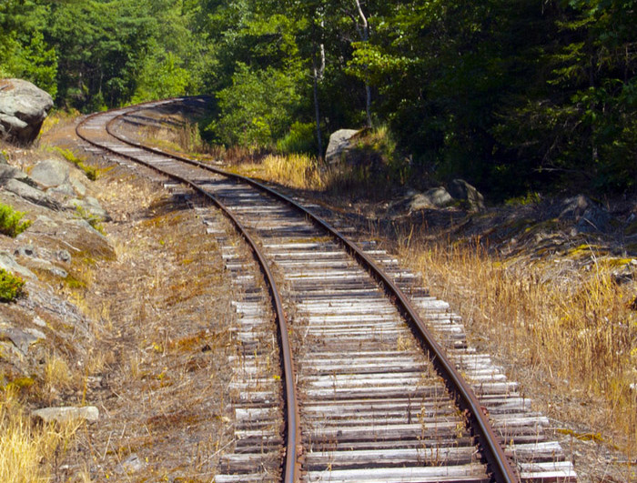
English: A railroad "S" curve (aka "reverse" curve) adjacent to the Fowler Hill/E Waldo Rd grade crossing located in Waldo, Maine, about five miles inland from Belfast, on the 33-mile grade of the Belfast and Moosehead Lake Railroad running the length of Waldo County, between Belfast and Burnham Junction. |
| Date |
17 July 2011 (according to Exif data)
|
| Source |
Photograph by uploader.
|
| Author | Centpacrr at en.wikipedia |
Licensing[edit]
Centpacrr at en.wikipedia, the copyright holder of this work, hereby publishes it under the following licenses:
This file is licensed under the Creative Commons Attribution-Share Alike 3.0 Unported license.
Attribution: Centpacrr at en.wikipedia
- You are free:
- to share – to copy, distribute and transmit the work
- to remix – to adapt the work
- Under the following conditions:
- attribution – You must give appropriate credit, provide a link to the license, and indicate if changes were made. You may do so in any reasonable manner, but not in any way that suggests the licensor endorses you or your use.
- share alike – If you remix, transform, or build upon the material, you must distribute your contributions under the same or compatible license as the original.

|
Permission is granted to copy, distribute and/or modify this document under the terms of the GNU Free Documentation License, Version 1.2 or any later version published by the Free Software Foundation; with no Invariant Sections, no Front-Cover Texts, and no Back-Cover Texts. A copy of the license is included in the section entitled GNU Free Documentation License. |
You may select the license of your choice.
Original upload log[edit]
The original description page was here. All following user names refer to en.wikipedia.
Upload date | User | Bytes | Dimensions | Comment
- 2011-11-16 02:24 (UTC) | Centpacrr | 216526 (bytes) | 700×531 | A railroad "S" curve (aka "reverse" curve) adjacent to the Fowler Hill/E Waldo Rd grade crossing located in Waldo, ME, about five miles inland from Belfast, ME on the 33-mile grade of the Belfast & Moosehead Lake Railroad running the length of Waldo Count
File history
Click on a date/time to view the file as it appeared at that time.
| Date/Time | Thumbnail | Dimensions | User | Comment | |
|---|---|---|---|---|---|
| current | 19:48, 20 January 2012 | | 700 × 531 (211 KB) | SreeBot (talk | contribs) | (Original text) : A railroad "S" curve (aka "reverse" curve) adjacent to the Fowler Hill/E Waldo Rd grade crossing located in Waldo, ME, about five miles inland from Belfast, ME on the 33-mile grade of the Belfast & Moosehead Lake Railroad running the len |
You cannot overwrite this file.
File usage on Commons
The following page uses this file:
File usage on other wikis
The following other wikis use this file:
- Usage on en.wikipedia.org
- Usage on nl.wikipedia.org