File:Radkarte MKL1888 edited (T and O style, east-up).png
Jump to navigation
Jump to search
No higher resolution available.
Radkarte_MKL1888_edited_(T_and_O_style,_east-up).png (357 × 355 pixels, file size: 13 KB, MIME type: image/png)
Captions
Captions
Add a one-line explanation of what this file represents
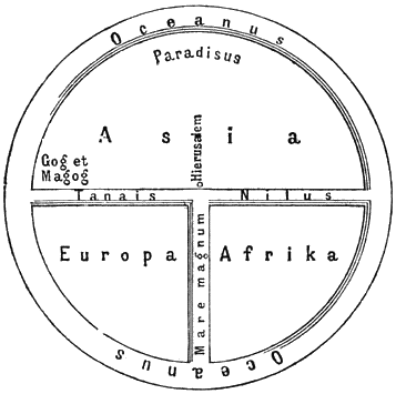
English: Ideal reconstruction of medieval world maps
Deutsch: Idealschema einer mittelalterlichen Weltkarte

| This image comes from the 4th edition of Meyers Konversationslexikon (1885–90). The copyrights have expired and this image is in the public domain. |
|
This work is in the public domain in its country of origin and other countries and areas where the copyright term is the author's life plus 100 years or fewer. This work is in the public domain in the United States because it was published (or registered with the U.S. Copyright Office) before January 1, 1929. | |
| This file has been identified as being free of known restrictions under copyright law, including all related and neighboring rights. | |
File history
Click on a date/time to view the file as it appeared at that time.
| Date/Time | Thumbnail | Dimensions | User | Comment | |
|---|---|---|---|---|---|
| current | 19:04, 17 February 2007 | | 357 × 355 (13 KB) | I.R. Annie IP. (talk | contribs) | {{en|Ideal reconstruction of medieval world maps}} {{de|Idealschema einer mittelalterlichen Weltkarte}} {{PD-Meyers}} Category:T and O map |
You cannot overwrite this file.
File usage on Commons
The following 4 pages use this file:
File usage on other wikis
The following other wikis use this file:
- Usage on cs.wikipedia.org
- Usage on de.wikipedia.org
- Usage on en.wikipedia.org
- Usage on he.wikipedia.org
- Usage on nl.wikipedia.org
- Usage on sv.wikipedia.org
.png&oldid=388984351)