File:Radar profile and glacier evolution Coropuna.png
Jump to navigation
Jump to search
Size of this preview: 645 × 599 pixels. Other resolutions: 258 × 240 pixels | 517 × 480 pixels | 872 × 810 pixels.
Original file (872 × 810 pixels, file size: 476 KB, MIME type: image/png)
Captions
Captions
Add a one-line explanation of what this file represents
Summary[edit]
| Description |
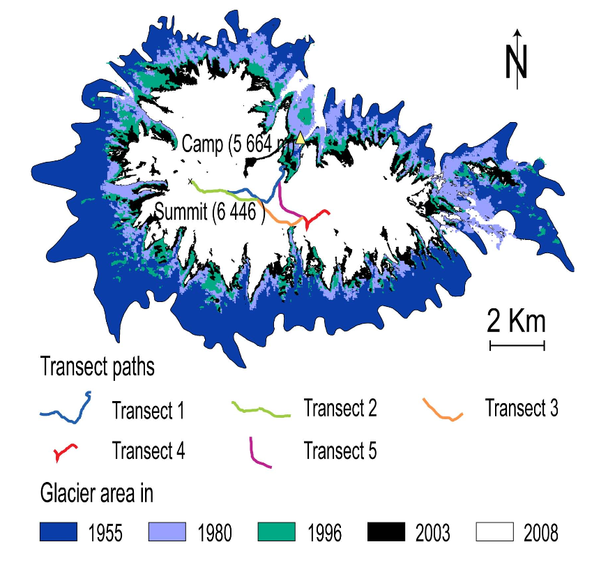
English: Georeferenced radar profiles and evolution of glaciated areas (1955-2008) - Coropuna |
| Date | |
| Source |
[http://www.the-cryosphere.net/4/313/2010/tc-4-313-2010.pdf Assessing high altitude glacier thickness, volume and area changes using field, GIS and remote sensing techniques: the case of Nevado Coropuna (Peru)] |
| Author | P. Peduzzi, C. Herold, and W. Silverio |
| Other versions |

.png)
Licensing[edit]
This file is licensed under the Creative Commons Attribution 3.0 Unported license.
- You are free:
- to share – to copy, distribute and transmit the work
- to remix – to adapt the work
- Under the following conditions:
- attribution – You must give appropriate credit, provide a link to the license, and indicate if changes were made. You may do so in any reasonable manner, but not in any way that suggests the licensor endorses you or your use.
This file, which was originally posted to
[http://www.the-cryosphere.net/4/313/2010/tc-4-313-2010.pdf Assessing high altitude glacier thickness, volume and area, was reviewed on 5 May 2016 by reviewer Ww2censor, who confirmed that it was available there under the stated license on that date.
|
File history
Click on a date/time to view the file as it appeared at that time.
| Date/Time | Thumbnail | Dimensions | User | Comment | |
|---|---|---|---|---|---|
| current | 17:58, 18 October 2019 | | 872 × 810 (476 KB) | Jo-Jo Eumerus (talk | contribs) | Larger sized image |
| 15:59, 26 February 2016 |  | 394 × 298 (61 KB) | Jo-Jo Eumerus (talk | contribs) | User created page with UploadWizard |
You cannot overwrite this file.
File usage on Commons
The following 3 pages use this file:
.png&redirect=no)
File usage on other wikis
The following other wikis use this file:
- Usage on en.wikipedia.org