File:Quillayute River erosion.jpg
Jump to navigation
Jump to search

Size of this preview: 800 × 533 pixels. Other resolutions: 320 × 213 pixels | 640 × 427 pixels | 1,024 × 683 pixels | 1,280 × 853 pixels | 2,560 × 1,707 pixels | 8,256 × 5,504 pixels.
Original file (8,256 × 5,504 pixels, file size: 44.48 MB, MIME type: image/jpeg)
Captions
Captions
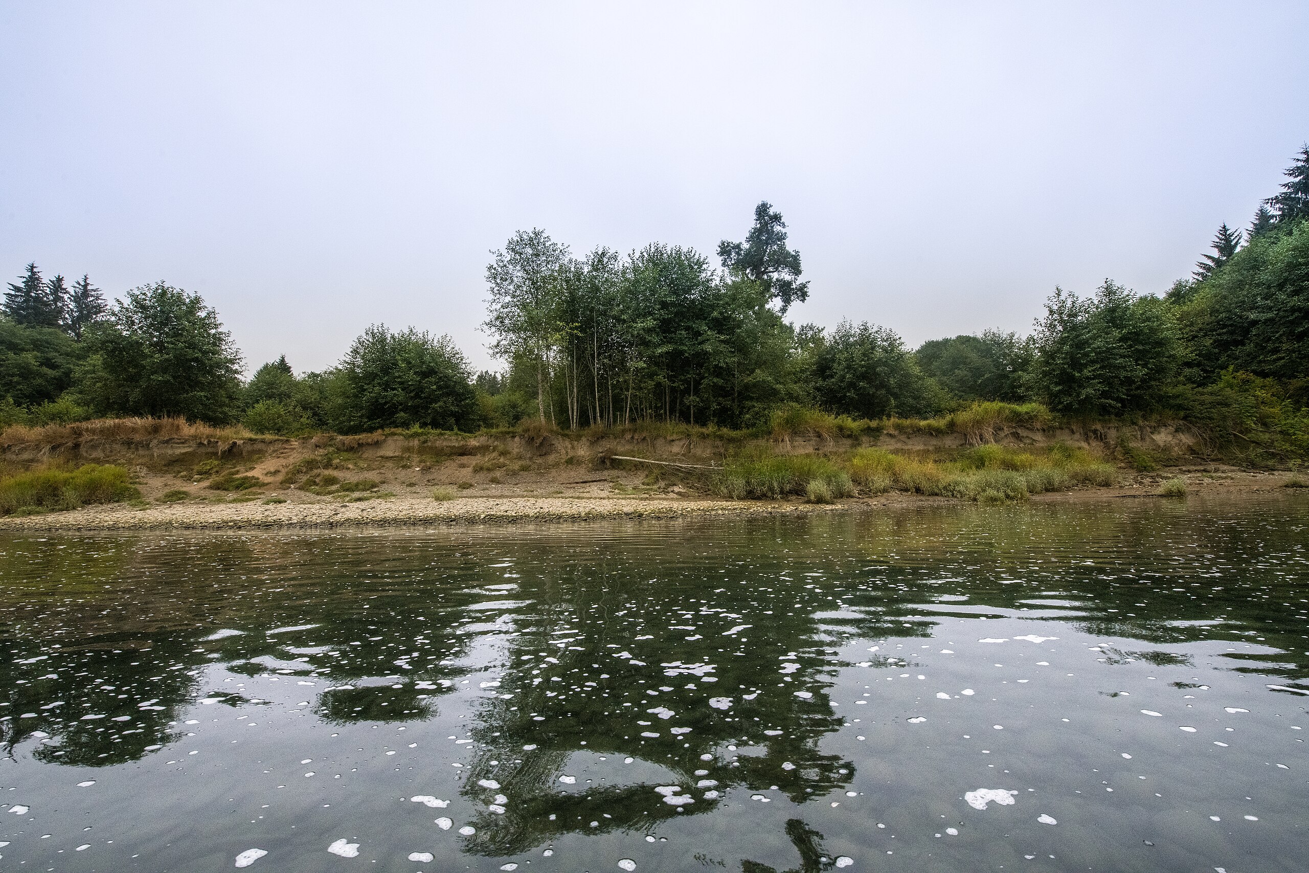
Signs of risk erosion on the Quillayute River in Washington state
Summary
[edit]
| Description |
English: Quileute Tribal Council Vice Chair Tony Foster, takes U.S. Department of Agriculture (USDA) Natural Resource Conservation Service (NRCS) Tribal Liaison for Washington State Robin Slate, and Quileute Tribal Water Quality Biologist Nicole Rasmussen use a Washington Department of Fish and Wildlife (WDFW) boat to travel along the Quillayute River looking for signs of erosion (risk erosion) of the bank at and about Smith Sough, the source of water that flows through the culverts of the NRCS Thunder Road project, that addresses four fish barriers that block more than 22 acres of fish habitat, in La Push, Washington, Aug 22, 2018. This conservation planning effort lead to an unusual partnership where the Quileute Tribe requested access to WDWF fish passage biologist and engineers through a NRCS/WDFW Contribution agreement. This partnership resulted in a coordinated effort to bring conservation actions to life in a remote location. The Thunder Road Project addressed the need for floodplain connectivity to restore natural flow of water across floodplain, restore access to off-channel fish habitat in wetlands and stream complex. The project also improved the roadway and reduced sediment runoff from tribal members using road to access the river during the wet season (peak fishing season). The conservation plans identified aquatic habitat, water quality, and plant pest resource concerns, along with a social resource concern related to the Tribeâs use of the degraded Thunder Road for fishing and recreational access. Additionally, conservation planning determined soils information was needed and resulted in a Soil Survey mapping effort on the Reservation. Environmental Quality Incentives Program (EQIP) funding in two successive years was used to provide the Tribe financial assistance. The tribe used State Salmon Recovery Funding Board funding to provide the balance of the implementation cost. EQIP 2015 contract included invasive species control aquatic organism passage and access road improvement=$60,964. EQIP 2016 contract included aquatic organism passage and access road improvement = $117,101. |
| Date | |
| Source | https://www.flickr.com/photos/usdagov/44150152944/ |
| Author | Lance Cheung |
Licensing
[edit]
| This image was originally posted to Flickr by USDAgov at https://flickr.com/photos/41284017@N08/44150152944. It was reviewed on 11 December 2023 by FlickreviewR 2 and was confirmed to be licensed under the terms of the Public Domain Mark. |
This image or file is a work of a United States Department of Agriculture employee, taken or made as part of that person's official duties. As a work of the U.S. federal government, the image is in the public domain.
|
 |
File history
Click on a date/time to view the file as it appeared at that time.
| Date/Time | Thumbnail | Dimensions | User | Comment | |
|---|---|---|---|---|---|
| current | 15:18, 11 December 2023 | | 8,256 × 5,504 (44.48 MB) | FlickreviewR 2 (talk | contribs) | Replacing image by its original image from Flickr |
| 21:06, 25 January 2023 |  | 2,048 × 1,365 (942 KB) | JamieF (talk | contribs) | Uploaded a work by Lance Cheung from https://www.flickr.com/photos/usdagov/44150152944/ with UploadWizard |
You cannot overwrite this file.
File usage on Commons
There are no pages that use this file.