File:Public transport map of Bilbao (city area).png
Jump to navigation
Jump to search
Size of this preview: 584 × 599 pixels. Other resolutions: 234 × 240 pixels | 468 × 480 pixels | 748 × 768 pixels | 998 × 1,024 pixels | 2,110 × 2,166 pixels.
Original file (2,110 × 2,166 pixels, file size: 3.1 MB, MIME type: image/png)
Captions
Captions
Add a one-line explanation of what this file represents
Summary[edit]
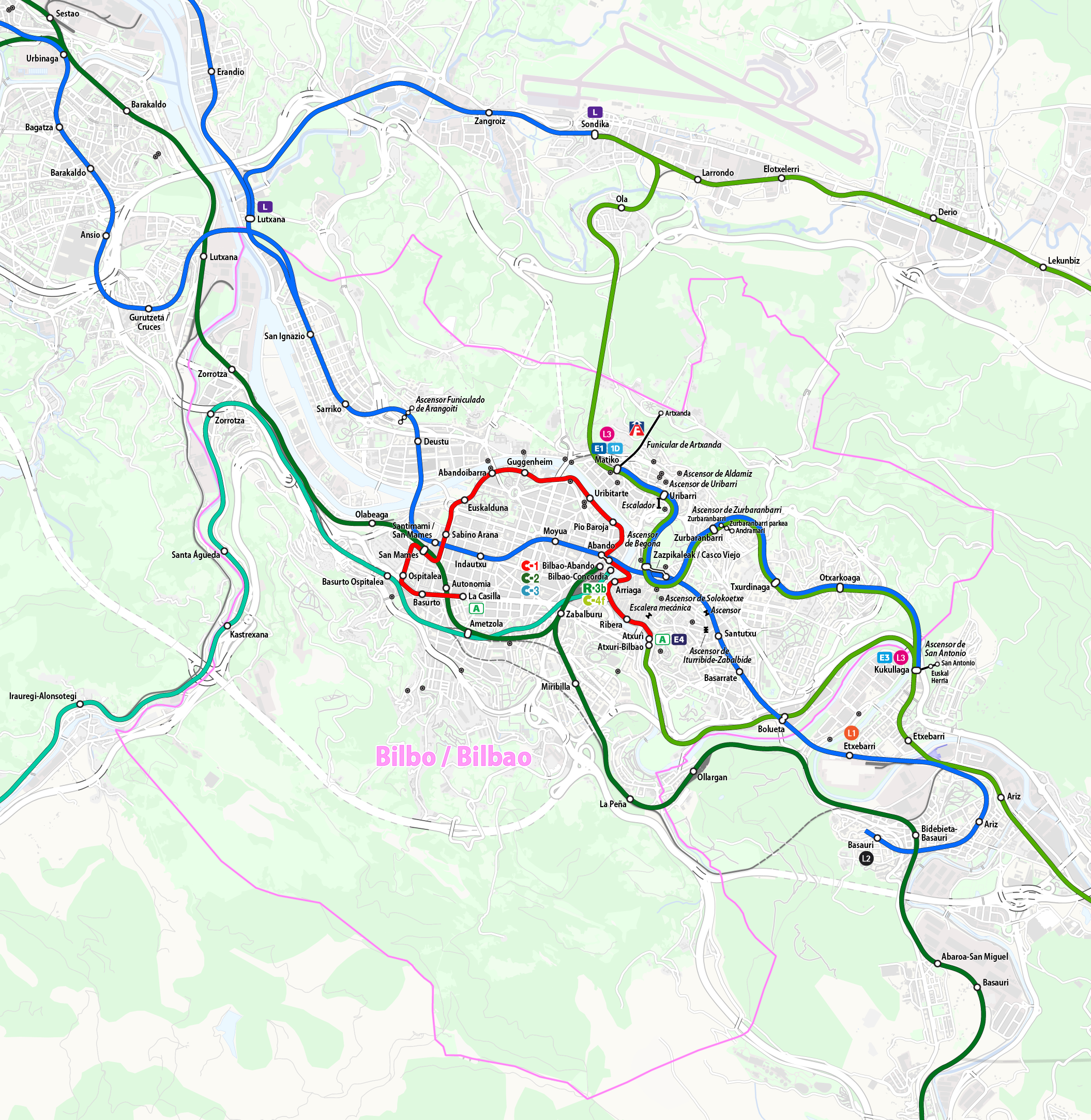
| Description |
Deutsch: Karte ÖPNV Bilbao
English: Public transport map of Bilbao
Français : Plan des Transports publics de Bilbao
Português: Mapa do transporte publico do Bilbao
|
|||
| Date | see file history | |||
| Source | Own work using: OpenStreetMap data for the background | |||
| Creator | ||||
| Permission (Reusing this file) |
All OpenStreetMap data and maps are Creative Commons "CC-BY-SA 2.0" licensed This file is licensed under the Creative Commons Attribution-Share Alike 2.0 Generic license.
|
|||
| Georeferencing | If inappropriate please set warp_status = skip to hide. | |||
| Other versions |
|

.png)
.png&action=edit§ion=1)
.png/overlay.kml&action=edit&redlink=1)
File history
Click on a date/time to view the file as it appeared at that time.
| Date/Time | Thumbnail | Dimensions | User | Comment | |
|---|---|---|---|---|---|
| current | 14:59, 3 December 2018 | | 2,110 × 2,166 (3.1 MB) | Chumwa (talk | contribs) | |
| 10:09, 3 December 2018 |  | 2,110 × 2,166 (3.1 MB) | Chumwa (talk | contribs) | == {{int:filedesc}} == {{Map |Description= {{de|Karte ÖPNV Bilbao}} {{en|Public transport map of Bilbao}} {{fr|Plan des Transports publics de Bilbao}} {{pt|Mapa do transporte publico do Bilbao}} {{Overlay}} |Author=Maximilian Dörrbecker (Chumwa) |Source={{own using}} OpenStreetMap data for the background |Date=see file history |Permission=All OpenStreetMap data and maps are Creative Commons "CC-BY-SA 2.0" licensed{{cc-by-sa-2.0}} |other_vers... |
You cannot overwrite this file.
File usage on Commons
The following 6 pages use this file:
- User:Chumwa/OgreBot/Potential transport maps/2018 December 1-10
- User:Chumwa/OgreBot/Public transport information/2018 December 1-10
- User:Chumwa/OgreBot/Transport Maps/2018 December 1-10
- User:Chumwa/OgreBot/Travel and communication maps/2018 December 1-10
- File:Public transport map of Bilbao.png
- File:Public transport map of Bilbao (city area).png
.png&oldid=520795221)