File:Public land oregon 1996.png
Jump to navigation
Jump to search
Size of this preview: 690 × 600 pixels. Other resolutions: 276 × 240 pixels | 552 × 480 pixels | 884 × 768 pixels | 1,178 × 1,024 pixels | 1,572 × 1,366 pixels.
Original file (1,572 × 1,366 pixels, file size: 3.48 MB, MIME type: image/png)
Captions
Captions
Add a one-line explanation of what this file represents
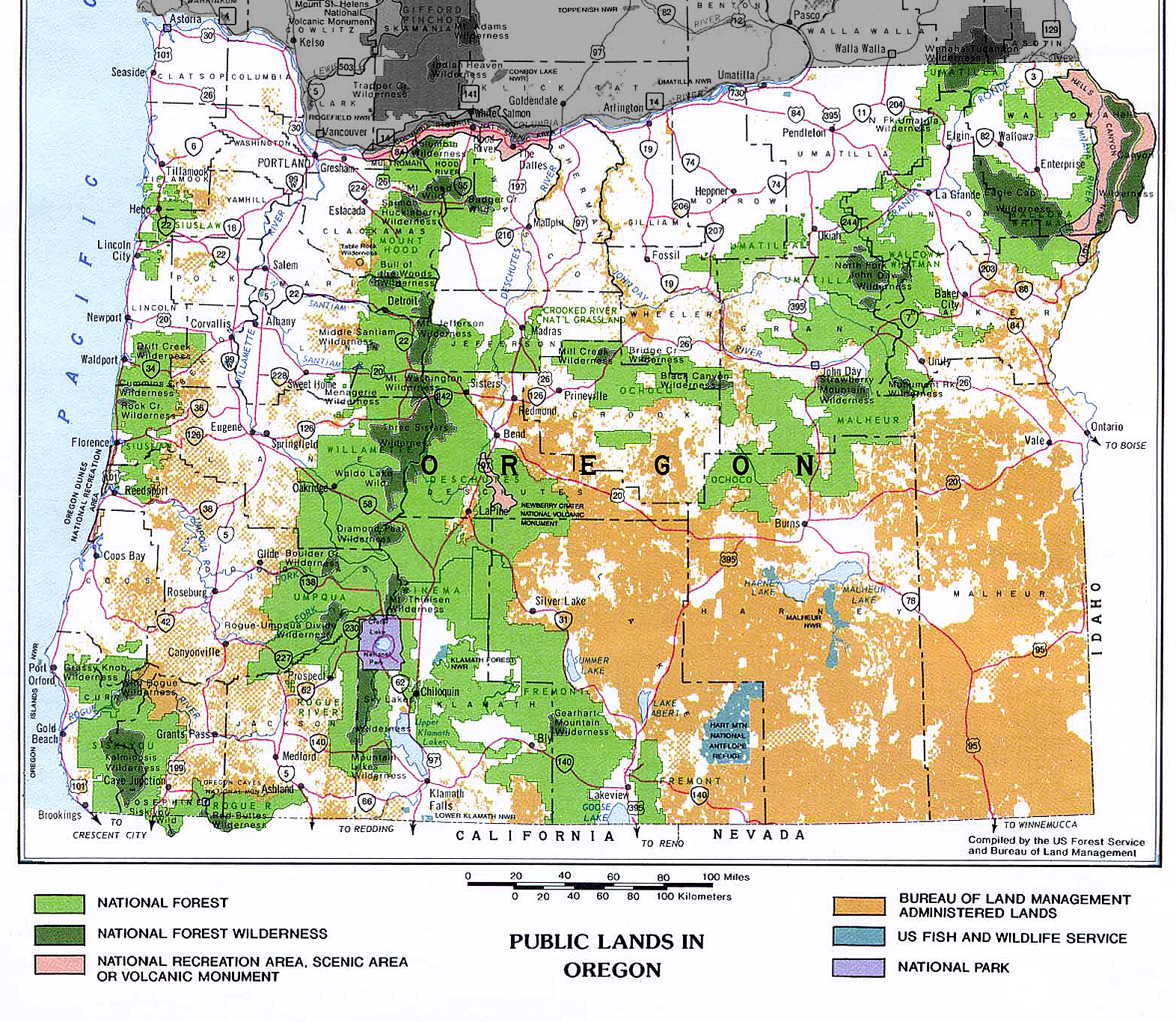
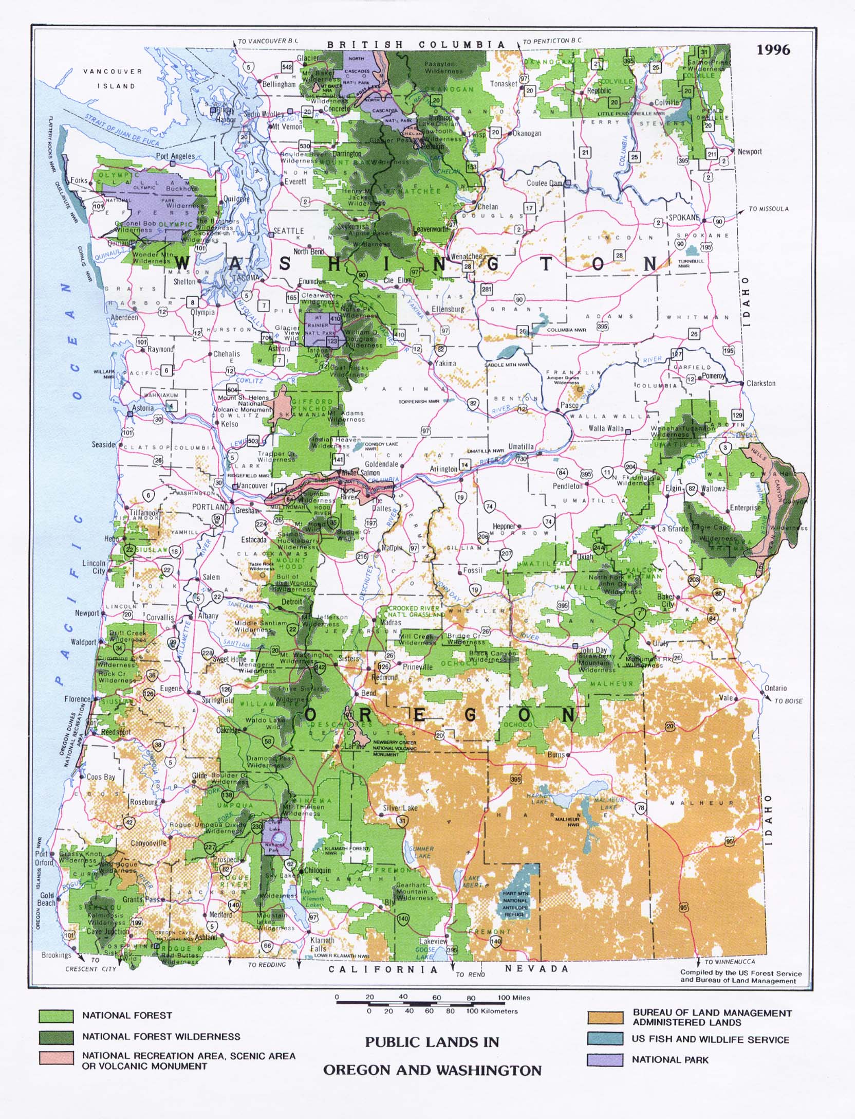
Legend
[edit]
National Forest
National Forest wilderness
National Recreation Area, Scenic Area, or Volcanic Monument
Bureau of Land Management administered lands
U.S. Fish and Wildlife Service
National Park
Summary
[edit]
| Description |
English: Map of public lands in the U.S. state of Oregon showing National Forests (light green), designated protected Wilderness (dark green), Bureau of Land Management lands (orange), US Fish and Wildlife Service (light blue), National Park (violet), National Recreation Area, Scenic Area, or Volcanic Monument (pink). The map is adapted from http://www.lib.utexas.edu/maps/united_states/public_land_or_wa_1996.jpg by deemphasizing Washington,adjusting the legend, and adjusting sharpness to overcome JPEG artifacts. |
| Date | |
| Source | http://www.lib.utexas.edu/maps/united_states/public_land_or_wa_1996.jpg |
| Author | US Forest Service and BLM, and EncMstr |
| Other versions | File:Federal lands in Oregon.pdf |
Licensing
[edit]
This image or recording is the work of a U.S. Fish and Wildlife Service employee, taken or made as part of that person's official duties. As a work of the U.S. federal government, the image is in the public domain. For more information, see the Fish and Wildlife Service copyright policy.
|
 |
File history
Click on a date/time to view the file as it appeared at that time.
| Date/Time | Thumbnail | Dimensions | User | Comment | |
|---|---|---|---|---|---|
| current | 22:57, 29 January 2009 | | 1,572 × 1,366 (3.48 MB) | EncMstr (talk | contribs) | {{Information |Description={{en|1=Map of public lands in the U.S. state of Oregon showing National Forests (light green), designated protected Wilderness (dark green), Bureau of Land Management lands (orange), US Fish and Wildlife Service (light blue), Na |
You cannot overwrite this file.
File usage on Commons
There are no pages that use this file.
File usage on other wikis
The following other wikis use this file:
- Usage on en.wikipedia.org