File:Provinz Taiwan ROC 1951–2014.svg
Jump to navigation
Jump to search

Size of this PNG preview of this SVG file: 800 × 197 pixels. Other resolutions: 320 × 79 pixels | 640 × 157 pixels | 1,024 × 252 pixels | 1,280 × 315 pixels | 2,560 × 630 pixels | 1,333 × 328 pixels.
Original file (SVG file, nominally 1,333 × 328 pixels, file size: 875 KB)
Captions
Captions
Add a one-line explanation of what this file represents
Summary
[edit]| Description |
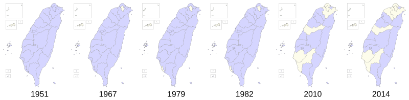
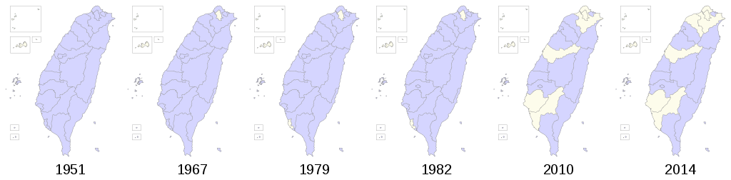
Deutsch: Territoriale Entwicklung der Provinz Taiwan 1951 bis 2014.
English: Territorial evolution of the province of Taiwan. |
||
| Date | |||
| Source |
Own work based on: This vector image includes elements that have been taken or adapted from this file: |
||
| Author | Furfur | ||
| Permission (Reusing this file) |
I, the copyright holder of this work, hereby publish it under the following licenses:
This file is licensed under the Creative Commons Attribution-Share Alike 4.0 International license.
You may select the license of your choice. |
||
| SVG development |

File history
Click on a date/time to view the file as it appeared at that time.
| Date/Time | Thumbnail | Dimensions | User | Comment | |
|---|---|---|---|---|---|
| current | 22:28, 1 March 2018 | 1,333 × 328 (875 KB) | Furfur (talk | contribs) | etwas breiterer Rand | |
| 22:20, 1 March 2018 | 1,323 × 318 (876 KB) | Furfur (talk | contribs) | Kinmen und Matsu gehörten nie zur Provinz | ||
| 23:40, 28 January 2018 | 1,061 × 267 (761 KB) | Furfur (talk | contribs) | Inkscape ist Schrott | ||
| 23:34, 28 January 2018 | 1,414 × 356 (740 KB) | Furfur (talk | contribs) | error | ||
| 23:26, 28 January 2018 | 1,414 × 356 (737 KB) | Furfur (talk | contribs) | 2014: Chiayi | ||
| 15:19, 27 January 2018 | 1,414 × 356 (679 KB) | Furfur (talk | contribs) | ... never ending errors: Tainan 1982 | ||
| 14:48, 27 January 2018 | 1,414 × 356 (679 KB) | Furfur (talk | contribs) | new color and error corrections | ||
| 07:15, 27 January 2018 | 1,255 × 309 (880 KB) | Furfur (talk | contribs) | Korrektur | ||
| 06:52, 27 January 2018 | 1,353 × 348 (619 KB) | Furfur (talk | contribs) | typo | ||
| 06:47, 27 January 2018 | 1,353 × 348 (619 KB) | Furfur (talk | contribs) | == {{int:filedesc}} == {{Information |Description={{User:Medium69/Traduction}} {{de|1=Territoriale Entwicklung der Provinz Taiwan 1951 bis 2014.}} {{en|1=Territorial evolution of the province of Taiwan.}} |Source={{AttribSVG|1=Taiwan Province in Taiwan... |
You cannot overwrite this file.
File usage on Commons
There are no pages that use this file.
File usage on other wikis
The following other wikis use this file:
- Usage on de.wikipedia.org