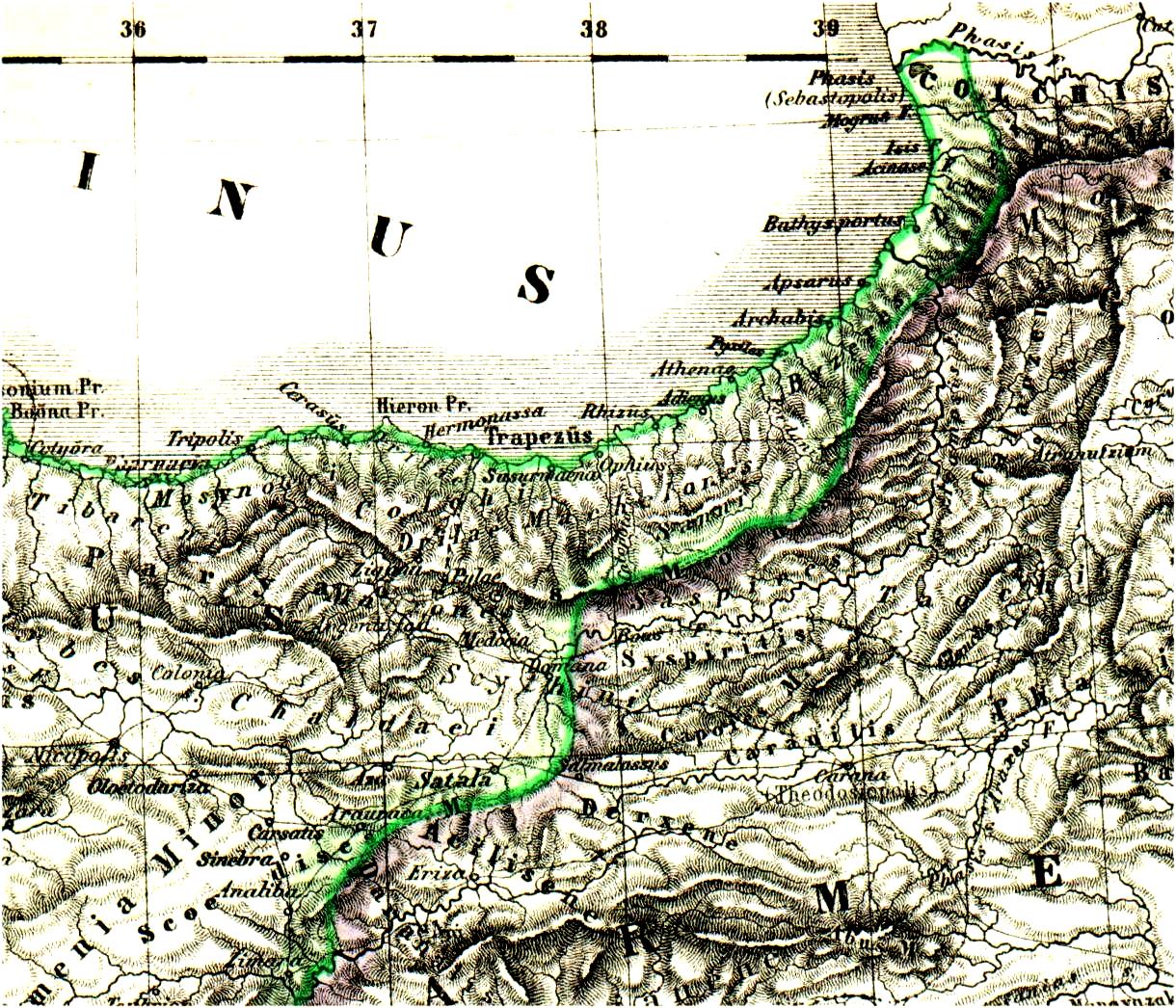
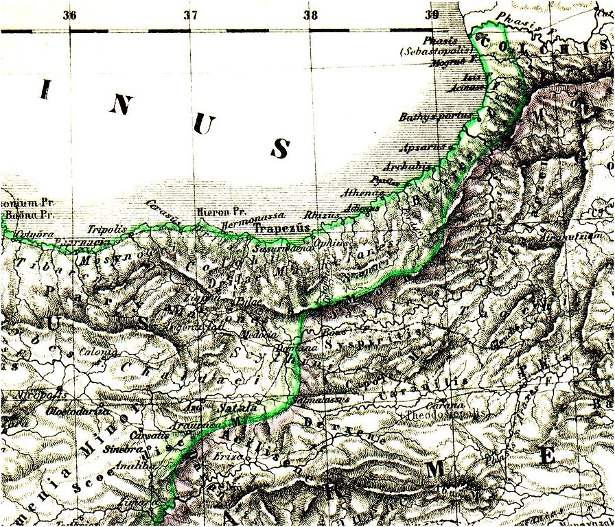
File:Pontus Armenia.jpg
Original file (1,220 × 1,046 pixels, file size: 428 KB, MIME type: image/jpeg)
Captions
Captions
Summary
[edit]
| Description |
English: This map shows the north of the roman province Pontus and the west of Armenia.
Deutsch: Die Karte zeigt den Norden der römischen Provinz Pontus und das westliche Armenien. |
| Date | published in 1877 in the "Atlas antiquus" |
| Source | http://www.gottwein.de/latine/map/as02_pont_o.php |
| Author |
English: Johann Samuel Heinrich Kiepert (* 31. Juli 1818 in Berlin; † 21. April 1899 in Berlin) was a german Geographer and cartographer.
Deutsch: Johann Samuel Heinrich Kiepert (* 31. Juli 1818 in Berlin; † 21. April 1899 in Berlin) war ein deutscher Geograph und Kartograph. |
| Permission (Reusing this file) |
The Author died in 1899. |
Licensing
[edit]
|
This work is in the public domain in its country of origin and other countries and areas where the copyright term is the author's life plus 70 years or fewer.
| |
| This file has been identified as being free of known restrictions under copyright law, including all related and neighboring rights. | |
File history
Click on a date/time to view the file as it appeared at that time.
| Date/Time | Thumbnail | Dimensions | User | Comment | |
|---|---|---|---|---|---|
| current | 13:57, 29 September 2006 | | 1,220 × 1,046 (428 KB) | Schogun (talk | contribs) | English: description: This map shows the north of the roman province Pontus and the west of Armenia. Author: Johann Samuel Heinrich Kiepert (* 31. Juli 1818 in Berlin; † 21. April 1899 in Berlin) was a german Geographer and cartographer. Deutsch: Bes |
You cannot overwrite this file.
File usage on Commons
There are no pages that use this file.
File usage on other wikis
The following other wikis use this file:
- Usage on de.wikipedia.org