File:Police (gmina) location map.png
Jump to navigation
Jump to search

Size of this preview: 567 × 599 pixels. Other resolutions: 227 × 240 pixels | 454 × 480 pixels | 727 × 768 pixels | 1,063 × 1,123 pixels.
Original file (1,063 × 1,123 pixels, file size: 99 KB, MIME type: image/png)
Captions
Captions
Add a one-line explanation of what this file represents
| Description |
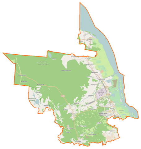
Polski: Mapa gminy Police, Polska
English: Map of Gmina Police, Poland |
|||||||||
| Date | ||||||||||
| Source | You may find a page on the OpenStreetMap wiki page for Police (gmina) | |||||||||
| Creator |
OpenStreetMap contributors OpenStreetMap contributors |
|||||||||
| Permission (Reusing this file) |
OpenStreetMap data is available under the Open Database License (details). Map tiles are licensed under the Creative Commons Attribution-ShareAlike 2.0 license (CC-BY-SA 2.0).
This file is licensed under the Creative Commons Attribution-Share Alike 2.0 Generic license.
|
|||||||||
| Geotemporal data | ||||||||||
| Bounding box |
|
|||||||||
| Georeferencing | If inappropriate please set warp_status = skip to hide. | |||||||||
File history
Click on a date/time to view the file as it appeared at that time.
| Date/Time | Thumbnail | Dimensions | User | Comment | |
|---|---|---|---|---|---|
| current | 07:14, 2 April 2015 | | 1,063 × 1,123 (99 KB) | VanWiel (talk | contribs) | {{OpenStreetMap | name = Police (gmina) | location = Police (gmina) | description = {{pl|Mapa gminy Police, Polska}} {{en|Map of Gmina Police, Poland}} | top = 53.7152 | bottom = 53.4864 | left... |
You cannot overwrite this file.
File usage on Commons
There are no pages that use this file.
File usage on other wikis
The following other wikis use this file:
- Usage on fr.wikipedia.org
- Bartoszewo (Poméranie-Occidentale)
- Dobieszczyn
- Drogoradz (Poméranie-Occidentale)
- Gunice
- Karpin (Police)
- Leśno Górne
- Mazańczyce
- Niekłończyca
- Nowa Jasienica
- Pienice (Poméranie-Occidentale)
- Pilchowo (Police)
- Podbrzezie (Poméranie-Occidentale)
- Poddymin
- Siedlice (Police)
- Sierakowo (Police)
- Stare Leśno
- Stary Dębostrów
- Turznica (Poméranie-Occidentale)
- Uniemyśl (Poméranie-Occidentale)
- Wieńkowo
- Witorza
- Zalesie (Police)
- Żółtew
- Usage on mk.wikipedia.org
- Usage on pl.wikipedia.org
- Pilchowo (powiat policki)
- Trzebież
- Police (gmina)
- Rezerwat przyrody Świdwie
- Tanowo
- Bartoszewo (województwo zachodniopomorskie)
- Dębostrów
- Leśno Górne
- Niekłończyca
- Drogoradz (województwo zachodniopomorskie)
- Przęsocin
- Tatynia
- Trzeszczyn
- Wieńkowo
- Węgornik
- Uniemyśl (województwo zachodniopomorskie)
- Zalesie (powiat policki)
- Dobieszczyn
- Siedlice (powiat policki)
- Bartoszewo (jezioro)
- Poddymin
- Gunice
- Nowa Jasienica
- Witorza
- Żółtew
- Karpino (jezioro w powiecie polickim)
View more global usage of this file.
_location_map.png)
_location_map.png&oldid=519989203)