File:Pointe de Pern.jpg

Original file (3,000 × 3,000 pixels, file size: 4.14 MB, MIME type: image/jpeg)
Captions
Captions
Summary[edit]
| DescriptionPointe de Pern.jpg |
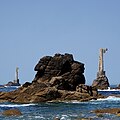
English: Pylônes en béton des cables et du téléphérique (1928-36) du Phare de Nividic (1912, classé MH, 2017). fr.wikipedia.org/wiki/Phare_de_Nividic
Concrete pylons of cables and cable car (1928-36) of Nividic Lighthouse (1912), which is one of five major lighthouses on Ouessant (en. Ushant) in Brittany. The Phare de Nividic was the first automatic lighthouse in the world. It is a listed French national monument since 2017. en.wikipedia.org/wiki/Nividic_Lighthouse L'île d'Ouessant (en breton : Enez Eusa) est une île française de la mer Celtique située à l’ouest de la partie continentale de la Bretagne, dans le Finistère. C'est le point le plus occidental de France métropolitaine. Il est à noter que les côtes sud de l'île sont baignées par la mer d'Iroise, elle-même incluse dans la mer Celtique. Cette île a donné son nom à la commune dont elle forme l'essentiel du territoire. Elle fait partie du parc naturel régional d'Armorique et du parc naturel marin d'Iroise. fr.wikipedia.org/wiki/%C3%8Ele_d%27Ouessant The island of Ouessant (in English, Ushant, in Breton: Enez Eusa) is a French island of the Celtic Sea located west of the mainland of Brittany, in Finistère. It is the westernmost point of metropolitan France. It should be noted that the southern coasts of the island are bathed by the Iroise Sea, itself included in the Celtic Sea. This island gave its name to the commune of which it forms the bulk of the territory. It is part of the Armorique Regional Natural Park and the Iroise Marine Natural Park. July 2022 - Uploaded 2022/09/28 |
| Date | |
| Source | https://www.flickr.com/photos/pom-angers/52389745791/ |
| Author | Pom' |
| Camera location | 48° 26′ 57.41″ N, 5° 08′ 32.58″ W | View this and other nearby images on: OpenStreetMap |
|---|
Licensing[edit]
- You are free:
- to share – to copy, distribute and transmit the work
- to remix – to adapt the work
- Under the following conditions:
- attribution – You must give appropriate credit, provide a link to the license, and indicate if changes were made. You may do so in any reasonable manner, but not in any way that suggests the licensor endorses you or your use.
- share alike – If you remix, transform, or build upon the material, you must distribute your contributions under the same or compatible license as the original.
| This image was originally posted to Flickr by pom'. at https://flickr.com/photos/146832554@N06/52389745791. It was reviewed on 24 March 2023 by FlickreviewR 2 and was confirmed to be licensed under the terms of the cc-by-sa-2.0. |
24 March 2023
File history
Click on a date/time to view the file as it appeared at that time.
| Date/Time | Thumbnail | Dimensions | User | Comment | |
|---|---|---|---|---|---|
| current | 16:45, 24 March 2023 |  | 3,000 × 3,000 (4.14 MB) | Hogo-2020 (talk | contribs) | Uploaded a work by Pom' from https://www.flickr.com/photos/pom-angers/52389745791/ with UploadWizard |
You cannot overwrite this file.
File usage on Commons
There are no pages that use this file.
Metadata
This file contains additional information such as Exif metadata which may have been added by the digital camera, scanner, or software program used to create or digitize it. If the file has been modified from its original state, some details such as the timestamp may not fully reflect those of the original file. The timestamp is only as accurate as the clock in the camera, and it may be completely wrong.
| Camera manufacturer | Panasonic |
|---|---|
| Camera model | DMC-TZ101 |
| Exposure time | 1/1,300 sec (0.00076923076923077) |
| F-number | f/4.9 |
| ISO speed rating | 125 |
| Date and time of data generation | 12:37, 18 July 2022 |
| Lens focal length | 31.9 mm |
| Orientation | Normal |
| Horizontal resolution | 180 dpi |
| Vertical resolution | 180 dpi |
| Software used | Adobe Photoshop CS2 Windows |
| File change date and time | 21:36, 27 September 2022 |
| Y and C positioning | Co-sited |
| Exposure Program | Landscape mode (for landscape photos with the background in focus) |
| Exif version | 2.3 |
| Date and time of digitizing | 12:37, 18 July 2022 |
| Meaning of each component |
|
| Image compression mode | 4 |
| APEX exposure bias | 0 |
| Maximum land aperture | 4.5859375 APEX (f/4.9) |
| Metering mode | Pattern |
| Light source | Unknown |
| Flash | Flash did not fire, compulsory flash suppression |
| DateTime subseconds | 292 |
| DateTimeOriginal subseconds | 292 |
| DateTimeDigitized subseconds | 292 |
| Supported Flashpix version | 1 |
| Color space | sRGB |
| Sensing method | One-chip color area sensor |
| File source | Digital still camera |
| Scene type | A directly photographed image |
| Custom image processing | Normal process |
| Exposure mode | Auto exposure |
| White balance | Auto white balance |
| Digital zoom ratio | 0 |
| Focal length in 35 mm film | 112 mm |
| Scene capture type | Standard |
| Scene control | Low gain up |
| Contrast | Normal |
| Saturation | Normal |
| Sharpness | Normal |
| Supported Flashpix version | 1 |
| Image width | 3,000 px |
| Image height | 3,000 px |
| Date metadata was last modified | 23:36, 27 September 2022 |