File:Plus beaux villages de France montsoreau 4.jpg
Jump to navigation
Jump to search

Size of this preview: 800 × 599 pixels. Other resolutions: 320 × 240 pixels | 640 × 480 pixels | 1,024 × 767 pixels | 1,280 × 959 pixels | 2,560 × 1,918 pixels | 4,604 × 3,450 pixels.
Original file (4,604 × 3,450 pixels, file size: 9.15 MB, MIME type: image/jpeg)
Captions
Captions
Add a one-line explanation of what this file represents
|
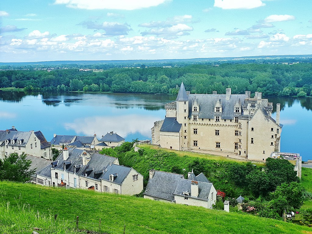
This place is a UNESCO World Heritage Site, listed as
The Loire Valley between Sully-sur-Loire and Chalonnes.
|
Summary
[edit]
| Description |
English: The Loire and the castle of Montsoreau, view from the village. Monstoreau, in the Loire Valley, is listed one of the most beautiful villages of France, member of the most beautiful villages of the world.
|
|||
| Date | ||||
| Source | Own work | |||
| Author | Philippe49730 |
| Camera location | | View this and other nearby images on: OpenStreetMap |
|---|
Licensing
[edit]
I, the copyright holder of this work, hereby publish it under the following license:
This file is licensed under the Creative Commons Attribution-Share Alike 4.0 International license.
- You are free:
- to share – to copy, distribute and transmit the work
- to remix – to adapt the work
- Under the following conditions:
- attribution – You must give appropriate credit, provide a link to the license, and indicate if changes were made. You may do so in any reasonable manner, but not in any way that suggests the licensor endorses you or your use.
- share alike – If you remix, transform, or build upon the material, you must distribute your contributions under the same or compatible license as the original.
File history
Click on a date/time to view the file as it appeared at that time.
| Date/Time | Thumbnail | Dimensions | User | Comment | |
|---|---|---|---|---|---|
| current | 15:48, 31 May 2018 | | 4,604 × 3,450 (9.15 MB) | Philippe49730 (talk | contribs) | User created page with UploadWizard |
You cannot overwrite this file.
File usage on Commons
The following page uses this file:
File usage on other wikis
The following other wikis use this file:
- Usage on hi.wikipedia.org
- Usage on nl.wikipedia.org