File:Plat of survey of land conveyed by Wm. D.C. Murdock to his daughters being part of "St. Philip & Whitehaven" in Washington County, District of Columbia LOC 88693085.jpg
Jump to navigation
Jump to search
Size of this preview: 504 × 600 pixels. Other resolutions: 202 × 240 pixels | 403 × 480 pixels | 645 × 768 pixels | 860 × 1,024 pixels | 1,720 × 2,048 pixels | 3,247 × 3,865 pixels.
Original file (3,247 × 3,865 pixels, file size: 1.21 MB, MIME type: image/jpeg)
Captions
Captions
Add a one-line explanation of what this file represents
Summary[edit]
| Description |
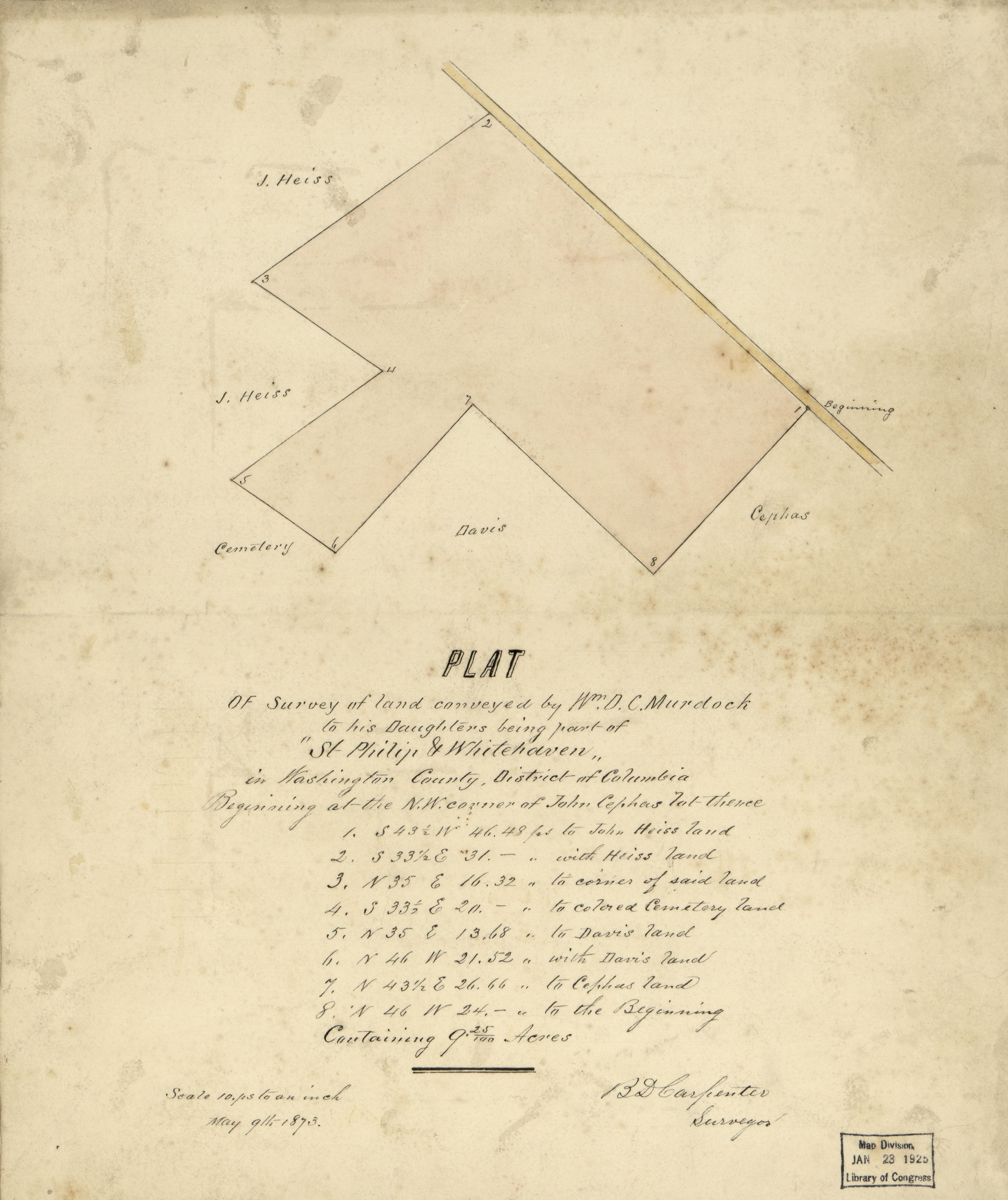
English: Cadastral survey map of single land tract, location unclear. "May 9th 1873." Pen-and-ink and watercolor. Fold-lined and mounted on cloth backing. Includes table of survey data. Available also through the Library of Congress Web site as a raster image. Vault DCP |
||
| Title | Plat of survey of land conveyed by Wm. D.C. Murdock to his daughters being part of "St. Philip & Whitehaven" in Washington County, District of Columbia | ||
| Shelf ID | G3851.G46 1873 .C3 | ||
| Date | |||
| Source | https://www.loc.gov/item/88693085/ | ||
| Author | Carpenter, D. (Benjamin D.); Murdock, Wm. D. C. (William D. C.); Carpenter, D. | ||
| Permission (Reusing this file) |
|
||
| Other versions |
|
||
| Location | United States · Washington D.C. · District Of Columbia · Washington | ||
| Part of | American Memory · Catalog · County Landownership Maps · Geography And Map Division · Cultural Landscapes | ||
| Subject | Washington (D.C.) · Surveys · Washington · United States · Maps · District Of Columbia · Real Property · Manuscript Maps |

Licensing[edit]
|
This is a faithful photographic reproduction of a two-dimensional, public domain work of art. The work of art itself is in the public domain for the following reason:
The official position taken by the Wikimedia Foundation is that "faithful reproductions of two-dimensional public domain works of art are public domain".
This photographic reproduction is therefore also considered to be in the public domain in the United States. In other jurisdictions, re-use of this content may be restricted; see Reuse of PD-Art photographs for details. | ||||
File history
Click on a date/time to view the file as it appeared at that time.
| Date/Time | Thumbnail | Dimensions | User | Comment | |
|---|---|---|---|---|---|
| current | 08:13, 21 May 2018 | | 3,247 × 3,865 (1.21 MB) | Fæ (talk | contribs) | LOC Maps https://www.loc.gov/item/88693085/ #691 |
You cannot overwrite this file.
File usage on Commons
The following page uses this file: