File:Plane Street, Hull - geograph.org.uk - 1207506.jpg
Jump to navigation
Jump to search
No higher resolution available.
Plane_Street,_Hull_-_geograph.org.uk_-_1207506.jpg (640 × 537 pixels, file size: 138 KB, MIME type: image/jpeg)
Captions
Captions
Add a one-line explanation of what this file represents
Summary
[edit]
| Description |
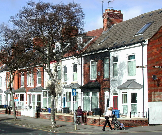
English: Plane Street, Hull Looking north from outside No.118. The house on the right is No.115 on the corner of Arthur Street. Many of the terraced houses in this part of Hull are being knocked down while others are being given a 'frontage improvement' by the city council. Part of this involves replacing the hotchpotch of front fences with low brick walls and wrought iron railings like the ones shown here. These are probably quite similar to what would have been here before World War Two when all wrought iron railings except those around the cemeteries were removed and the iron reused in munitions manufacturing. |
| Date | |
| Source | From geograph.org.uk |
| Author | Paul Glazzard |
| Attribution (required by the license) | Paul Glazzard / Plane Street, Hull / |
| Camera location | | View this and other nearby images on: OpenStreetMap |
|---|
_heading:0.00&language=en)
| Object location | | View this and other nearby images on: OpenStreetMap |
|---|
_heading:0.00&language=en)
Licensing
[edit]

|
This image was taken from the Geograph project collection. See this photograph's page on the Geograph website for the photographer's contact details. The copyright on this image is owned by Paul Glazzard and is licensed for reuse under the Creative Commons Attribution-ShareAlike 2.0 license.
|
This file is licensed under the Creative Commons Attribution-Share Alike 2.0 Generic license.
Attribution: Paul Glazzard
- You are free:
- to share – to copy, distribute and transmit the work
- to remix – to adapt the work
- Under the following conditions:
- attribution – You must give appropriate credit, provide a link to the license, and indicate if changes were made. You may do so in any reasonable manner, but not in any way that suggests the licensor endorses you or your use.
- share alike – If you remix, transform, or build upon the material, you must distribute your contributions under the same or compatible license as the original.
File history
Click on a date/time to view the file as it appeared at that time.
| Date/Time | Thumbnail | Dimensions | User | Comment | |
|---|---|---|---|---|---|
| current | 04:09, 26 February 2011 | | 640 × 537 (138 KB) | GeographBot (talk | contribs) | == {{int:filedesc}} == {{Information |description={{en|1=Plane Street, Hull Looking north from outside No.118. The house on the right is No.115 on the corner of Arthur Street. Many of the terraced houses in this part of Hull are being knocked down while o |
You cannot overwrite this file.
File usage on Commons
There are no pages that use this file.