File:Plan Tours siette.jpg
Jump to navigation
Jump to search

Size of this preview: 794 × 599 pixels. Other resolutions: 318 × 240 pixels | 636 × 480 pixels | 1,018 × 768 pixels | 1,215 × 917 pixels.
Original file (1,215 × 917 pixels, file size: 633 KB, MIME type: image/jpeg)
Captions
Captions
Add a one-line explanation of what this file represents
Summary[edit]
| Description |
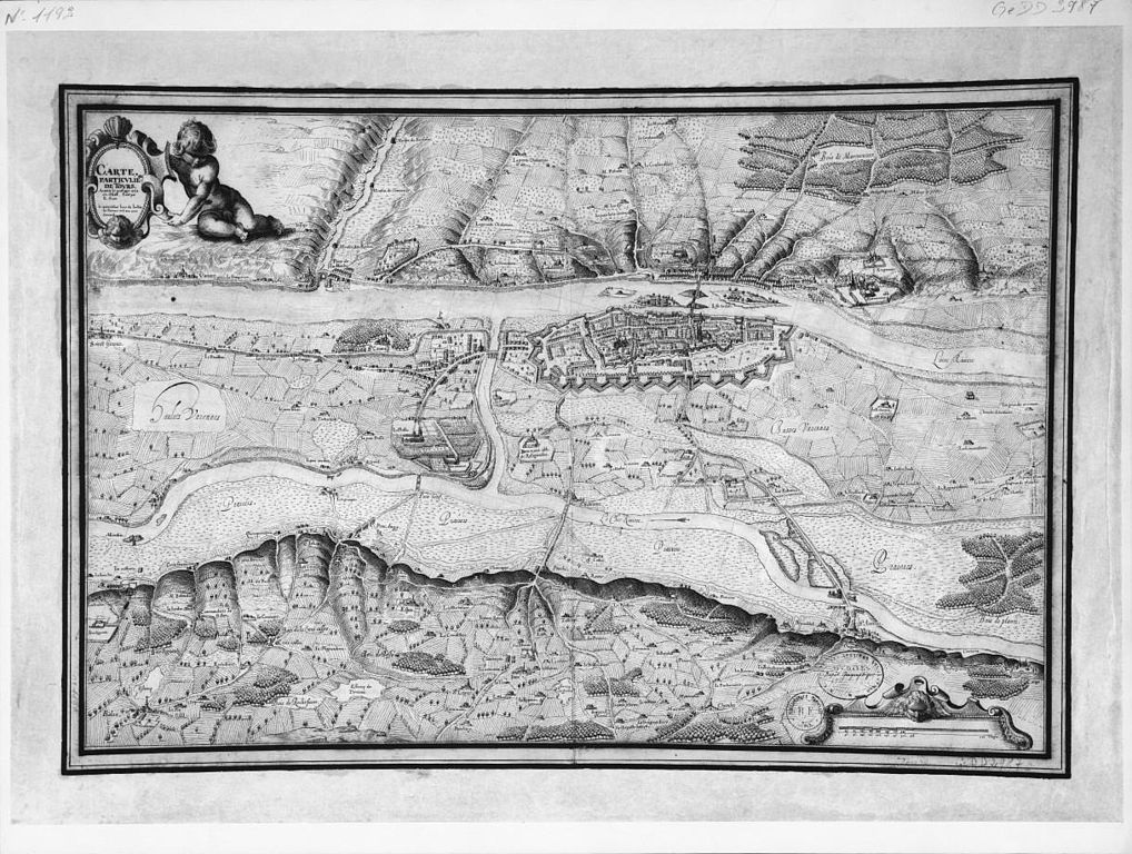
Français : plan de Tours en 1619 |
| Date | |
| Source |
http://gallica.bnf.fr/ark:/12148/btv1b7710147m Provenance : bnf.fr Date de mise en ligne : 15/10/2007 |
| Author | René Siette cartographe |
Licensing[edit]
|
This work is in the public domain in its country of origin and other countries and areas where the copyright term is the author's life plus 100 years or fewer. | |
| This file has been identified as being free of known restrictions under copyright law, including all related and neighboring rights. | |
File history
Click on a date/time to view the file as it appeared at that time.
| Date/Time | Thumbnail | Dimensions | User | Comment | |
|---|---|---|---|---|---|
| current | 12:52, 15 March 2015 | | 1,215 × 917 (633 KB) | VIGNERON (talk | contribs) | better version from the source |
| 16:05, 2 July 2014 |  | 654 × 542 (68 KB) | Arcyon37 (talk | contribs) | User created page with UploadWizard |
You cannot overwrite this file.
File usage on Commons
There are no pages that use this file.