File:Picton Lennox and Nueva.png
Jump to navigation
Jump to search
No higher resolution available.
Picton_Lennox_and_Nueva.png (800 × 600 pixels, file size: 38 KB, MIME type: image/png)
Captions
Captions
Add a one-line explanation of what this file represents
Largely self-made, using www.planiglobe.com (License archive copy at the Wayback Machine) as source for cartographic data and colors from CIA World Factbook maps.
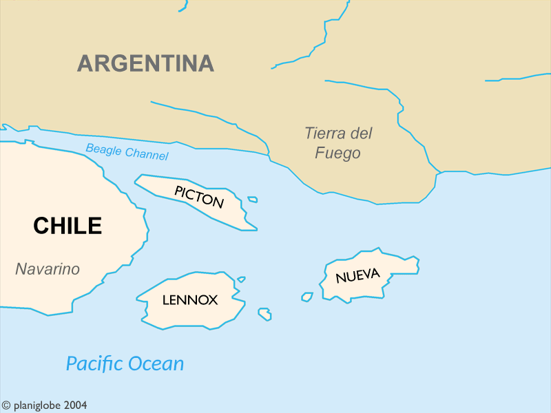
These Islands are part of Chile and where disputed by Chile and Argentina until 1985.
Author: Cantus
This file is licensed under the Creative Commons Attribution 2.5 Generic license.
- You are free:
- to share – to copy, distribute and transmit the work
- to remix – to adapt the work
- Under the following conditions:
- attribution – You must give appropriate credit, provide a link to the license, and indicate if changes were made. You may do so in any reasonable manner, but not in any way that suggests the licensor endorses you or your use.
Planiglobe license:
| This image is from Planiglobe. All maps hosted on Planiglobe are licensed under the Creative Commons Attribution 2.5 License, but Planiglobe suggests that they not be used for navigational purposes. For the purposes of this license, this clause is considered a disclaimer and not a license restriction. This file is licensed under the Creative Commons Attribution 2.5 Generic license.
|
File history
Click on a date/time to view the file as it appeared at that time.
| Date/Time | Thumbnail | Dimensions | User | Comment | |
|---|---|---|---|---|---|
| current | 21:36, 1 January 2018 | | 800 × 600 (38 KB) | Janitoalevic (talk | contribs) | . |
| 22:24, 1 September 2005 |  | 800 × 600 (21 KB) | B1mbo (talk | contribs) | Largely self-made, using www.planiglobe.com ([http://www.planiglobe.com/eula.html License]) as source for cartographic data and colors from CIA World Factbook maps. Author: Cantus {{CopyrightedFreeUse}} Category:Maps of Chile |
You cannot overwrite this file.
File usage on Commons
The following page uses this file:
File usage on other wikis
The following other wikis use this file:
- Usage on ast.wikipedia.org
- Usage on eo.wikipedia.org
- Usage on es.wikipedia.org
- Usage on fr.wikipedia.org
- Usage on it.wikipedia.org
- Usage on ja.wikipedia.org
- Usage on ko.wikipedia.org
- Usage on no.wikipedia.org
- Usage on pl.wikipedia.org
- Usage on pt.wikipedia.org
- Usage on tr.wikipedia.org
- Usage on www.wikidata.org