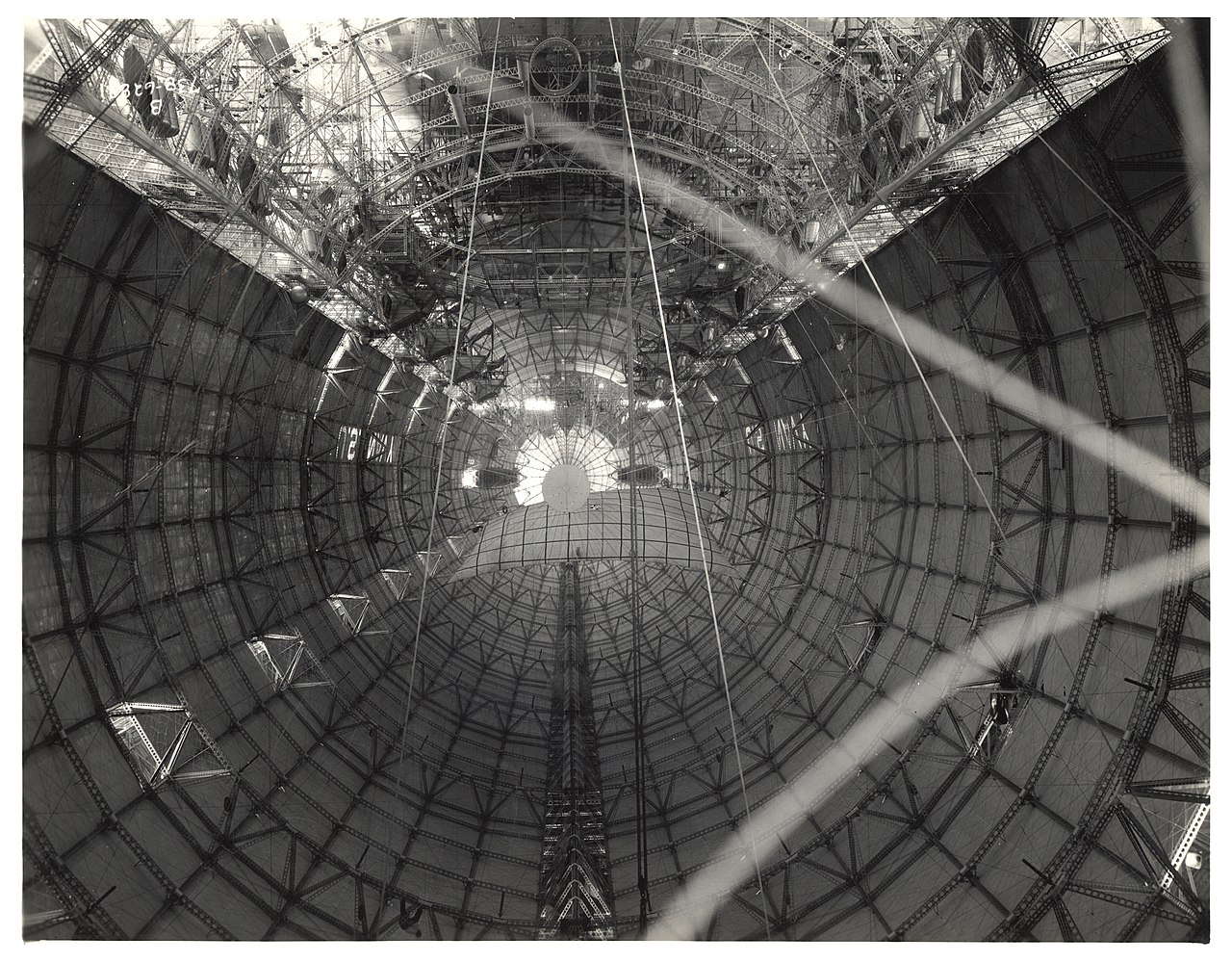
File:Photograph of the Interior Hull of a Dirigible before Gas Cells were Installed, ca. 1933 (7951502220).jpg

Original file (3,150 × 2,458 pixels, file size: 2.99 MB, MIME type: image/jpeg)
Captions
Captions
Summary[edit]
.jpg&action=edit§ion=1)
| Description |
Original Caption: Photograph of the Interior Hull of a Dirigible before Gas Cells were Installed, ca. 1933 U.S. National Archives’ HMS Record Entry ID: NWL-16051 Creator: U.S. Congress. Joint Committee to Investigate Dirigible Disasters
Persistent URL: arcweb.archives.gov/arc/action/ExternalIdSearch?id=6708559 Repository: Still Picture Records Section, Special Media Archives Services Division (NWCS-S), National Archives at College Park, 8601 Adelphi Road, College Park, MD, 20740-6001. For information about ordering reproductions of photographs held by the Still Picture Unit, visit: www.archives.gov/research/order/still-pictures.html Reproductions may be ordered via an independent vendor. NARA maintains a list of vendors at www.archives.gov/research/order/vendors-photos-maps-dc.html Access Restrictions: Unrestricted Use Restrictions: Unrestricted |
|||
| Source |
Photograph of the Interior Hull of a Dirigible before Gas Cells were Installed, ca. 1933
|
|||
| Author | The U.S. National Archives | |||
| Permission (Reusing this file) |
The U.S. National Archives @ Flickr Commons |
| Camera location | | View this and other nearby images on: OpenStreetMap |
|---|
.jpg¶ms=041.043109_N_-081.469711_E_globe:Earth_type:camera_source:Flickr_&language=en)
Licensing[edit]
.jpg&action=edit§ion=2)
This image was taken from Flickr's The Commons. The uploading organization may have various reasons for determining that no known copyright restrictions exist, such as:
More information can be found at https://flickr.com/commons/usage/. Please add additional copyright tags to this image if more specific information about copyright status can be determined. See Commons:Licensing for more information. |
| This image was originally posted to Flickr by The U.S. National Archives at https://flickr.com/photos/35740357@N03/7951502220. It was reviewed on 19 April 2016 by FlickreviewR and was confirmed to be licensed under the terms of the No known copyright restrictions. |
File history
Click on a date/time to view the file as it appeared at that time.
| Date/Time | Thumbnail | Dimensions | User | Comment | |
|---|---|---|---|---|---|
| current | 19:59, 19 April 2016 | | 3,150 × 2,458 (2.99 MB) | Rhododendrites (talk | contribs) | Transferred from Flickr via Flickr2Commons |
You cannot overwrite this file.
File usage on Commons
The following 3 pages use this file:
File usage on other wikis
The following other wikis use this file:
- Usage on zh.wikipedia.org
.jpg&oldid=736535130)