File:Peru sat.png
Jump to navigation
Jump to search
Size of this preview: 742 × 599 pixels. Other resolutions: 297 × 240 pixels | 594 × 480 pixels | 951 × 768 pixels | 1,268 × 1,024 pixels | 2,536 × 2,048 pixels | 2,600 × 2,100 pixels.
Original file (2,600 × 2,100 pixels, file size: 11.25 MB, MIME type: image/png)
Captions
Captions
Add a one-line explanation of what this file represents
Summary[edit]
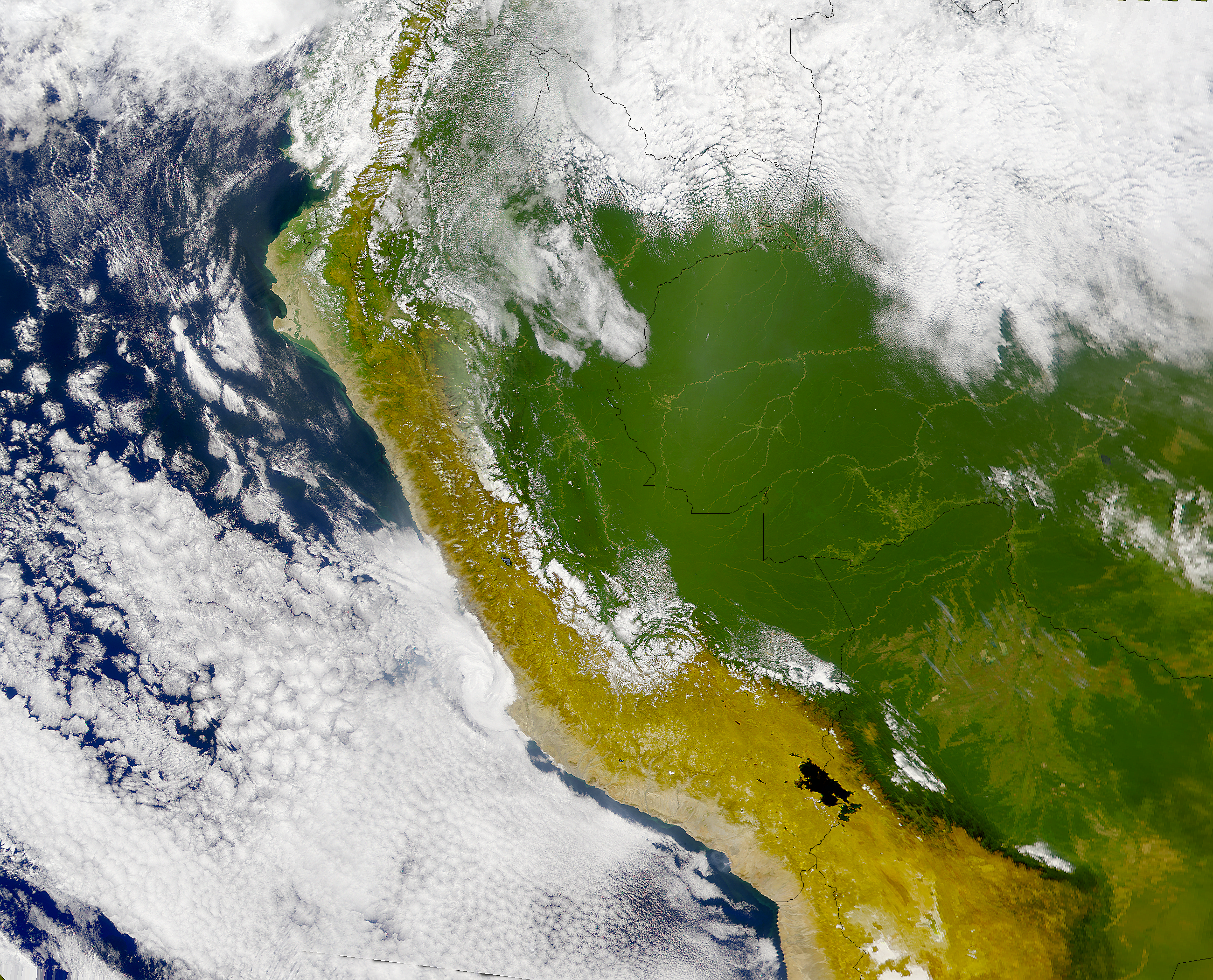
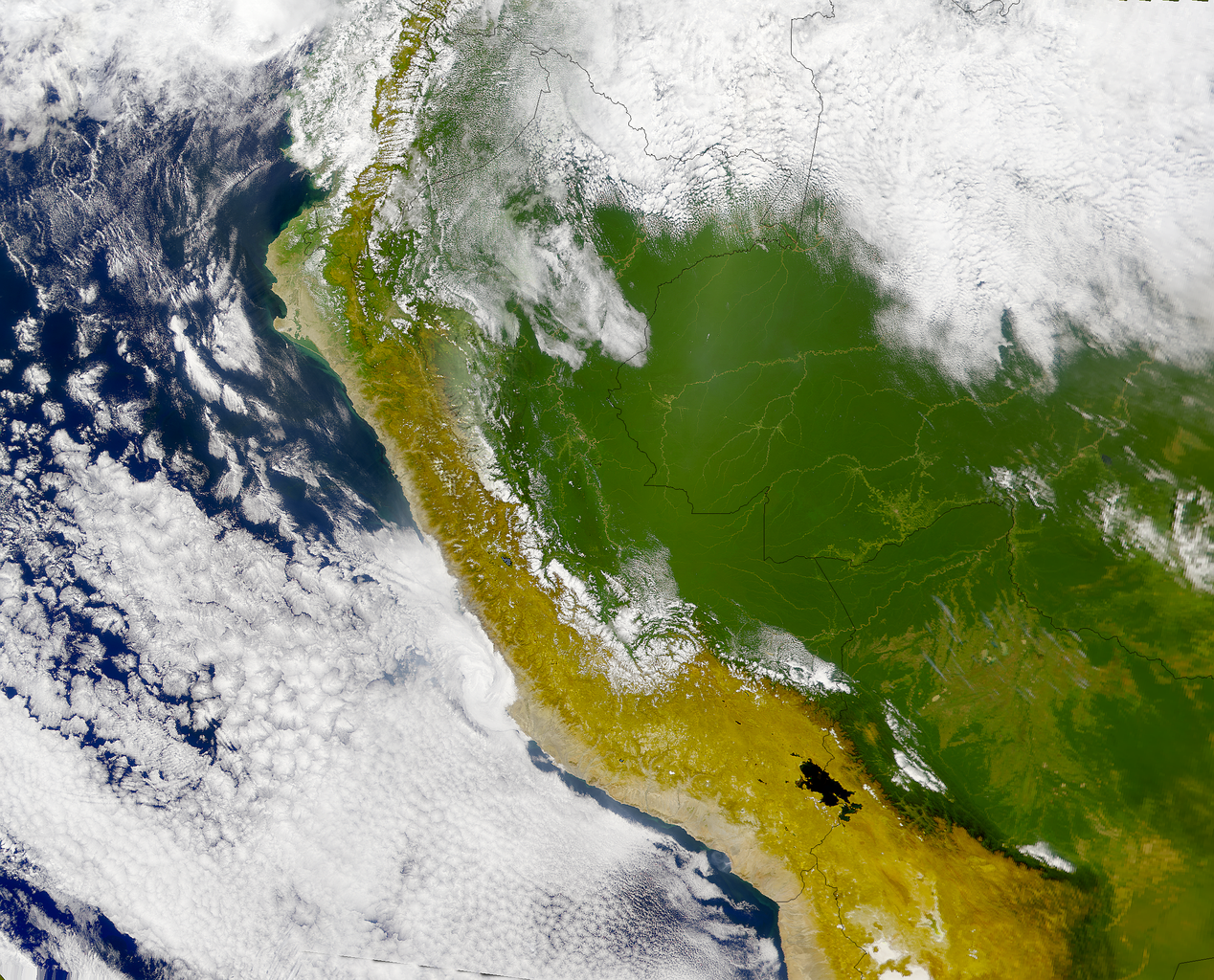
Runa Simi: Piruwta satélite tikti.
Español: Imagen satelital del Perú.
English: Satellite image of Perú.
Licensing[edit]
| This file is in the public domain in the United States because it was solely created by NASA. NASA copyright policy states that "NASA material is not protected by copyright unless noted". (See Template:PD-USGov, NASA copyright policy page or JPL Image Use Policy.) | ||
 |
Warnings:
|
derivative works[edit]
Derivative works of this file: Piura satelital.png
File history
Click on a date/time to view the file as it appeared at that time.
| Date/Time | Thumbnail | Dimensions | User | Comment | |
|---|---|---|---|---|---|
| current | 21:11, 23 April 2005 | | 2,600 × 2,100 (11.25 MB) | Huhsunqu (talk | contribs) | *Piruwta ''satélite'' imaxin. *Imagen satelital del Perú. *Satellite image of Perú. {{PD-USGov-NASA}} Category:Maps of Peru Category:Satellite images |
You cannot overwrite this file.
File usage on Commons
The following 2 pages use this file:
File usage on other wikis
The following other wikis use this file:
- Usage on af.wikipedia.org
- Usage on arz.wikipedia.org
- Usage on ca.wikipedia.org
- Usage on en.wikipedia.org
- Usage on es.wikipedia.org
- Usage on fa.wikipedia.org
- Usage on fr.wikipedia.org
- Usage on gl.wikipedia.org
- Usage on incubator.wikimedia.org
- Usage on it.wikipedia.org
- Usage on mt.wikipedia.org
- Usage on pl.wikipedia.org
- Usage on qu.wikipedia.org
- Kunturkunka (Ayakuchu)
- Rurimachay
- Chiqllarasu
- Achasiri
- Punpuyaq
- Kukauru
- Lunq'u urqu
- Wanipaku
- Aknu
- Luqlusqa
- Yanakusma
- T'uksi urqu
- Yanawaqra
- Chankarra
- Kunturillu
- Pukaqapa
- Urpuna
- Pawqaray urqu
- Pikullu
- Chuymala
- Pumanuta
- Putaqa (Anqash)
- Waqay Willka
- Bonanta
- Quriwayrachina rit'i urqu
- Chuqitakarpu
- Chawpimayu rit'i urqu
- Qullqa hirka
- Wila Quta rit'i urqu (Qusqu)
View more global usage of this file.