File:PequeñaEntente.svg
Jump to navigation
Jump to search

Size of this PNG preview of this SVG file: 800 × 589 pixels. Other resolutions: 320 × 236 pixels | 640 × 471 pixels | 1,024 × 754 pixels | 1,280 × 942 pixels | 2,560 × 1,884 pixels | 822 × 605 pixels.
Original file (SVG file, nominally 822 × 605 pixels, file size: 113 KB)
Captions
Captions
Add a one-line explanation of what this file represents
| Description |
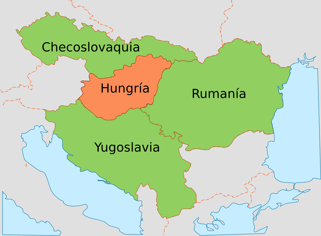
Español: Mapa con los países de la wikipedia:es:Pequeña Entente y su principal adversario, Hungría.
English: Map showing the Little Entente and its main adversary, Hungary. |
| Date | (UTC) |
| Source | |
| Author |
|
| This is a retouched picture, which means that it has been digitally altered from its original version. Modifications: New map using the borders in the original. The original can be viewed here: WW2 Holocaust Europe map-fr.svg:
|
I, the copyright holder of this work, hereby publish it under the following license:
This file is licensed under the Creative Commons Attribution 3.0 Unported license.
- You are free:
- to share – to copy, distribute and transmit the work
- to remix – to adapt the work
- Under the following conditions:
- attribution – You must give appropriate credit, provide a link to the license, and indicate if changes were made. You may do so in any reasonable manner, but not in any way that suggests the licensor endorses you or your use.
Original upload log[edit]
This image is a derivative work of the following images:
- File:WW2_Holocaust_Europe_map-fr.svg licensed with Cc-by-3.0
- 2009-05-11T16:52:07Z Sémhur 1310x1090 (607330 Bytes) {{Information |Description=Map of the Holocaust in Europe during World War II, 1939-1945. This map shows all extermination camps (or ''death camps''), most major concentration camps, labor camps, prison camps, ghettos, major
Uploaded with derivativeFX
File history
Click on a date/time to view the file as it appeared at that time.
| Date/Time | Thumbnail | Dimensions | User | Comment | |
|---|---|---|---|---|---|
| current | 13:16, 7 December 2016 | | 822 × 605 (113 KB) | Rowanwindwhistler (talk | contribs) | https://en.wikipedia.org/wiki/Wikipedia:WikiProject_Maps/Conventions Fake text added |
| 11:29, 29 August 2010 |  | 822 × 605 (83 KB) | Rowanwindwhistler (talk | contribs) | {{Information |Description={{es|1=Mapa con los países de la wikipedia:es:Pequeña Entente y su principal adversario, Hungría.}} {{en|1=Map showing the Little Entente and its main adversary, Hungary.}} |Source=*[[:File:WW2_Holocaust_Europe_map-fr.svg |
You cannot overwrite this file.
File usage on Commons
There are no pages that use this file.
File usage on other wikis
The following other wikis use this file:
- Usage on ast.wikipedia.org
- Usage on en.wikipedia.org
- Usage on eo.wikipedia.org
- Usage on es.wikipedia.org
- Usage on pt.wikipedia.org
- Usage on ro.wikipedia.org
- Usage on zh.wikipedia.org