File:Path up Colley Hill - geograph.org.uk - 1316031.jpg
Jump to navigation
Jump to search
No higher resolution available.
Path_up_Colley_Hill_-_geograph.org.uk_-_1316031.jpg (640 × 426 pixels, file size: 145 KB, MIME type: image/jpeg)
Captions
Captions
Add a one-line explanation of what this file represents
Summary
[edit]
| Description |
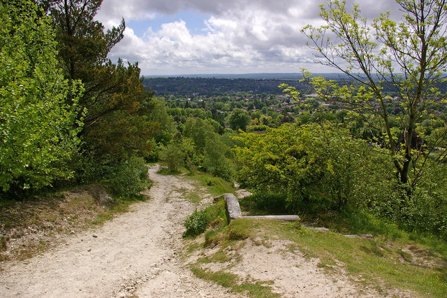
English: Path up Colley Hill. One of the medieval routes out of Reigate over the North Downs, leading over Colley Hill and on to Walton Heath. This is looking down the path, with central Reigate on the right in the background, with the High Trees ridge on the left. In the foreground is the brick structure seen in 1316028. |
| Date | |
| Source | From geograph.org.uk |
| Author | Ian Capper |
| Attribution (required by the license) | Ian Capper / Path up Colley Hill / |
| Camera location | | View this and other nearby images on: OpenStreetMap |
|---|
_heading:135.00&language=en)
| Object location | | View this and other nearby images on: OpenStreetMap |
|---|
_heading:135.00&language=en)
Licensing
[edit]

|
This image was taken from the Geograph project collection. See this photograph's page on the Geograph website for the photographer's contact details. The copyright on this image is owned by Ian Capper and is licensed for reuse under the Creative Commons Attribution-ShareAlike 2.0 license.
|
This file is licensed under the Creative Commons Attribution-Share Alike 2.0 Generic license.
Attribution: Ian Capper
- You are free:
- to share – to copy, distribute and transmit the work
- to remix – to adapt the work
- Under the following conditions:
- attribution – You must give appropriate credit, provide a link to the license, and indicate if changes were made. You may do so in any reasonable manner, but not in any way that suggests the licensor endorses you or your use.
- share alike – If you remix, transform, or build upon the material, you must distribute your contributions under the same or compatible license as the original.
File history
Click on a date/time to view the file as it appeared at that time.
| Date/Time | Thumbnail | Dimensions | User | Comment | |
|---|---|---|---|---|---|
| current | 17:41, 27 February 2011 | | 640 × 426 (145 KB) | GeographBot (talk | contribs) | == {{int:filedesc}} == {{Information |description={{en|1=Path up Colley Hill One of the medieval routes out of Reigate over the North Downs, leading over Colley Hill and on to Walton Heath. This is looking down the path, with central Reigate on the right |
You cannot overwrite this file.
File usage on Commons
There are no pages that use this file.