File:Partition-plan-Talleyrand-en.svg
Jump to navigation
Jump to search

Size of this PNG preview of this SVG file: 426 × 599 pixels. Other resolutions: 171 × 240 pixels | 341 × 480 pixels | 546 × 768 pixels | 728 × 1,024 pixels | 1,456 × 2,048 pixels.
Original file (SVG file, nominally 426 × 599 pixels, file size: 312 KB)
Captions
Captions
Add a one-line explanation of what this file represents
Summary[edit]
| Description |
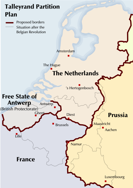
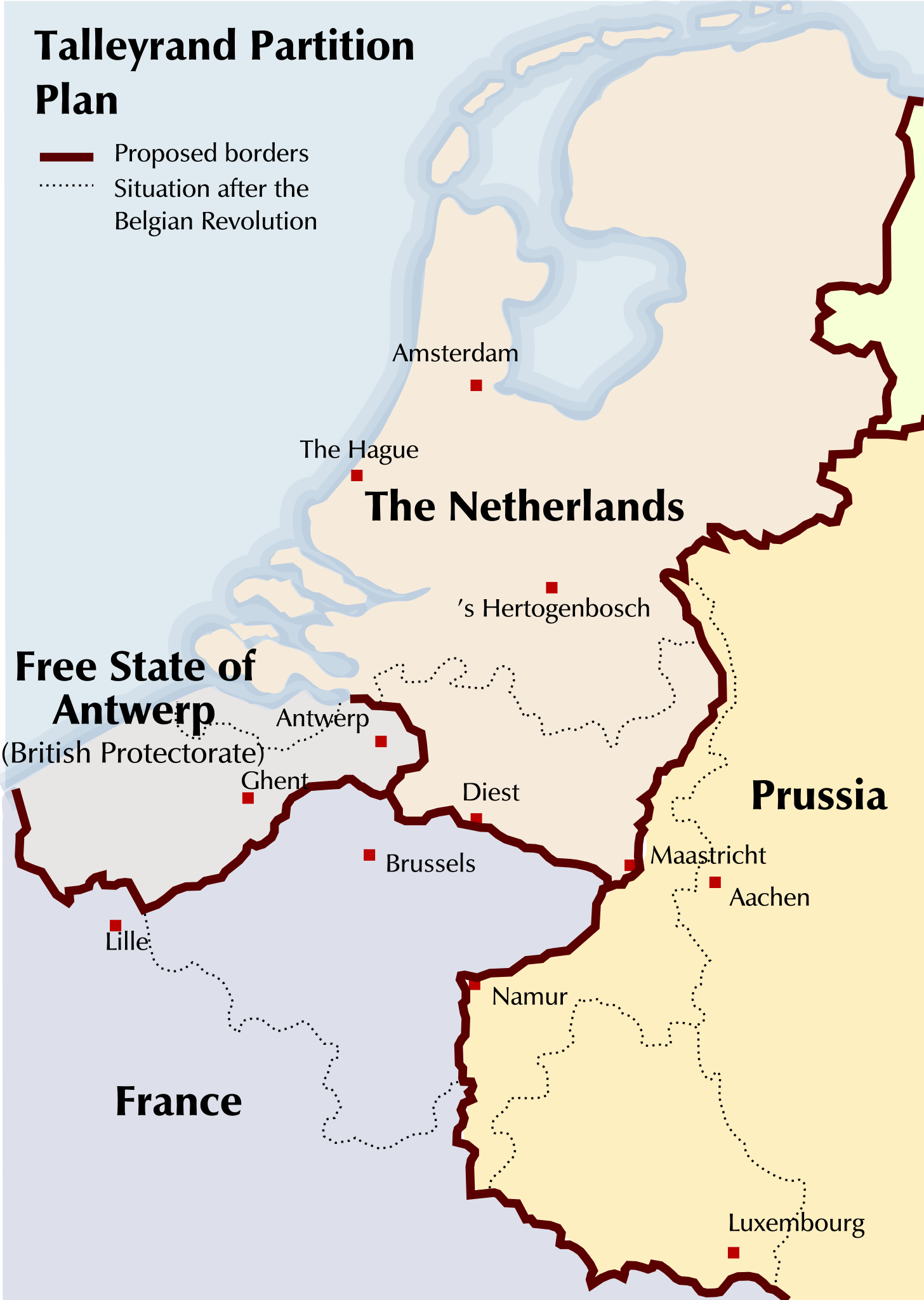
English: Map of a partitioning of the Southern Netherlands proposed by Talleyrand after the Belgian Revolution of 1830 |
| Date | |
| Source | Based on a GFDL Image: Image:Verdelingsplan_Talleyrand.PNG |
| Author | Michiel Buddingh', basing it on an image by Nederlandse Leeuw, which was itself based on an image by Karel Anthonissen |
| Other versions |
Derivative works of this file: Partition-plan-Talleyrand-nl.svg Image:Talleyrand_partition_plan.jpg, Image:Verdelingsplan_Talleyrand.PNG |
Licensing[edit]

|
Permission is granted to copy, distribute and/or modify this document under the terms of the GNU Free Documentation License, Version 1.2 or any later version published by the Free Software Foundation; with no Invariant Sections, no Front-Cover Texts, and no Back-Cover Texts. A copy of the license is included in the section entitled GNU Free Documentation License. |
| This file is licensed under the Creative Commons Attribution-Share Alike 3.0 Unported license. | ||
| ||
| This licensing tag was added to this file as part of the GFDL licensing update. |
File history
Click on a date/time to view the file as it appeared at that time.
| Date/Time | Thumbnail | Dimensions | User | Comment | |
|---|---|---|---|---|---|
| current | 21:09, 19 August 2011 | | 426 × 599 (312 KB) | Hans Erren (talk | contribs) | north-limburg talleyrand boundary moved river Meuse |
| 23:38, 4 September 2008 |  | 426 × 599 (426 KB) | Michiel Buddingh'~commonswiki (talk | contribs) | {{Information |Description={{en|1=Map of a partitioning of the Southern Netherlands proposed by Talleyrand after the Belgian Revolution of 1830}} |Source=Based on a GFDL Image: Image:Verdelingsplan_Talleyrand.PNG |Author=[[User:Michiel Buddingh'|Mich |
You cannot overwrite this file.
File usage on Commons
The following 2 pages use this file:
File usage on other wikis
The following other wikis use this file:
- Usage on ar.wikipedia.org
- Usage on azb.wikipedia.org
- Usage on bg.wikipedia.org
- Usage on en.wikipedia.org
- Usage on fr.wikipedia.org
- Usage on id.wikipedia.org
- Usage on ja.wikipedia.org
- Usage on lv.wikipedia.org
- Usage on ms.wikipedia.org
- Usage on pt.wikipedia.org
- Usage on zh.wikipedia.org