File:Parc Slate Quarry map.jpg
Jump to navigation
Jump to search

Size of this preview: 740 × 599 pixels. Other resolutions: 296 × 240 pixels | 593 × 480 pixels | 821 × 665 pixels.
Original file (821 × 665 pixels, file size: 246 KB, MIME type: image/jpeg)
Captions
Captions
Add a one-line explanation of what this file represents


Summary
[edit]
| Description |
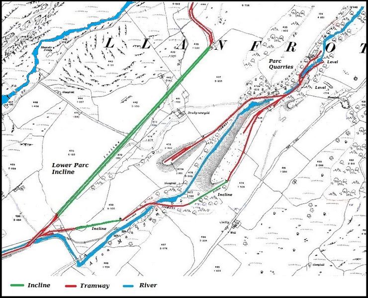
English: Map of the Parc Slate Quarry, Gwynedd, Wales from 1915, with coloured overlays to show the tramways and rivers |
| Date | |
| Source | Ordnance Survey 1915 |
| Author | Ordnance Survey, coloured overlays by Bob1960evens |
Licensing
[edit]
This work created by the United Kingdom Government is in the public domain.
This is because it is one of the following:
HMSO has declared that the expiry of Crown Copyrights applies worldwide (ref: HMSO Email Reply)
|
 |
The work is in the public domain because it was published by the Ordnance Survey and is more than 50 years old.
File history
Click on a date/time to view the file as it appeared at that time.
| Date/Time | Thumbnail | Dimensions | User | Comment | |
|---|---|---|---|---|---|
| current | 08:29, 3 October 2016 | | 821 × 665 (246 KB) | Bob1960evens (talk | contribs) | User created page with UploadWizard |
You cannot overwrite this file.
File usage on Commons
The following page uses this file:
File usage on other wikis
The following other wikis use this file:
- Usage on en.wikipedia.org
- Usage on www.wikidata.org