File:Paraguay location map.svg
Jump to navigation
Jump to search

Size of this PNG preview of this SVG file: 545 × 600 pixels. Other resolutions: 218 × 240 pixels | 436 × 480 pixels | 698 × 768 pixels | 930 × 1,024 pixels | 1,861 × 2,048 pixels | 1,261 × 1,388 pixels.
Original file (SVG file, nominally 1,261 × 1,388 pixels, file size: 177 KB)
Captions
Captions
Add a one-line explanation of what this file represents
Summary
[edit]| Description |
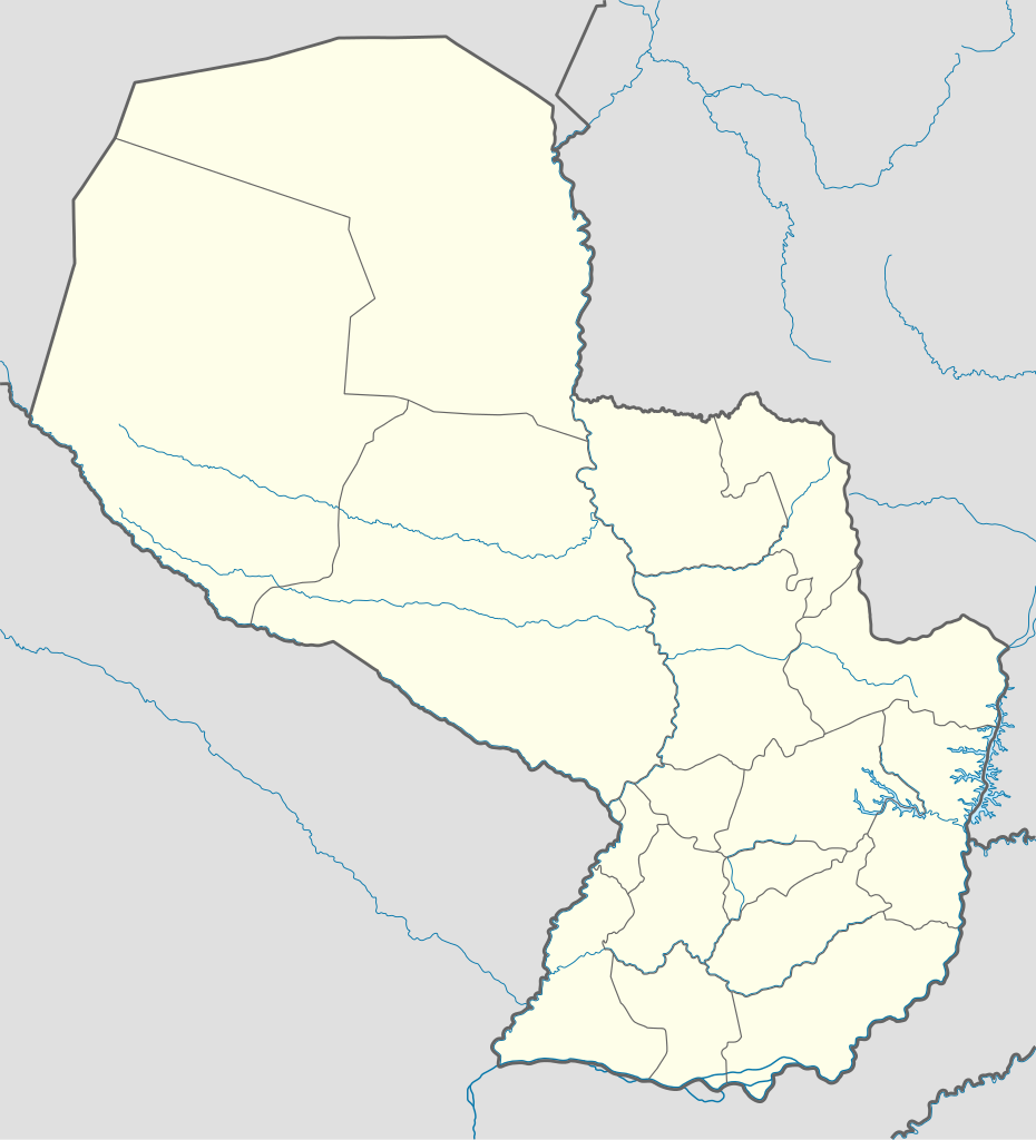
Deutsch: Positionskarte von Paraguay
Quadratische Plattkarte, N-S-Streckung 110 %. Geographische Begrenzung der Karte:
English: Location map of Paraguay
Equirectangular projection, N/S stretching 110 %. Geographic limits of the map:
|
| Date | |
| Source |
own work, using
|
| Author | NordNordWest |
| Other versions |
Derivative works of this file:
|


|
This map has been made or improved in the German Kartenwerkstatt (Map Lab). You can propose maps to improve as well.
|
Licensing
[edit]
I, the copyright holder of this work, hereby publish it under the following licenses:

|
Permission is granted to copy, distribute and/or modify this document under the terms of the GNU Free Documentation License, Version 1.2 or any later version published by the Free Software Foundation; with no Invariant Sections, no Front-Cover Texts, and no Back-Cover Texts. A copy of the license is included in the section entitled GNU Free Documentation License. |
This file is licensed under the Creative Commons Attribution-Share Alike 3.0 Unported license.
- You are free:
- to share – to copy, distribute and transmit the work
- to remix – to adapt the work
- Under the following conditions:
- attribution – You must give appropriate credit, provide a link to the license, and indicate if changes were made. You may do so in any reasonable manner, but not in any way that suggests the licensor endorses you or your use.
- share alike – If you remix, transform, or build upon the material, you must distribute your contributions under the same or compatible license as the original.
You may select the license of your choice.
File history
Click on a date/time to view the file as it appeared at that time.
| Date/Time | Thumbnail | Dimensions | User | Comment | |
|---|---|---|---|---|---|
| current | 09:35, 24 November 2011 | | 1,261 × 1,388 (177 KB) | NordNordWest (talk | contribs) | corr |
| 19:59, 1 September 2009 |  | 1,262 × 1,388 (301 KB) | NordNordWest (talk | contribs) | ||
| 15:18, 25 July 2008 |  | 842 × 926 (153 KB) | NordNordWest (talk | contribs) | ||
| 15:14, 25 July 2008 |  | 842 × 926 (154 KB) | NordNordWest (talk | contribs) | {{Information |Description= {{de|Positionskarte von Paraguay}} Quadratische Plattkarte, N-S-Streckung 110 %. Geographische Begrenzung der Karte: * N: 19.0° S * S: 27.9° S * W: 62.9° W * O: 54.0° W {{en|Location map of [[:en:Paraguay|P |
You cannot overwrite this file.
File usage on Commons
The following 28 pages use this file:
- User:NordNordWest/Gallery/Location maps
- File:Alto Paraguay in Paraguay.svg
- File:Alto Parana in Paraguay.svg
- File:Amambay in Paraguay.svg
- File:Asuncion Capital District in Paraguay.svg
- File:Asuncion Capital District in Paraguay (special marker).svg
- File:Boqueron in Paraguay.svg
- File:Caaguazu in Paraguay.svg
- File:Caazapa in Paraguay.svg
- File:Canindeyu in Paraguay.svg
- File:Central in Paraguay.svg
- File:Concepcion in Paraguay.svg
- File:Copa America Paraguay 1999 estadios.png
- File:Cordillera in Paraguay.svg
- File:Guaira in Paraguay.svg
- File:Itapua in Paraguay.svg
- File:Misiones in Paraguay.svg
- File:Neembucu in Paraguay.svg
- File:Paraguari in Paraguay.svg
- File:Presidente Hayes in Paraguay.svg
- File:Ruta 11 paraguay.PNG
- File:Ruta 3 - trayecto.PNG
- File:Ruta 5 paraguay.PNG
- File:Rutas Nacionales del Paraguay.PNG
- File:San Pedro in Paraguay.svg
- File:Trayecto Ruta 10 Paraguay.PNG
- File:Trayecto Ruta 12 Paraguay.PNG
- File:Trayecto Ruta 8 Paraguay.PNG
.svg)
File usage on other wikis
The following other wikis use this file:
- Usage on az.wikipedia.org
- Usage on ba.wikipedia.org
- Usage on be-tarask.wikipedia.org
- Usage on bg.wikipedia.org
- Usage on bn.wikipedia.org
- Usage on crh.wikipedia.org
- Usage on da.wikipedia.org
- Usage on en.wikipedia.org
- Usage on es.wikipedia.org
- Usage on gv.wikipedia.org
- Usage on hsb.wikipedia.org
- Usage on hu.wiktionary.org
- Usage on id.wikipedia.org
- Usage on incubator.wikimedia.org
- Usage on kaa.wikipedia.org
- Usage on kbd.wikipedia.org
- Usage on kk.wikipedia.org
- Usage on ko.wikipedia.org
- Usage on ku.wikipedia.org
- Usage on lez.wikipedia.org
- Usage on mk.wikipedia.org
- Usage on ml.wikipedia.org
- Usage on ms.wikipedia.org
- Usage on os.wikipedia.org
- Usage on pa.wikipedia.org
- Usage on pt.wikipedia.org
View more global usage of this file.