File:Pais Yumbo.jpg
Jump to navigation
Jump to search

Size of this preview: 600 × 600 pixels. Other resolutions: 240 × 240 pixels | 480 × 480 pixels | 768 × 768 pixels | 1,024 × 1,024 pixels | 2,000 × 2,000 pixels.
Original file (2,000 × 2,000 pixels, file size: 1.52 MB, MIME type: image/jpeg)
Captions
Captions
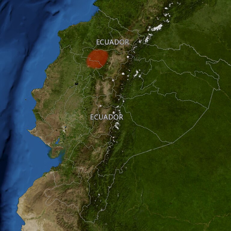
Map of the aproximate area of the Yumbo Countries.
Summary[edit]
| Description |
English: Yumbo countries span over the western part of modern day Pichincha and Santo Domingo de los Tsachilas |
| Date | |
| Source | NASA WorldWind |
| Author | NASA |
Licensing[edit]
| This file is in the public domain in the United States because it was solely created by NASA. NASA copyright policy states that "NASA material is not protected by copyright unless noted". (See Template:PD-USGov, NASA copyright policy page or JPL Image Use Policy.) | ||
 |
Warnings:
|

|
This media file is uncategorized.
Please help improve this media file by adding it to one or more categories, so it may be associated with related media files (how?), and so that it can be more easily found.
Please notify the uploader with {{subst:Please link images|File:Pais Yumbo.jpg}} ~~~~ |
File history
Click on a date/time to view the file as it appeared at that time.
| Date/Time | Thumbnail | Dimensions | User | Comment | |
|---|---|---|---|---|---|
| current | 08:26, 29 April 2023 | | 2,000 × 2,000 (1.52 MB) | SimonLuzuriaga (talk | contribs) | Uploaded a work by NASA from NASA WorldWind with UploadWizard |
You cannot overwrite this file.
File usage on Commons
There are no pages that use this file.
File usage on other wikis
The following other wikis use this file:
- Usage on es.wikipedia.org