File:Pacific Theater Areas;map1-zh.svg
Jump to navigation
Jump to search

Size of this PNG preview of this SVG file: 500 × 380 pixels. Other resolutions: 316 × 240 pixels | 632 × 480 pixels | 1,011 × 768 pixels | 1,280 × 973 pixels | 2,560 × 1,946 pixels.
Original file (SVG file, nominally 500 × 380 pixels, file size: 302 KB)
Captions
Captions
Add a one-line explanation of what this file represents
Summary
[edit]
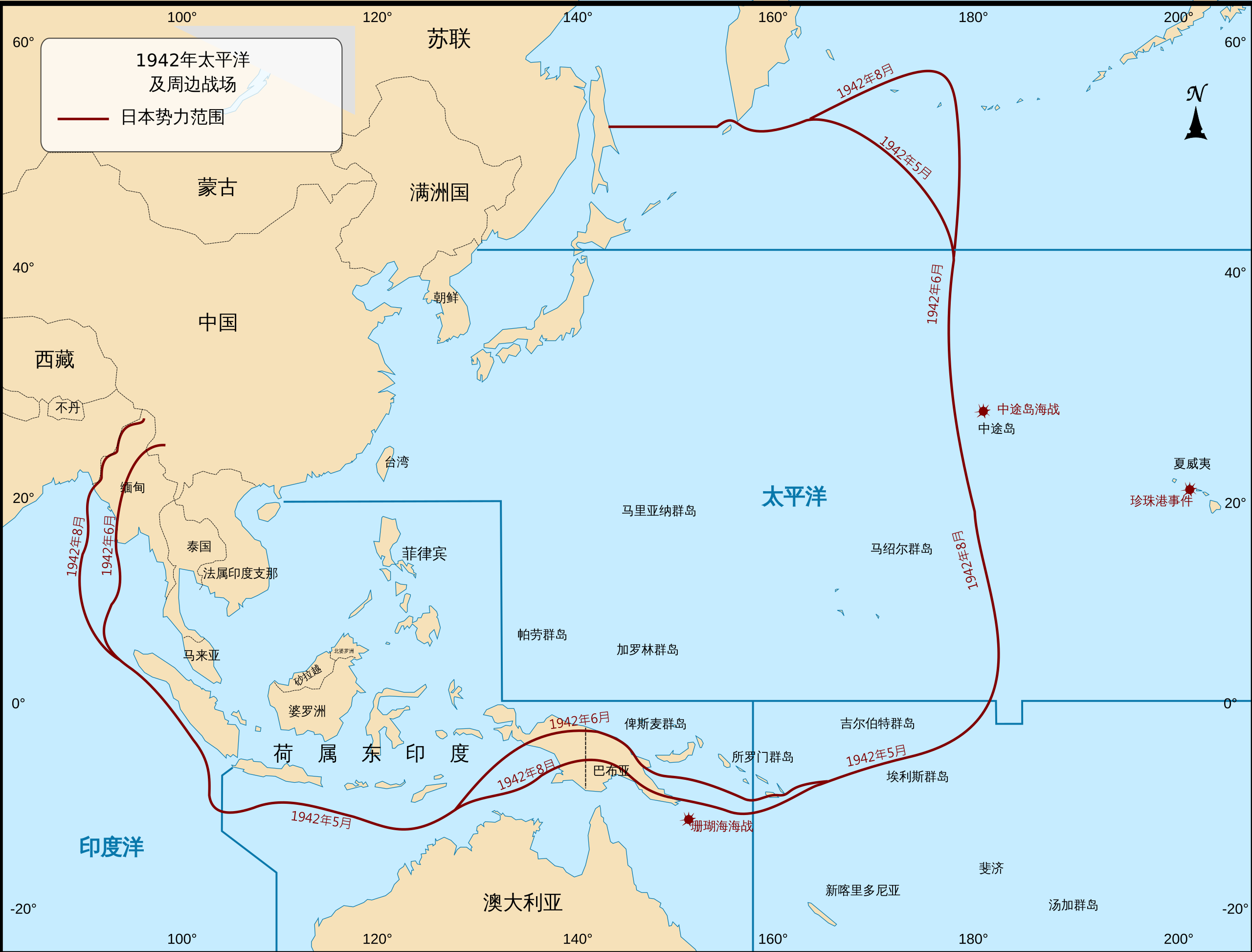
| Description | 第二次世界大戰期間太平洋戰場地圖,以及大日本帝國的勢力範圍。 |
| Date | (UTC) |
| Source |
This file was derived from: Pacific Theater Areas;map1.svg: |
| Author |
|
| This is a retouched picture, which means that it has been digitally altered from its original version. Modifications: Translated into Chinese. The original can be viewed here: Pacific Theater Areas;map1.svg:
|
Licensing
[edit]
This file is a work of a U.S. Army soldier or employee, taken or made as part of that person's official duties. As a work of the U.S. federal government, it is in the public domain in the United States.
|
 |
Original upload log
[edit]
This image is a derivative work of the following images:
- File:Pacific Theater Areas;map1.svg licensed with PD-USGov-Military-Army
- 2009-12-01T23:30:45Z Addicted04 500x380 (657165 Bytes) text
- 2009-12-01T23:17:48Z Addicted04 500x380 (263694 Bytes) {{Information |Description=Map of Pacific theater of operations during World War II showing the boundries of the Japanese Empire. |Source=*[[:File:Pacific_Theater_Areas;map1.JPG|]] |Date=2009-12-01 23:15 (UTC) |Author=*[[:Fil
Uploaded with derivativeFX
File history
Click on a date/time to view the file as it appeared at that time.
| Date/Time | Thumbnail | Dimensions | User | Comment | |
|---|---|---|---|---|---|
| current | 07:15, 29 January 2021 | | 500 × 380 (302 KB) | GnolizX (talk | contribs) | text to path |
| 07:10, 29 January 2021 |  | 500 × 380 (262 KB) | GnolizX (talk | contribs) | == {{int:filedesc}} == {{Information |Description=第二次世界大戰期間太平洋戰場地圖,以及大日本帝國的勢力範圍。 |Source={{Derived from|Pacific Theater Areas;map1.svg|display=50}} |Date=2021-01-29 07:10 (UTC) |Author=* File:Pacific Theater Areas;map1.svg: *Pacific_Theater_Areas;map1.JPG: '''Wwoods''' *derivative work: Addicted04 (<span class="signature-talk">talk</span>) * derivative work: [[User:{{... |
You cannot overwrite this file.
File usage on Commons
The following page uses this file:
File usage on other wikis
The following other wikis use this file:
- Usage on zh.wikipedia.org