File:PIA21451 - Unlocking an Impact Crater's Clues.jpg

Original file (2,880 × 1,800 pixels, file size: 992 KB, MIME type: image/jpeg)
Captions
Captions
Summary[edit]
| Description |
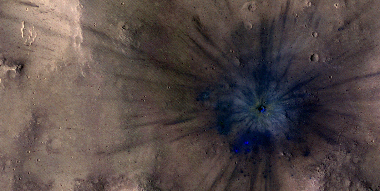
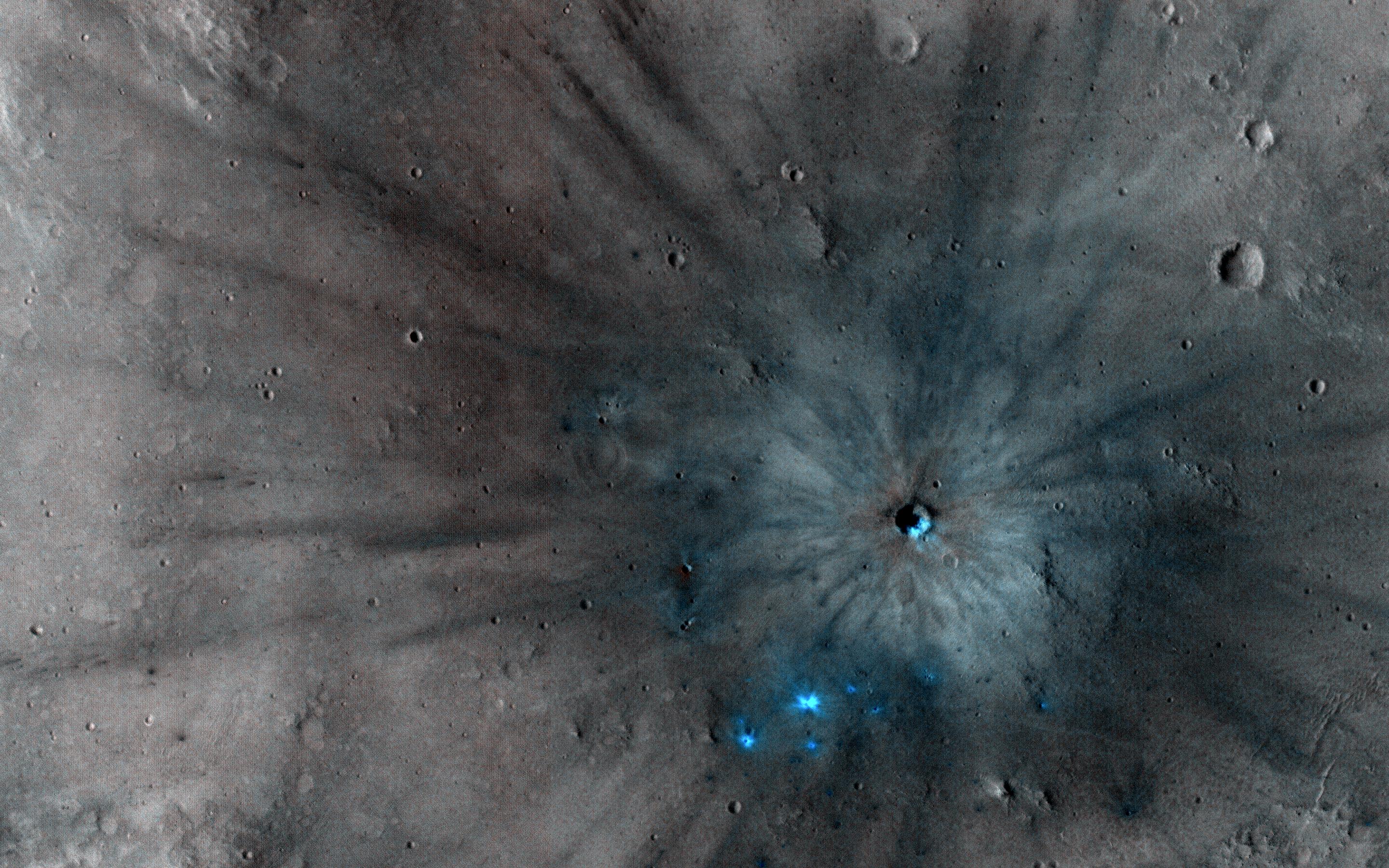
English: Mars is a dynamic planet. HiRISE has witnessed many surface changes over the past ten years, including hundreds of new craters formed by ongoing impacts. Most of these impacts are likely caused by asteroids that have strayed into collision courses with Mars. The planet's much thinner atmosphere compared to Earth makes small asteroids less likely to burn up prior to hitting the Martian surface.
This new crater, which formed explosively at the point of impact, has a diameter of roughly 8 meters (about 25 feet), but its surrounding blast zone and ejecta extend over a kilometer (about one mile) beyond the crater itself. The materials exposed nearest the crater have distinctive yellowish and lighter grey appearances, while more distant ejected materials range from dark brown to bright bluish in an enhanced-color view. These varied materials may have originated from different layers penetrated by the impact. This new impact was discovered using the lower-resolution Context Camera (CTX), also on board Mars Reconnaissance Orbiter. An older CTX image of this region from May 2012 shows a uniformly dust-covered surface, while a newer CTX image from September 2016 reveals the crater's dark blast zone. New craters on Mars are easiest to locate in such dust-coated terrains, where they provide opportunistic “road cuts†that allow scientists to see beneath the dust blanket and determine the underlying rock compositions and textures. This particular crater formed about 300 kilometers (roughly 200 miles) east of the Spirit rover's final resting spot in Gusev Crater. The University of Arizona, Tucson, operates HiRISE, which was built by Ball Aerospace & Technologies Corp., Boulder, Colo. NASA's Jet Propulsion Laboratory, a division of Caltech in Pasadena, California, manages the Mars Reconnaissance Orbiter Project for NASA's Science Mission Directorate, Washington. |
| Date | 27 November 2016 (published 9 February 2017) |
| Source | Catalog page · Full-res (JPEG · TIFF) |
| Author | NASA/JPL-Caltech/Univ. of Arizona |
| Location on Mars | View this and other nearby images on: Google Maps |
|---|
This image or video was catalogued by Jet Propulsion Laboratory of the United States National Aeronautics and Space Administration (NASA) under Photo ID: PIA21451. This tag does not indicate the copyright status of the attached work. A normal copyright tag is still required. See Commons:Licensing. Other languages:
|
 |
This media is a product of the Mars Reconnaissance Orbiter mission Credit and attribution belongs to the High Resolution Imaging Science Experiment (HiRISE) team, NASA/JPL-Caltech/Univ. of Arizona |
Licensing[edit]
| This file is in the public domain in the United States because it was solely created by NASA. NASA copyright policy states that "NASA material is not protected by copyright unless noted". (See Template:PD-USGov, NASA copyright policy page or JPL Image Use Policy.) | ||
 |
Warnings:
|
File history
Click on a date/time to view the file as it appeared at that time.
| Date/Time | Thumbnail | Dimensions | User | Comment | |
|---|---|---|---|---|---|
| current | 22:45, 9 February 2017 | | 2,880 × 1,800 (992 KB) | PhilipTerryGraham (talk | contribs) | User created page with UploadWizard |
You cannot overwrite this file.
File usage on Commons
The following page uses this file: