File:PIA15375 MISR Where on Earth...? MISR Mystery Image Quiz 28.jpg
Jump to navigation
Jump to search

Size of this preview: 763 × 600 pixels. Other resolutions: 306 × 240 pixels | 611 × 480 pixels | 978 × 768 pixels | 1,280 × 1,006 pixels | 2,560 × 2,011 pixels | 4,200 × 3,300 pixels.
Original file (4,200 × 3,300 pixels, file size: 1.34 MB, MIME type: image/jpeg)
Captions
Captions
Add a one-line explanation of what this file represents
Summary
[edit]
| Description |
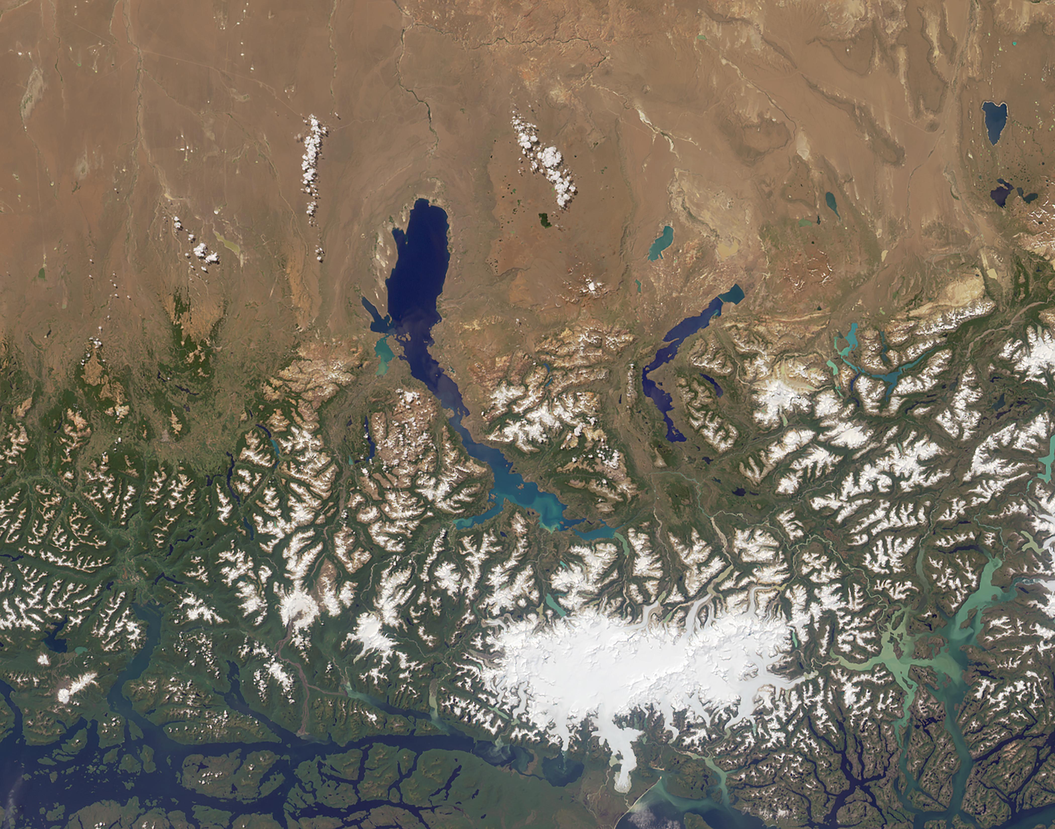
English: Are you ready for a challenge? Become a geographical detective and solve the latest mystery quiz from NASA's MISR (Multi-angle Imaging SpectroRadiometer) instrument onboard the Terra satellite. Prize submissions for perfect scores accepted until Wednesday, November 23, at 4:00 p.m. PST. Happy sleuthing!
Take the quiz here http://climate.nasa.gov/quizzes/misr_quiz_28. MISR was built and is managed by NASA's Jet Propulsion Laboratory, Pasadena, California, for NASA's Science Mission Directorate, Washington, D.C. The Terra spacecraft is managed by NASA's Goddard Space Flight Center, Greenbelt, Maryland. The MISR data were obtained from the NASA Langley Research Center Atmospheric Science Data Center, Hampton, Virginia. JPL is a division of Caltech in Pasadena. |
| Date | (published) |
| Source | Catalog page · Full-res (JPEG · TIFF) |
| Author | NASA/GSFC/LaRC/JPL, MISR Team |
| Camera location | | View this and other nearby images on: OpenStreetMap |
|---|
This image or video was catalogued by Jet Propulsion Laboratory of the United States National Aeronautics and Space Administration (NASA) under Photo ID: PIA15375. This tag does not indicate the copyright status of the attached work. A normal copyright tag is still required. See Commons:Licensing. Other languages:
|
| This media is a product of the Terra mission Credit and attribution belongs to the Multi-angle Imaging SpectroRadiometer (MISR) team, NASA/GSFC/LaRC/JPL |
Licensing
[edit]
| This file is in the public domain in the United States because it was solely created by NASA. NASA copyright policy states that "NASA material is not protected by copyright unless noted". (See Template:PD-USGov, NASA copyright policy page or JPL Image Use Policy.) | ||
 |
Warnings:
|
File history
Click on a date/time to view the file as it appeared at that time.
| Date/Time | Thumbnail | Dimensions | User | Comment | |
|---|---|---|---|---|---|
| current | 03:56, 5 March 2017 | | 4,200 × 3,300 (1.34 MB) | PhilipTerryGraham (talk | contribs) | User created page with UploadWizard |
You cannot overwrite this file.
File usage on Commons
The following 4 pages use this file:
File usage on other wikis
The following other wikis use this file:
- Usage on ceb.wikipedia.org
- Usage on es.wikipedia.org
- Usage on www.wikidata.org