File:Osterseen and Isar-Vorlandgletscher Map.jpg

Original file (6,491 × 5,355 pixels, file size: 24.95 MB, MIME type: image/jpeg)
Captions
Captions
Summary[edit]
| Description |
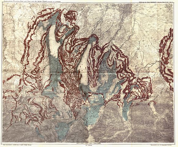
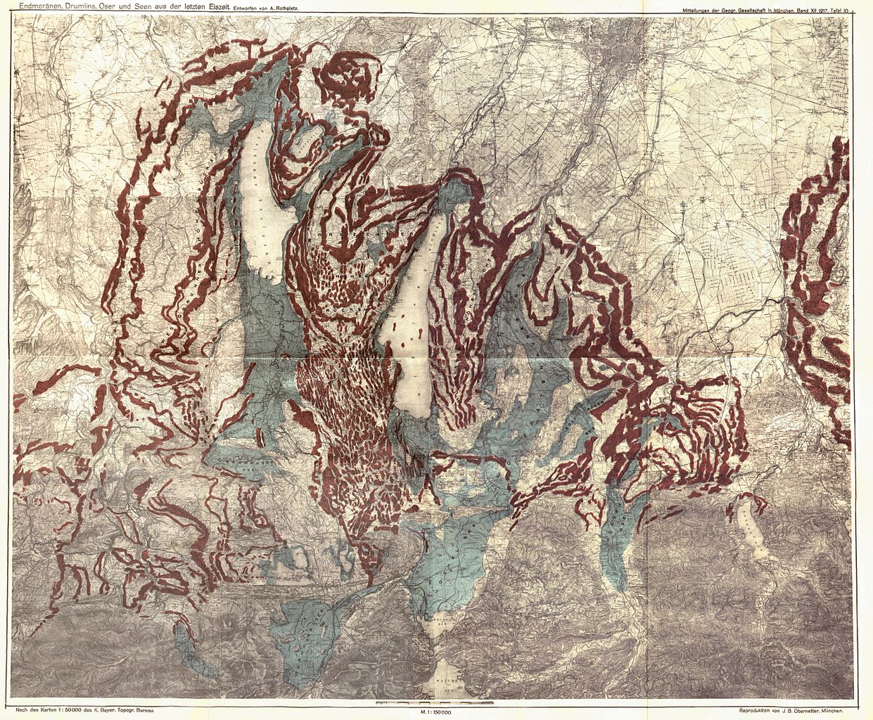
English: Map of the Osterseen Lake area and the prehistoric Isar-Loisach-Glacier in southern Bavaria below the alps, showing the maximum reach of the glacier at the end of the latest ice age, morains and other glacial morphological objects and the glacial lakes appearing from the melting glacier. All lakes are shown in their maximal size despite they did not reach that at the same time, so the state shown on this map did not happen at one single point of time.
Morainswalls (red) and barrier lakes (blue) Deutsch: Karte der Osterseen und des Isar-Vorlandgletschers in Südbayern. Die Karte zeigt rekonstruiert die maximale Ausdehnung des Isar-Loisach-Gletschers am Ende der letzten Eiszeit, Moränen und andere glazialmorphologische Objekte und die ehemaligen Seen, die durch den abschmelzenden Gletscher gebildet wurden. Die Karte zeigt alle Seen in ihrer maximalen Ausdehnung, die nicht gleichzeitig erreicht wurde, so dass der in der Karte dargestellte Zustand so nicht zu einem Zeitpunkt vorhanden war. Würmzeitliche Moränenwälle (rot) und Moränenstauseen (blau) |
|||||
| Date | ||||||
| Source | August Rothpletz: Die Osterseen und der Isar-Vorlandgletscher. In: Mitteilungen der Geographischen Gesellschaft München. Volume 12, Issue 2 (November 1917) | |||||
| Author | August Rothpletz (1853-1918) | |||||
| Permission (Reusing this file) |
|
|||||

| Annotations | This image is annotated: View the annotations at Commons |
File history
Click on a date/time to view the file as it appeared at that time.
| Date/Time | Thumbnail | Dimensions | User | Comment | |
|---|---|---|---|---|---|
| current | 09:13, 2 October 2011 | | 6,491 × 5,355 (24.95 MB) | Hic et nunc (talk | contribs) | kleiner Fehler am bildrand |
| 09:10, 2 October 2011 |  | 6,491 × 5,355 (25.28 MB) | Hic et nunc (talk | contribs) | new stitched | |
| 09:47, 29 September 2011 |  | 6,593 × 5,588 (30.44 MB) | Hic et nunc (talk | contribs) | {{Information |Description ={{de|1=Karte der Osterseen und des Isar-Vorlandgletschers}} |Source =h-stt Foto |Author =August Rothpletz: Die Osterseen und der Isar-Vorlandgletscher. In: Mitteilungen der Geographischen Gese |
You cannot overwrite this file.
File usage on Commons
The following 2 pages use this file:
File usage on other wikis
The following other wikis use this file:
- Usage on ca.wikipedia.org
- Usage on de.wikipedia.org
- Usage on fr.wikipedia.org
- Usage on uk.wikipedia.org