File:OregonHDMap.svg
Jump to navigation
Jump to search

Size of this PNG preview of this SVG file: 529 × 395 pixels. Other resolutions: 320 × 239 pixels | 640 × 478 pixels | 1,024 × 765 pixels | 1,280 × 956 pixels | 2,560 × 1,912 pixels.
Original file (SVG file, nominally 529 × 395 pixels, file size: 107 KB)
Captions
Captions
Add a one-line explanation of what this file represents
Summary[edit]
| Description | |
| Date | |
| Source |
Own work This W3C-unspecified vector image was created with Adobe Illustrator. |
| Author | Kjmoran |
| Other versions |

Licensing[edit]
| This work has been released into the public domain by its author, Kjmoran at English Wikipedia. This applies worldwide. In some countries this may not be legally possible; if so: Kjmoran grants anyone the right to use this work for any purpose, without any conditions, unless such conditions are required by law. |
Original upload log[edit]
The original description page was here. All following user names refer to en.wikipedia.
| Date/Time | Dimensions | User | Comment |
|---|---|---|---|
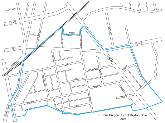
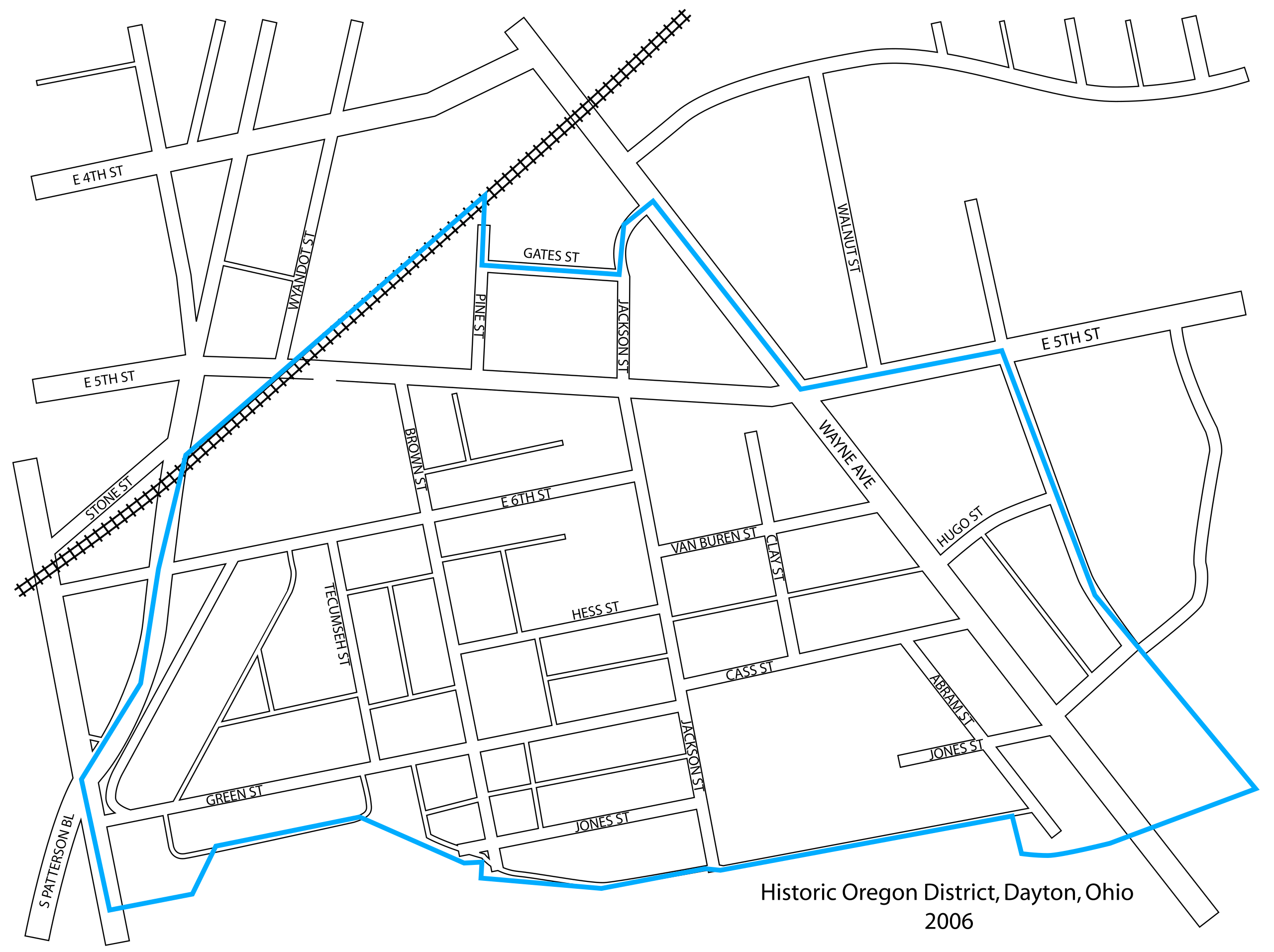
| 2007-01-23 15:32 | 529×395× (109273 bytes) | Kjmoran | == Licensing == {{PD-self}} {{Information| |Description= 2006 map of the [[Oregon District, Dayton, Ohio|Oregon Historic District]] in [[Dayton, Ohio]] |Source=I created this map using [[Adobe Illustrator]]. |Date= 21 December 2006 |Author= [[user:Kjmora |
| 2007-01-23 15:22 | 529×395× (99359 bytes) | Kjmoran | == Licensing == {{PD-self}} {{Information| |Description= 2006 map of the [[Oregon District, Dayton, Ohio|Oregon Historic District]] in [[Dayton, Ohio]] |Source=I created this map using [[Adobe Illustrator]]. |Date= 21 December 2006 |Author= [[user:Kjmora (version lost by MediaWiki) |
| 2007-01-23 15:20 | 529×395× (99359 bytes) | Kjmoran | == Licensing == {{PD-self}} {{Information| |Description= 2006 map of the [[Oregon District, Dayton, Ohio|Oregon Historic District]] in [[Dayton, Ohio]] |Source=I created this map using [[Adobe Illustrator]]. |Date= 21 December 2006 |Author= [[user:Kjmora (version lost by MediaWiki) |
| 2007-01-23 15:17 | 529×395× (99359 bytes) | Kjmoran | == Licensing == {{PD-self}} {{Information| |Description= 2006 map of the [[Oregon District, Dayton, Ohio|Oregon Historic District]] in [[Dayton, Ohio]] |Source=I created this map using [[Adobe Illustrator]]. |Date= 21 December 2006 |Author= [[user:Kjmora (version lost by MediaWiki) |
| 2006-12-21 17:46 | 529×395× (148624 bytes) | Kjmoran | (version lost by MediaWiki) |
File history
Click on a date/time to view the file as it appeared at that time.
| Date/Time | Thumbnail | Dimensions | User | Comment | |
|---|---|---|---|---|---|
| current | 18:54, 10 August 2019 | | 529 × 395 (107 KB) | Magog the Ogre (talk | contribs) | Transferred from en.wikipedia via #commonshelper |
You cannot overwrite this file.
File usage on Commons
The following page uses this file:
File usage on other wikis
The following other wikis use this file:
- Usage on en.wikipedia.org