File:Ordnance Survey Drawings - Tewkesbury (OSD 173).jpg
Jump to navigation
Jump to search
Size of this preview: 800 × 511 pixels. Other resolutions: 320 × 204 pixels | 640 × 408 pixels | 1,024 × 654 pixels | 1,280 × 817 pixels | 2,560 × 1,634 pixels | 4,000 × 2,553 pixels.
Original file (4,000 × 2,553 pixels, file size: 4.39 MB, MIME type: image/jpeg)
Captions
Captions
Add a one-line explanation of what this file represents
| Tewkesbury (OSD 173)
|
|||||
|---|---|---|---|---|---|
| Artist |
[Dawson, Robert] - Draughtsman |
.jpg) | |||
| Title |
Ordnance Survey Drawings: Tewkesbury (OSD 173) |
||||
| Object type |
manuscript map |
||||
| Description |
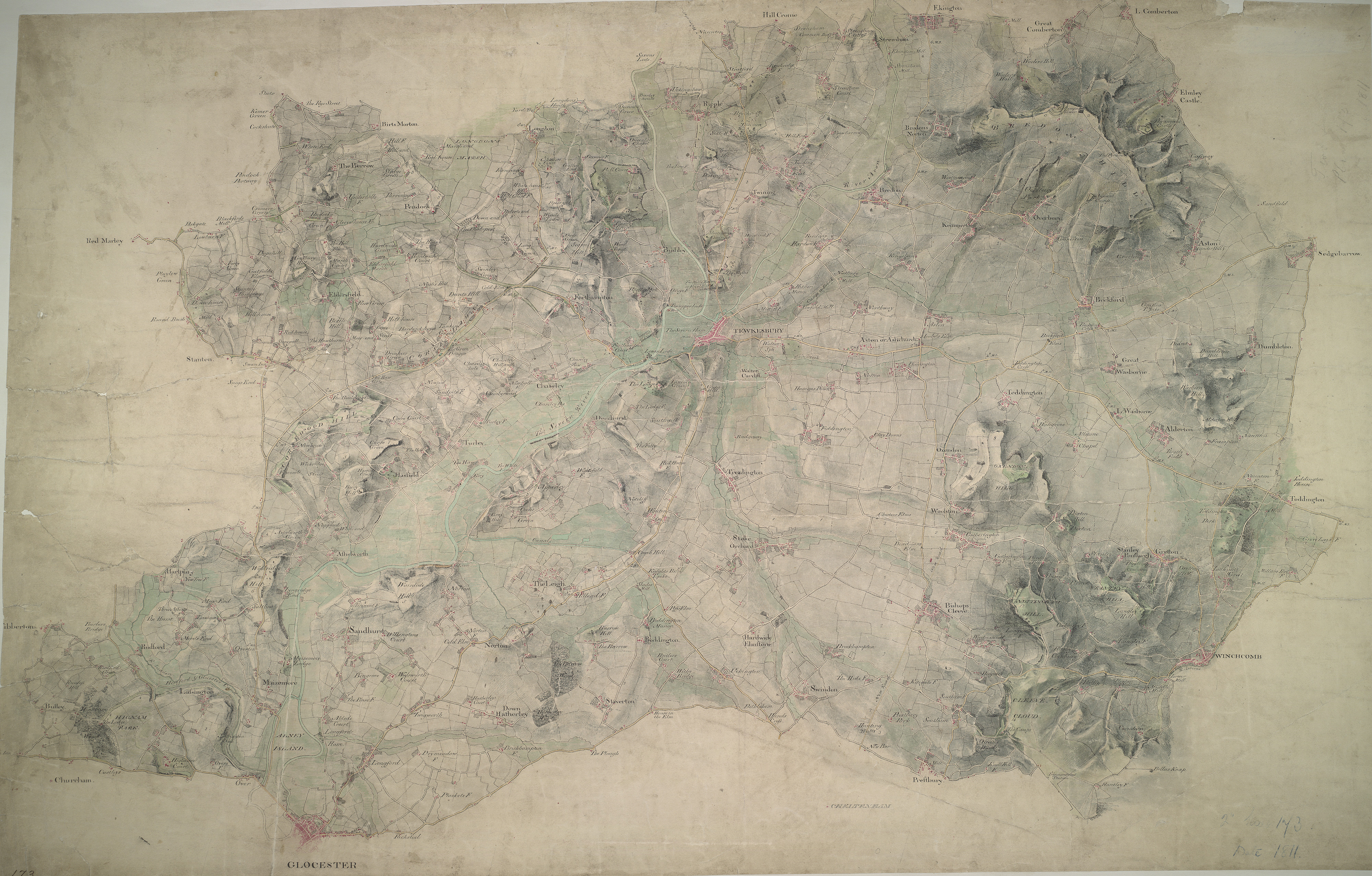
 Centre of map shown on a map of England
English: This plan of the Vale of Gloucester is indicative of the draughtman's convention of "relative command": the indication of relative heights of hills by numbers; hill 3 being higher than hill 2, for example. Brushwork interlining ('hachuring') and ink washes further depict relief. Pencil rays intersect across the map, evidence of measurements taken by the surveyor between fixed triangulation points. Archaeological details, such as those at Bredon Hill (at the top right of the plan), are documented even though this did not become obligatory until 1816. The rivers Severn and Leadon and part of the Hereford and Gloucester Canal are described at the bottom left of the map, with Tewkesbury situated centrally at the confluence of the Severn and Upper Avon Rivers..
This image has been georeferenced.
|
||||
| Language |
English |
||||
| Date | 1811 | ||||
| Medium | Pen and ink on paper | ||||
| Dimensions | height: 280 mm (11.02 in); width: 430 mm (16.92 in) | ||||
| Collection | |||||
| Accession number |
Maps OSD 173 |
||||
| Credit line | British Library | ||||
| Notes |
Scale 2 inches : 1 mile (1:31680). Please note that the British Library provides these digital files "as-is"; materials will not be rephotographed under this programme. If resupply of files is required, the requestor will be required to purchase them at the standard rate. |
||||
| References |
http://www.bl.uk/onlinegallery/onlineex/ordsurvdraw/t/002osd000000010u00129000.html (English) |
||||
| Source/Photographer |
|
||||
| Permission (Reusing this file) |
|
||||


_(St_Edwards_Crown).svg)
.jpg¶ms=51.968784_N_-2.157802_E_)
.jpg¶ms=51.831218_N_-2.438988_E_)
.jpg¶ms=52.10635_N_-1.876617_E_)
.jpg¶ms=52.018567_N_-2.438988_E_)
.jpg¶ms=51.831218_N_-2.348195_E_)
.jpg¶ms=51.919001_N_-1.876617_E_)
.jpg¶ms=52.10635_N_-1.96741_E_)
File history
Click on a date/time to view the file as it appeared at that time.
| Date/Time | Thumbnail | Dimensions | User | Comment | |
|---|---|---|---|---|---|
| current | 08:30, 26 September 2013 | | 4,000 × 2,553 (4.39 MB) | LibraryBot (talk | contribs) | {{subst:User:Andrew Gray/OSD|ID= 002OSD000000010U00129000 |OSD_NUM= OSD 173 |MEDIUM= Pen and ink on paper |TITLE= Tewkesbury |CREATOR= [Dawson, Robert] - Draughtsman |YEAR= 1811 |DESCRIPTION= This plan of the Vale of Gloucester is indicative of the d... |
You cannot overwrite this file.
File usage on Commons
The following page uses this file:
File usage on other wikis
The following other wikis use this file:
- Usage on www.wikidata.org
.jpg&oldid=670624406)