File:Ordnance Survey Drawings - Newport (OSD 176).jpg
Jump to navigation
Jump to search
Size of this preview: 800 × 457 pixels. Other resolutions: 320 × 183 pixels | 640 × 365 pixels | 1,024 × 584 pixels | 1,280 × 731 pixels | 2,560 × 1,461 pixels | 4,000 × 2,283 pixels.
Original file (4,000 × 2,283 pixels, file size: 2.7 MB, MIME type: image/jpeg)
Captions
Captions
Add a one-line explanation of what this file represents
| Newport 21 (OSD 176)
|
|||||
|---|---|---|---|---|---|
| Artist |
Budgen, Charles - Draughtsman |
.jpg) | |||
| Title |
Ordnance Survey Drawings: Newport, Newport (Casnewydd) (OSD 176) |
||||
| Object type |
manuscript map |
||||
| Description |
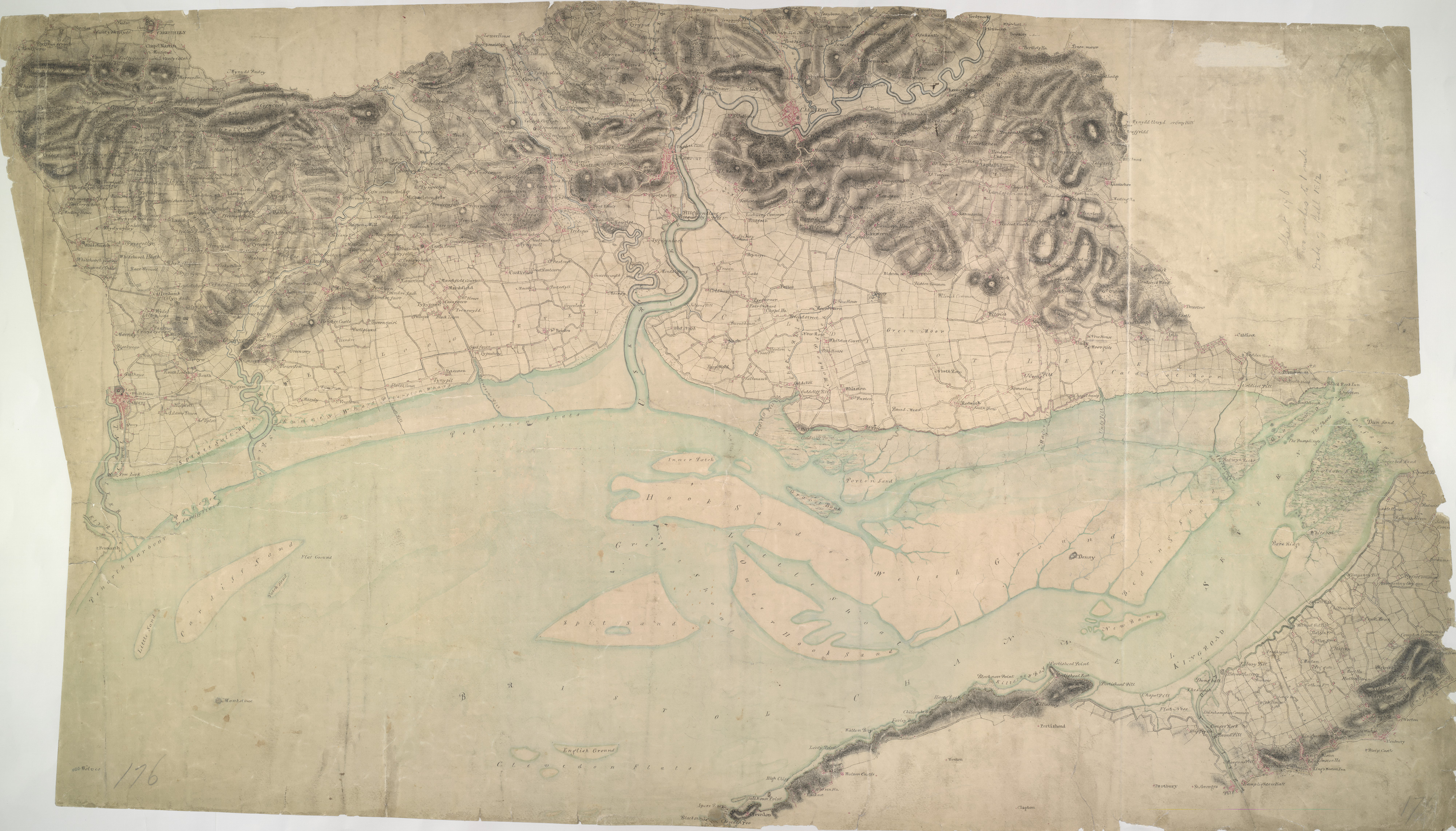
 Centre of map shown on a map of England
English: This drawings depicts the winding course of the River Usk as it flows by the Roman town of Caerleon into the Severn Estuary and the Bristol Channel. Not far from the river mouth lies Newport. The Usk is not navigable except at this point, but the Monmouthshire and Brecon and Abergavenny canals, in part following the valley, carry a small trade up to Brecon. Cardiff, depicted at bottom left, was a town of only 6,000 inhabitants when this plan was produced..
This image has been georeferenced.
|
||||
| Language |
English |
||||
| Date | 1811 | ||||
| Medium | Pen and ink on paper | ||||
| Dimensions | height: 320 mm (12.59 in); width: 550 mm (21.65 in) | ||||
| Collection | |||||
| Accession number |
Maps OSD 176 |
||||
| Credit line | British Library | ||||
| Notes |
Scale 2 inches : 1 mile (1:31680). Please note that the British Library provides these digital files "as-is"; materials will not be rephotographed under this programme. If resupply of files is required, the requestor will be required to purchase them at the standard rate. |
||||
| References |
http://www.bl.uk/onlinegallery/onlineex/ordsurvdraw/n/002osd000000021u00132000.html (English) |
||||
| Source/Photographer |
|
||||
| Permission (Reusing this file) |
|
||||


_(St_Edwards_Crown).svg)
.jpg¶ms=51.530117_N_-2.936778_E_)
.jpg¶ms=51.363514_N_-3.284378_E_)
.jpg¶ms=51.69672_N_-2.589177_E_)
.jpg¶ms=51.570202_N_-3.284378_E_)
.jpg¶ms=51.363514_N_-3.165934_E_)
.jpg¶ms=51.490032_N_-2.589177_E_)
.jpg¶ms=51.69672_N_-2.707621_E_)
File history
Click on a date/time to view the file as it appeared at that time.
| Date/Time | Thumbnail | Dimensions | User | Comment | |
|---|---|---|---|---|---|
| current | 08:35, 26 September 2013 | | 4,000 × 2,283 (2.7 MB) | LibraryBot (talk | contribs) | {{subst:User:Andrew Gray/OSD|ID= 002OSD000000021U00132000 |OSD_NUM= OSD 176 |MEDIUM= Pen and ink on paper |TITLE= Newport, Newport (Casnewydd) |CREATOR= Budgen, Charles - Draughtsman |YEAR= 1811 |DESCRIPTION= This drawings depicts the winding course o... |
You cannot overwrite this file.
File usage on Commons
The following 2 pages use this file:
_(OSD_176).jpg&redirect=no)
File usage on other wikis
The following other wikis use this file:
- Usage on www.wikidata.org
.jpg&oldid=670624228)