File:Oneseed pussypaws, Calyptridium paniculatum (35394799342).jpg
Jump to navigation
Jump to search
Size of this preview: 800 × 600 pixels. Other resolutions: 320 × 240 pixels | 640 × 480 pixels | 1,024 × 768 pixels | 1,280 × 960 pixels | 2,560 × 1,920 pixels | 3,648 × 2,736 pixels.
Original file (3,648 × 2,736 pixels, file size: 6.29 MB, MIME type: image/jpeg)
Captions
Captions
Add a one-line explanation of what this file represents
Summary[edit]
.jpg&action=edit§ion=1)
| Description |
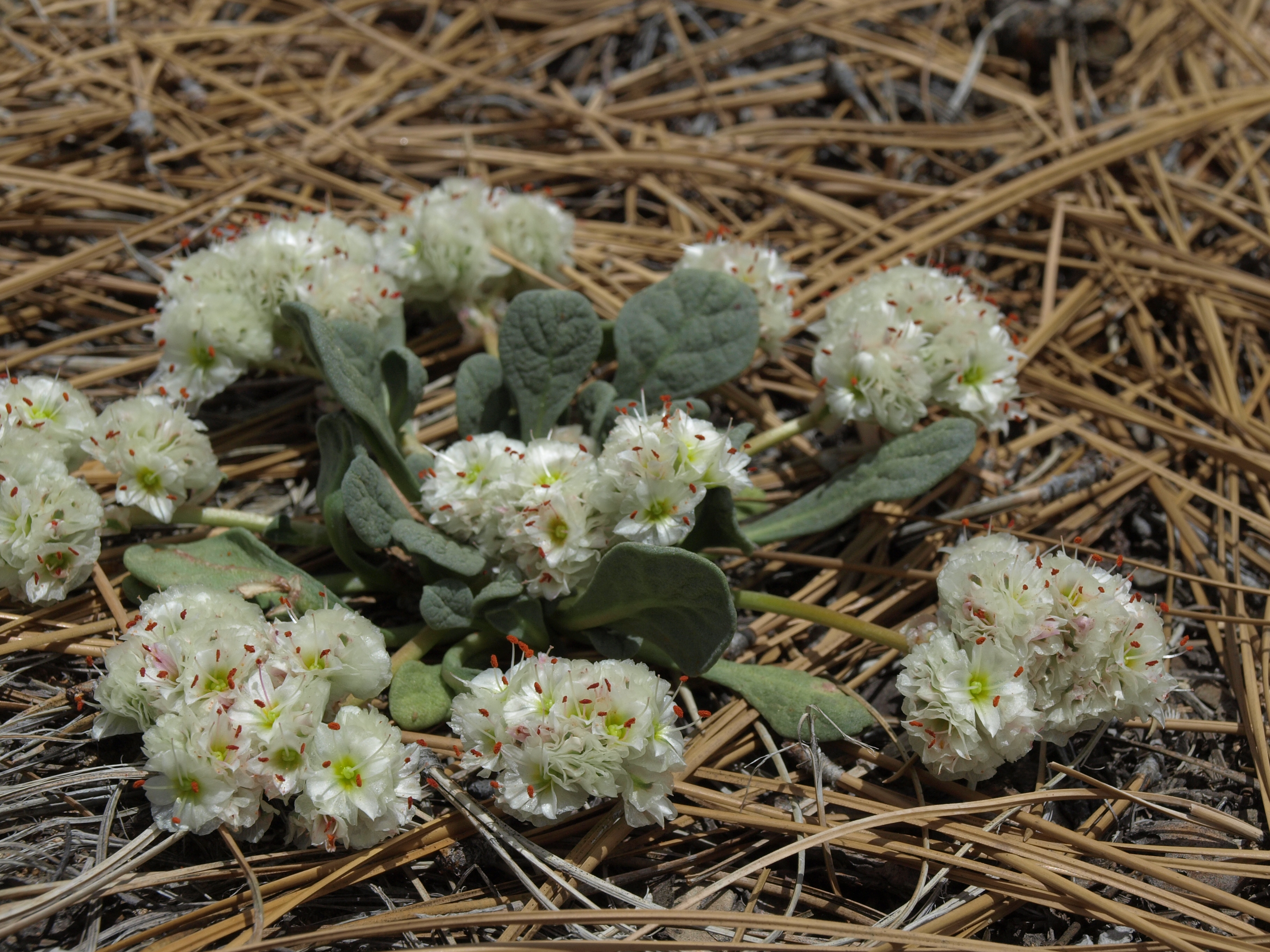
oneseed pussypaws, Calyptridium paniculatum, Nevada, Virginia Range, Geiger Grade, Steamboat Creek - Truckee Meadows drainage, elevation 1640 m (5380 ft). This species is common in the conifer forests of California, extending to adjacent corners of Oregon, Nevada, and Baja California. The name Calyptridium paniculatum was recently found to be an older name for what has been called C. monospermum. Closely related to C. umbellatum (with which it sometimes hybridizes), C. paniculatum is distinguished most readily by having a single leaf rosette from which all stems arise, versus each stem having its own separate leaf rosette in C. umbellatum. |
| Date | |
| Source | oneseed pussypaws, Calyptridium paniculatum |
| Author | Jim Morefield from Nevada, USA |
| Camera location | | View this and other nearby images on: OpenStreetMap |
|---|
.jpg¶ms=039.391138_N_-119.704031_E_globe:Earth_type:camera_source:Flickr_&language=en)
Licensing[edit]
.jpg&action=edit§ion=2)
This file is licensed under the Creative Commons Attribution-Share Alike 2.0 Generic license.
- You are free:
- to share – to copy, distribute and transmit the work
- to remix – to adapt the work
- Under the following conditions:
- attribution – You must give appropriate credit, provide a link to the license, and indicate if changes were made. You may do so in any reasonable manner, but not in any way that suggests the licensor endorses you or your use.
- share alike – If you remix, transform, or build upon the material, you must distribute your contributions under the same or compatible license as the original.
| This image was originally posted to Flickr by Jim Morefield at https://flickr.com/photos/127605180@N04/35394799342 (archive). It was reviewed on 29 December 2019 by FlickreviewR 2 and was confirmed to be licensed under the terms of the cc-by-sa-2.0. |
File history
Click on a date/time to view the file as it appeared at that time.
| Date/Time | Thumbnail | Dimensions | User | Comment | |
|---|---|---|---|---|---|
| current | 03:25, 29 December 2019 | | 3,648 × 2,736 (6.29 MB) | Ser Amantio di Nicolao (talk | contribs) | Transferred from Flickr via #flickr2commons |
You cannot overwrite this file.
File usage on Commons
There are no pages that use this file.
.jpg&oldid=601300738)