File:Old hay rake - geograph.org.uk - 160802.jpg
Old_hay_rake_-_geograph.org.uk_-_160802.jpg (640 × 480 pixels, file size: 130 KB, MIME type: image/jpeg)
Captions
DescriptionOld hay rake - geograph.org.uk - 160802.jpg |
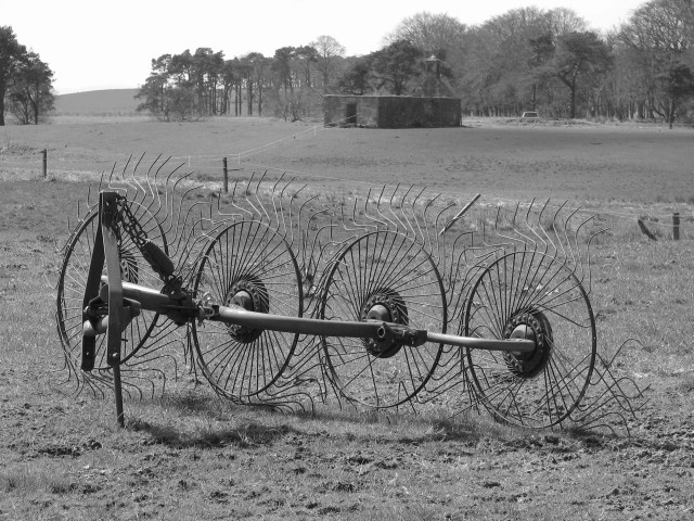
English: Old hay rake. Old farm machinery at Fordmouth. Looking over to the ruined mausoleum in the next square. |
||
Date | |||
Source | From geograph.org.uk | ||
Author | Callum Black | ||
Permission (Reusing this file) |
This file is licensed under the Creative Commons Attribution-Share Alike 2.0 Generic license. Attribution: Callum Black
|
||
Attribution (required by the license) InfoField | Callum Black / Old hay rake / | ||
InfoField | Callum Black / Old hay rake |
Object location | 55° 44′ 28″ N, 3° 37′ 30″ W | View this and other nearby images on: OpenStreetMap | 55.741200; -3.625000 |
---|
- Remove redundant categories and try to put this image in the most specific category/categories
- Remove this template
- The location categories are based on information from this geonames tool and this OpenStreetMap tool combined with a database. You can also have a look at this tool from mysociety.
- The topic category from Geograph was Farming machinery (find similar images machinery at Geograph)
English | suomi | français | galego | עברית | magyar | македонски | മലയാളം | português | português do Brasil | Türkçe | +/−
File history
Click on a date/time to view the file as it appeared at that time.
Date/Time | Thumbnail | Dimensions | User | Comment | |
---|---|---|---|---|---|
current | 11:26, 31 January 2010 | 640 × 480 (130 KB) | GeographBot (talk | contribs) | == {{int:filedesc}} == {{Information |description={{en|1=Old hay rake. Old farm machinery at Fordmouth. Looking over to the ruined mausoleum in the next square.}} |date=2006-04-29 |source=From [http://www.geograph.org.uk/photo/160802 geograph.org.uk] |au |
You cannot overwrite this file.
File usage on Commons
The following page uses this file:
Metadata
This file contains additional information such as Exif metadata which may have been added by the digital camera, scanner, or software program used to create or digitize it. If the file has been modified from its original state, some details such as the timestamp may not fully reflect those of the original file. The timestamp is only as accurate as the clock in the camera, and it may be completely wrong.
Camera manufacturer | Canon |
---|---|
Camera model | Canon PowerShot S2 IS |
Exposure time | 1/400 sec (0.0025) |
F-number | f/4 |
Date and time of data generation | 12:34, 29 April 2006 |
Lens focal length | 24.5 mm |
Orientation | Normal |
Horizontal resolution | 180 dpi |
Vertical resolution | 180 dpi |
File change date and time | 12:34, 29 April 2006 |
Y and C positioning | Centered |
Exif version | 2.2 |
Date and time of digitizing | 12:34, 29 April 2006 |
Image compression mode | 3 |
APEX shutter speed | 8.65625 |
APEX aperture | 4 |
APEX exposure bias | 0 |
Maximum land aperture | 3.625 APEX (f/3.51) |
Metering mode | Center weighted average |
Flash | Flash did not fire, compulsory flash suppression |
Color space | sRGB |
Focal plane X resolution | 11,520 |
Focal plane Y resolution | 11,571.428571429 |
Focal plane resolution unit | inches |
Sensing method | One-chip color area sensor |
Custom image processing | Normal process |
Exposure mode | Auto exposure |
White balance | Manual white balance |
Digital zoom ratio | 1 |
Scene capture type | Standard |
- CC-BY-SA-2.0
- Images from Geograph Britain and Ireland
- Images from Geograph Britain and Ireland missing SDC coordinates of the point of view
- Images from Geograph Britain and Ireland missing SDC MIME type
- Information field template with formatting
- Files with coordinates missing SDC location of creation (55° N, 4° W)
- Images from Geograph Britain and Ireland needing category review
- Images by Callum Black
- United Kingdom photographs taken on 2006-04-29
- Pages with maps