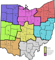
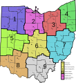
File:Ohio Highway Patrol Map.svg
From Wikimedia Commons, the free media repository
Jump to navigation
Jump to search

Size of this PNG preview of this SVG file: 552 × 600 pixels. Other resolutions: 221 × 240 pixels | 442 × 480 pixels | 707 × 768 pixels | 942 × 1,024 pixels | 1,885 × 2,048 pixels | 3,690 × 4,010 pixels.
Original file (SVG file, nominally 3,690 × 4,010 pixels, file size: 257 KB)
File information
Structured data
Captions
Captions
Add a one-line explanation of what this file represents
Summary[edit]
| DescriptionOhio Highway Patrol Map.svg |
English: Map of Ohio Highway Patrol districts and posts. Map from File:Map of Ohio highlighting Wood County.svg. |
| Date | |
| Source | Own work |
| Author | Ibagli |
Licensing[edit]
| Public domainPublic domainfalsefalse |
| I, the copyright holder of this work, release this work into the public domain. This applies worldwide. In some countries this may not be legally possible; if so: I grant anyone the right to use this work for any purpose, without any conditions, unless such conditions are required by law. |
File history
Click on a date/time to view the file as it appeared at that time.
| Date/Time | Thumbnail | Dimensions | User | Comment | |
|---|---|---|---|---|---|
| current | 00:22, 14 January 2015 |  | 3,690 × 4,010 (257 KB) | Ibagli (talk | contribs) | fix Pike County |
| 23:29, 20 January 2013 |  | 3,690 × 4,010 (254 KB) | Ibagli (talk | contribs) | fix | |
| 23:28, 20 January 2013 |  | 3,690 × 4,010 (254 KB) | Ibagli (talk | contribs) | fix | |
| 02:28, 19 January 2013 |  | 3,690 × 4,010 (254 KB) | Ibagli (talk | contribs) | New districts | |
| 06:54, 6 July 2012 |  | 3,690 × 4,010 (230 KB) | Ibagli (talk | contribs) | Font | |
| 06:50, 6 July 2012 |  | 3,690 × 4,010 (230 KB) | Ibagli (talk | contribs) | Font | |
| 06:43, 6 July 2012 |  | 3,690 × 4,010 (230 KB) | Ibagli (talk | contribs) | Add new metro posts in Franklin and Hamilton counties. | |
| 02:17, 28 May 2012 |  | 3,675 × 3,995 (298 KB) | Ibagli (talk | contribs) | Cuyahoga County now seems to be a part of District 3, according to the most recent maps on the OSP website | |
| 21:32, 16 October 2010 |  | 3,675 × 3,995 (299 KB) | Ibagli (talk | contribs) | more accurate post locations | |
| 02:39, 24 December 2009 |  | 3,675 × 3,995 (303 KB) | Ibagli (talk | contribs) | Post 14 |
You cannot overwrite this file.
File usage on Commons
The following page uses this file:
File usage on other wikis
The following other wikis use this file:
- Usage on en.wikipedia.org
- Usage on uk.wikipedia.org
Metadata
This file contains additional information such as Exif metadata which may have been added by the digital camera, scanner, or software program used to create or digitize it. If the file has been modified from its original state, some details such as the timestamp may not fully reflect those of the original file. The timestamp is only as accurate as the clock in the camera, and it may be completely wrong.
| Width | 3690.405 |
|---|---|
| Height | 4010.186 |