File:Oahe Chapel.jpg
Jump to navigation
Jump to search

Size of this preview: 765 × 600 pixels. Other resolutions: 306 × 240 pixels | 613 × 480 pixels | 980 × 768 pixels | 1,280 × 1,003 pixels | 2,560 × 2,006 pixels | 4,336 × 3,398 pixels.
Original file (4,336 × 3,398 pixels, file size: 1.73 MB, MIME type: image/jpeg)
Captions
Captions
Add a one-line explanation of what this file represents
|
This is an image of a place or building that is listed on the National Register of Historic Places in the United States of America. Its reference number is 80003725. |
| Camera location | | View this and other nearby images on: OpenStreetMap |
|---|
| Description |
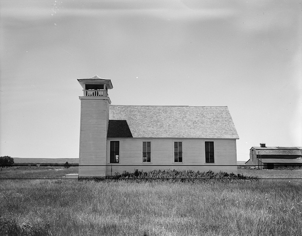
English: Eastern side of the Oahe Chapel, a Congregationalist mission church northwest of Pierre in Hughes County, South Dakota, United States. Built in 1877, it is listed on the National Register of Historic Places. |
|||||
| Date | ||||||
| Source | Library of Congress, Prints and Photograph Division HABS: SD,33-PIER.V,1-2 | |||||
| Author | John A. Bryan | |||||
| Permission (Reusing this file) |
|
|||||
| Other versions | None |


|
This image is available from the United States Library of Congress's Prints and Photographs division
under the digital ID hhh.sd0005. This tag does not indicate the copyright status of the attached work. A normal copyright tag is still required. See Commons:Licensing.
|
File history
Click on a date/time to view the file as it appeared at that time.
| Date/Time | Thumbnail | Dimensions | User | Comment | |
|---|---|---|---|---|---|
| current | 06:23, 9 October 2009 | | 4,336 × 3,398 (1.73 MB) | Cropbot (talk | contribs) | upload cropped version, operated by User:Finavon. Summary: border cropped |
| 13:30, 30 September 2009 |  | 5,000 × 3,734 (2.01 MB) | Nyttend (talk | contribs) | {{Location|41|35|21|N|93|36|58|W}} {{Information |Description={{en|Eastern side of the {{w|Oahe Chapel}}, a {{w|Congregationalist polity|Congregationalist}} northwest of {{w|Pierre, South Dakota|Pierre}} in {{w|Hughes County, South Dakota|Hughes County}}, |
You cannot overwrite this file.
File usage on Commons
There are no pages that use this file.
File usage on other wikis
The following other wikis use this file:
Metadata
Categories:
- Churches in South Dakota built in 1877
- Wooden churches in South Dakota
- Bell towers in South Dakota
- Congregationalist churches in South Dakota
- National Register of Historic Places in Hughes County, South Dakota
- Mission churches in the United States
- Buildings of religious function on the National Register of Historic Places in South Dakota