File:OSM Clapham Junction area transport layer.jpg
Jump to navigation
Jump to search
Size of this preview: 784 × 600 pixels. Other resolutions: 314 × 240 pixels | 628 × 480 pixels | 850 × 650 pixels.
Original file (850 × 650 pixels, file size: 505 KB, MIME type: image/jpeg)
Captions
Captions
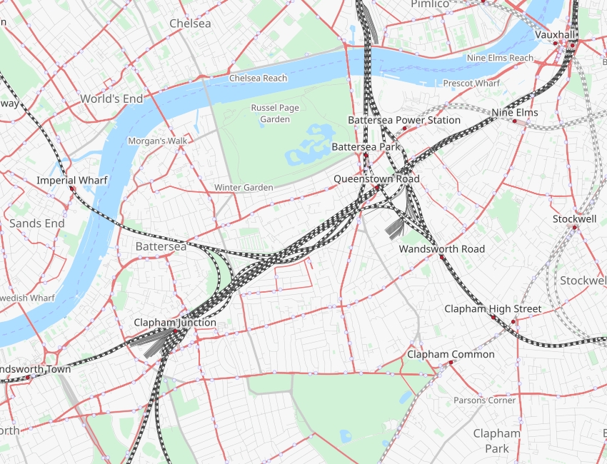
OSM transport layer map of the railways between Clapham Junction and Vauxhall stations in South London
Summary
[edit]
| Description |
English: A map highlighting the overground rail network in South London between Clapham Junction and Vauxhall stations |
| Date | |
| Source | Open Street Map |
| Author | Open Street Map |
Licensing
[edit]
| This work contains information from OpenStreetMap, which is made available under the Open Database License (ODbL).
The ODbL does not require any particular license for maps produced from ODbL data. Prior to 1 August 2020, map tiles produced by the OpenStreetMap Foundation were licensed under the CC-BY-SA-2.0 license. Maps produced by other people may be subject to other licences. |
File history
Click on a date/time to view the file as it appeared at that time.
| Date/Time | Thumbnail | Dimensions | User | Comment | |
|---|---|---|---|---|---|
| current | 19:34, 4 October 2023 | | 850 × 650 (505 KB) | Verbarson (talk | contribs) | Uploaded a work by Open Street Map from Open Street Map with UploadWizard |
You cannot overwrite this file.
File usage on Commons
The following 3 pages use this file:
File usage on other wikis
The following other wikis use this file:
- Usage on en.wikipedia.org