File:OH State Routes 4 19 100 south at US 30.jpg
Jump to navigation
Jump to search

Size of this preview: 800 × 600 pixels. Other resolutions: 320 × 240 pixels | 640 × 480 pixels | 1,024 × 768 pixels | 1,280 × 960 pixels | 2,272 × 1,704 pixels.
Original file (2,272 × 1,704 pixels, file size: 1.14 MB, MIME type: image/jpeg)
Captions
Captions
Add a one-line explanation of what this file represents
| Camera location | | View this and other nearby images on: OpenStreetMap |
|---|
| Description |
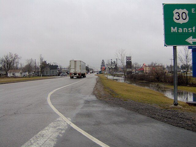
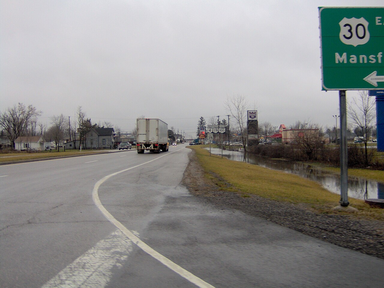
English: Junction of U.S. Route 30 with State Routes 4, 19, and 100 near Bucyrus in Crawford County, Ohio. |
||
| Date | Taken on 15 January 2007 | ||
| Source | Own work | ||
| Author | Nyttend | ||
| Permission (Reusing this file) |
|
File history
Click on a date/time to view the file as it appeared at that time.
| Date/Time | Thumbnail | Dimensions | User | Comment | |
|---|---|---|---|---|---|
| current | 21:06, 21 January 2007 | | 2,272 × 1,704 (1.14 MB) | Nyttend (talk | contribs) | Intersection of [http://en.wikipedia.org/wiki/U.S._Route_30 US 30] with Ohio State Routes [http://en.wikipedia.org/wiki/Ohio_State_Route_4 4], [http://en.wikipedia.org/wiki/Ohio_State_Route_19 19], and [http://en.wikipedia.org/wiki/Ohio_State_Route_100 10 |
You cannot overwrite this file.
File usage on Commons
The following 2 pages use this file:
- Commons:Files used on the AARoads Wiki/48
- File:State Routes.jpg (file redirect)
File usage on other wikis
The following other wikis use this file:
- Usage on en.wikipedia.org
- Usage on fr.wikipedia.org
Metadata
Categories:
- 2007 in Ohio
- Bucyrus, Ohio
- Intersections in Ohio
- Ohio State Route 4
- U.S. Route 30 in Ohio
- Ohio State Route 19
- Ohio State Route 100
- U.S. Route 30 shields
- Number 4 on highway signs
- Number 19 on highway signs
- Number 100 on highway signs
- Speed limit road signs in Ohio
- 35 mph speed limit road signs in the United States