File:Novonaselje map.JPG
Jump to navigation
Jump to search

Size of this preview: 515 × 600 pixels. Other resolutions: 206 × 240 pixels | 412 × 480 pixels | 659 × 768 pixels | 879 × 1,024 pixels | 1,800 × 2,097 pixels.
Original file (1,800 × 2,097 pixels, file size: 286 KB, MIME type: image/jpeg)
Captions
Captions
Add a one-line explanation of what this file represents
Summary
[edit]
| Description |
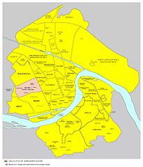
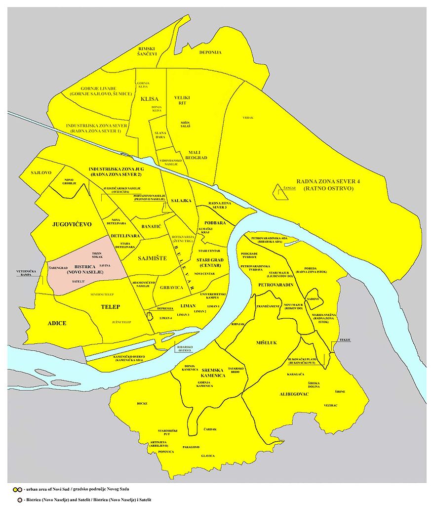
English: Location of Novo Naselje (Bistrica) and Satelit neighborhoods in Novi Sad.
Српски / srpski: Положај Новог Насеља (Бистрице) и Сателита у Новом Саду. |
| Date | 6 May 2006 (original upload date) |
| Source | Own work |
| Author | PANONIAN and Goran.Smith2~commonswiki |
Source and Licensing
[edit]
Created from this image: File:Novi_sad_quarters.png - original image was created by user:PANONIAN, it was modified by user:Goran.Smith2 and modified again by user:PANONIAN.
Licensing
[edit]
| I, the copyright holder of this work, release this work into the public domain. This applies worldwide. In some countries this may not be legally possible; if so: I grant anyone the right to use this work for any purpose, without any conditions, unless such conditions are required by law. |
File history
Click on a date/time to view the file as it appeared at that time.
| Date/Time | Thumbnail | Dimensions | User | Comment | |
|---|---|---|---|---|---|
| current | 19:23, 15 September 2010 | | 1,800 × 2,097 (286 KB) | PANONIAN (talk | contribs) | improved version |
| 23:13, 17 February 2009 |  | 1,800 × 2,061 (526 KB) | PANONIAN (talk | contribs) | ||
| 13:55, 16 February 2009 |  | 1,800 × 2,061 (527 KB) | PANONIAN (talk | contribs) | ||
| 19:03, 6 May 2006 |  | 524 × 600 (39 KB) | Goran.Smith2~commonswiki (talk | contribs) | NS map |
You cannot overwrite this file.
File usage on Commons
There are no pages that use this file.
File usage on other wikis
The following other wikis use this file:
- Usage on en.wikipedia.org
- Usage on es.wikipedia.org
- Usage on fr.wikipedia.org
- Usage on sr.wikipedia.org