File:Nova totius terrarum orbis geographica.jpg

Original file (1,280 × 1,100 pixels, file size: 481 KB, MIME type: image/jpeg)
Captions
Captions
Summary[edit]
| Description |
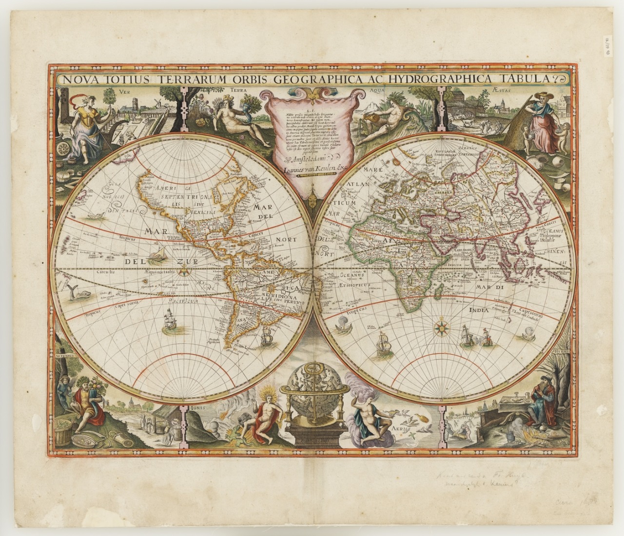
English: Published Amstelodami : Ioannes van Keulen exc, [168-?]
1 map : col. ; 2 hemispheres, each 27 cm. on sheet 53.5 x 62 cm. Map showing Indian Ocean and coasts of eastern Africa, India, East Indies, and Australia. Relief shown by bathymetric soundings. Plate probably from: Groote nieuwe vermeerderde zee-atlas ofte water-werelt . |
|||||||||||||||||||
| Date | [168-?] | |||||||||||||||||||
| Source | https://66.media.tumblr.com/7444930b992c19136dfd7ac5098542d0/tumblr_o6w7vmfxxN1ttttg2o1_1280.jpg | |||||||||||||||||||
| Author |
|
|||||||||||||||||||
Licensing[edit]
|
This is a faithful photographic reproduction of a two-dimensional, public domain work of art. The work of art itself is in the public domain for the following reason:
The official position taken by the Wikimedia Foundation is that "faithful reproductions of two-dimensional public domain works of art are public domain".
This photographic reproduction is therefore also considered to be in the public domain in the United States. In other jurisdictions, re-use of this content may be restricted; see Reuse of PD-Art photographs for details. | ||||
File history
Click on a date/time to view the file as it appeared at that time.
| Date/Time | Thumbnail | Dimensions | User | Comment | |
|---|---|---|---|---|---|
| current | 12:19, 29 September 2019 | | 1,280 × 1,100 (481 KB) | Poli.Pav (talk | contribs) | User created page with UploadWizard |
You cannot overwrite this file.
File usage on Commons
There are no pages that use this file.
File usage on other wikis
The following other wikis use this file:
- Usage on uk.wikipedia.org