File:Norwegian Arctic Expedition (1898—1902) map-ru.svg
Jump to navigation
Jump to search

Size of this PNG preview of this SVG file: 682 × 599 pixels. Other resolutions: 273 × 240 pixels | 546 × 480 pixels | 874 × 768 pixels | 1,165 × 1,024 pixels | 2,331 × 2,048 pixels | 1,731 × 1,521 pixels.
Original file (SVG file, nominally 1,731 × 1,521 pixels, file size: 787 KB)
Captions
Captions
Add a one-line explanation of what this file represents
Summary[edit]
| Description |
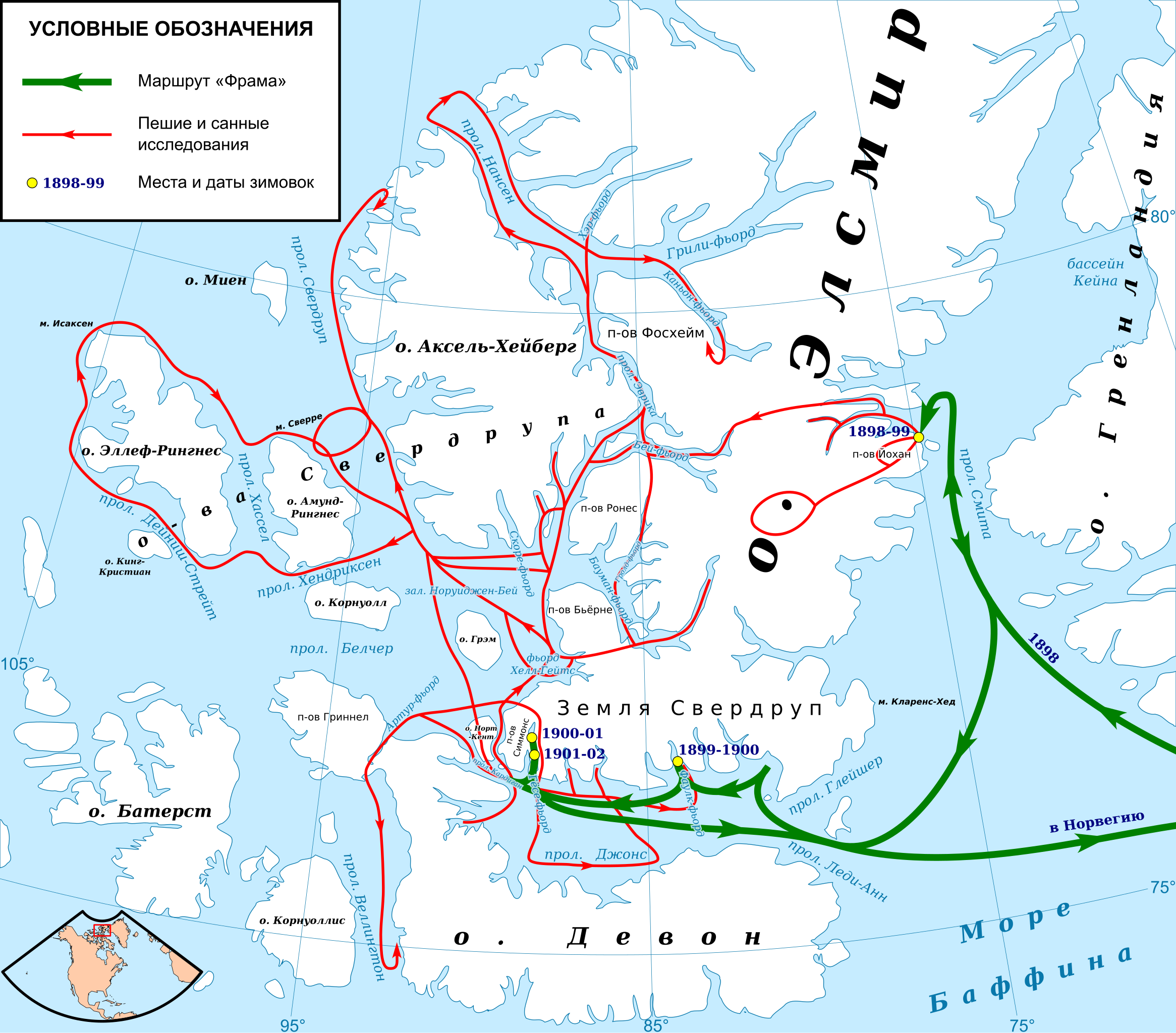
Русский: Карта исследований Норвежской арктической экспедиции (1898-1902) под руководством Отто Свердрупа. |
||
| Date | |||
| Source |
 Map: Natural Earth data (public domain) edited with QGIS and vectorized with Inkscape; Equidistant conic projection. |
||
| Author | Kaidor | ||
| Permission (Reusing this file) |
I, the copyright holder of this work, hereby publish it under the following licenses: This file is licensed under the Creative Commons Attribution-Share Alike 4.0 International license.
You may select the license of your choice. |
||
| SVG development |

_map-ru.svg&action=edit§ion=1)
| Camera location | | View this and other nearby images on: OpenStreetMap |
|---|
_map-ru.svg¶ms=078.000000_N_-088.000000_E_globe:Earth_type:camera__&language=en)
File history
Click on a date/time to view the file as it appeared at that time.
| Date/Time | Thumbnail | Dimensions | User | Comment | |
|---|---|---|---|---|---|
| current | 20:04, 22 November 2016 | | 1,731 × 1,521 (787 KB) | Kaidor (talk | contribs) | redrawn 2 |
| 14:08, 20 November 2016 |  | 1,649 × 1,661 (118 KB) | Kaidor (talk | contribs) | redrawn | |
| 17:17, 3 September 2010 |  | 1,649 × 1,661 (144 KB) | Kaidor (talk | contribs) | Очертания островов заменены на другие, взятые из свободного источника. |
You cannot overwrite this file.
File usage on Commons
The following 4 pages use this file:
File usage on other wikis
The following other wikis use this file:
- Usage on be.wikipedia.org
- Usage on de.wikipedia.org
- Usage on fr.wikipedia.org
- Usage on ru.wikipedia.org
_map-ru.svg&oldid=606472474)