File:Northwest India map.svg
Jump to navigation
Jump to search

Size of this PNG preview of this SVG file: 512 × 583 pixels. Other resolutions: 211 × 240 pixels | 421 × 480 pixels | 674 × 768 pixels | 899 × 1,024 pixels | 1,799 × 2,048 pixels.
Original file (SVG file, nominally 512 × 583 pixels, file size: 155 KB)
Captions
Captions
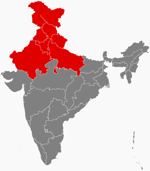
States majorly impacted by the 2023 north India floods
Summary[edit]
| Description |
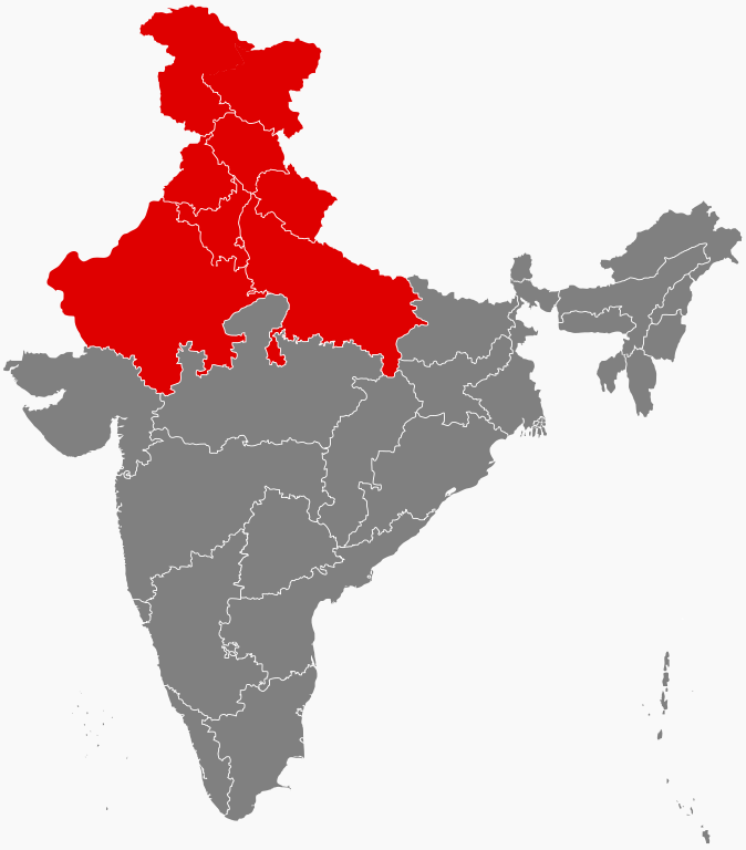
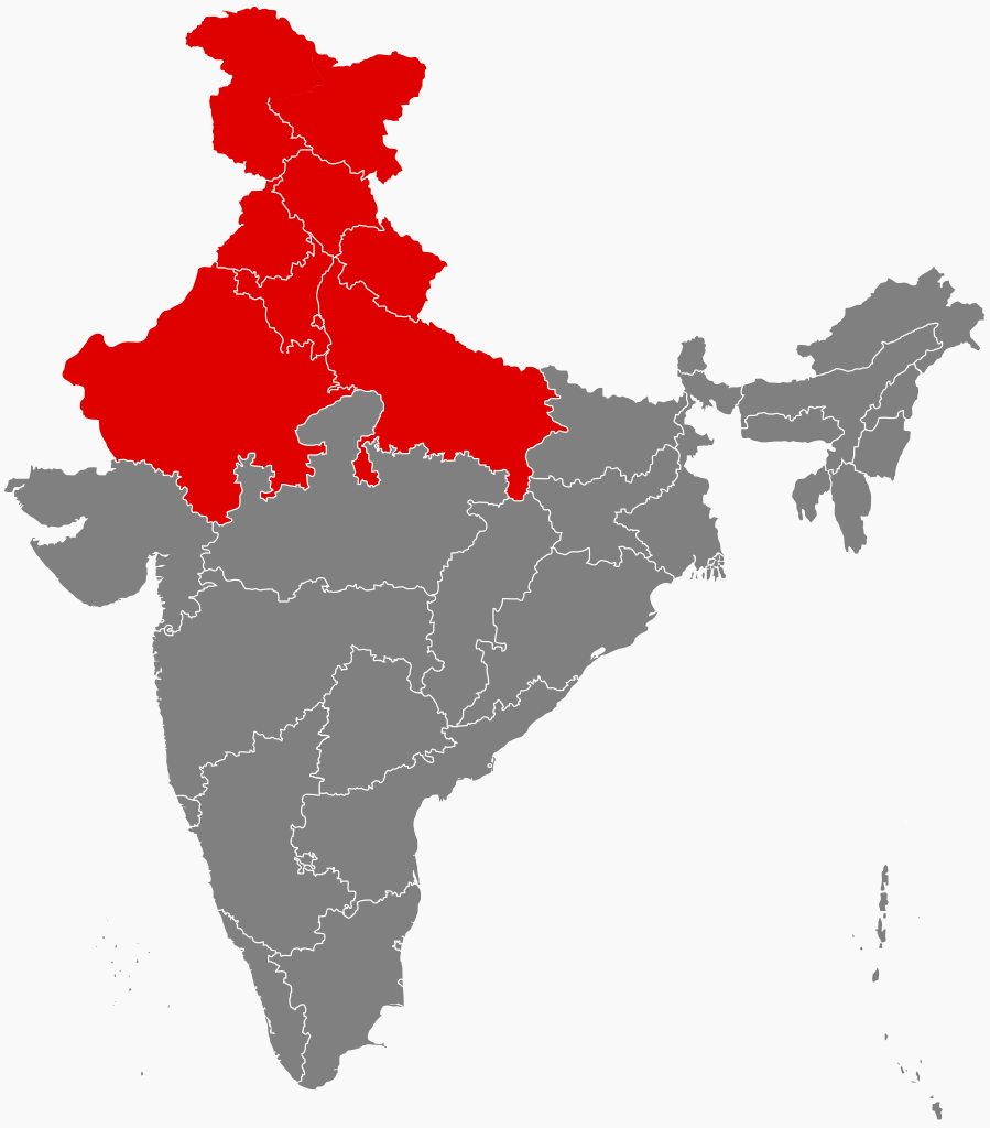
English: States and Union Territories of Northwest India
|
| Date | |
| Source | Filpro (https://commons.wikimedia.org/wiki/User:Filpro) |
| Author | Filpro (https://commons.wikimedia.org/wiki/User:Filpro) |
Licensing[edit]
This file is licensed under the Creative Commons Attribution-Share Alike 4.0 International license.
- You are free:
- to share – to copy, distribute and transmit the work
- to remix – to adapt the work
- Under the following conditions:
- attribution – You must give appropriate credit, provide a link to the license, and indicate if changes were made. You may do so in any reasonable manner, but not in any way that suggests the licensor endorses you or your use.
- share alike – If you remix, transform, or build upon the material, you must distribute your contributions under the same or compatible license as the original.
File history
Click on a date/time to view the file as it appeared at that time.
| Date/Time | Thumbnail | Dimensions | User | Comment | |
|---|---|---|---|---|---|
| current | 17:10, 15 May 2024 | | 512 × 583 (155 KB) | Sbb1413 (talk | contribs) | Colouring the claimed territories since there are no neighbouring countries in this map. |
| 00:32, 15 February 2017 |  | 1,574 × 1,792 (323 KB) | Tiger7253 (talk | contribs) | User created page with UploadWizard |
You cannot overwrite this file.
File usage on Commons
The following page uses this file:
File usage on other wikis
The following other wikis use this file:
- Usage on bn.wikipedia.org
- Usage on en.wikipedia.org
- Usage on he.wikipedia.org
- Usage on hi.wikipedia.org
- Usage on id.wikipedia.org
- Usage on ka.wikipedia.org
- Usage on my.wikipedia.org
- Usage on www.wikidata.org