File:Northumberland 1996.png
Jump to navigation
Jump to search
No higher resolution available.
Northumberland_1996.png (463 × 326 pixels, file size: 17 KB, MIME type: image/png)
Captions
Captions
Add a one-line explanation of what this file represents
Summary[edit]
| Description |
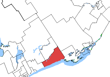
English: Map of the Northumberland electoral district (1996-2003)
Français : Carte de la circonscription Northumberland (1996-2003) |
| Date | |
| Source | Original map: File:Northumberland-Quinte West.png Boundaries: Elections Canada archived riding descriptions & maps |
| Author | Original map by SimonP at English Wikipedia, some boundaries redrawn by Username6892 |
Licensing[edit]
| This file is made available under the Creative Commons CC0 1.0 Universal Public Domain Dedication. | |
| The person who associated a work with this deed has dedicated the work to the public domain by waiving all of their rights to the work worldwide under copyright law, including all related and neighboring rights, to the extent allowed by law. You can copy, modify, distribute and perform the work, even for commercial purposes, all without asking permission.
|
File history
Click on a date/time to view the file as it appeared at that time.
| Date/Time | Thumbnail | Dimensions | User | Comment | |
|---|---|---|---|---|---|
| current | 00:24, 4 September 2020 | | 463 × 326 (17 KB) | Username6892 (talk | contribs) | One boundary was a bit too north |
| 00:15, 3 September 2020 |  | 463 × 326 (17 KB) | Username6892 (talk | contribs) | Uploaded a work by Original map by SimonP at English Wikipedia, some boundaries redrawn by Username6892 from Original map: File:Northumberland-Quinte West.png Boundaries: Elections Canada archived riding descriptions & maps with UploadWizard |
You cannot overwrite this file.
File usage on Commons
The following page uses this file:
File usage on other wikis
The following other wikis use this file:
- Usage on en.wikipedia.org
- Usage on fr.wikipedia.org