File:Northern California 2.svg
Jump to navigation
Jump to search

Size of this PNG preview of this SVG file: 424 × 600 pixels. Other resolutions: 170 × 240 pixels | 339 × 480 pixels | 543 × 768 pixels | 724 × 1,024 pixels | 1,448 × 2,048 pixels | 744 × 1,052 pixels.
Original file (SVG file, nominally 744 × 1,052 pixels, file size: 151 KB)
Captions
Captions
Add a one-line explanation of what this file represents
Summary[edit]
| Description |
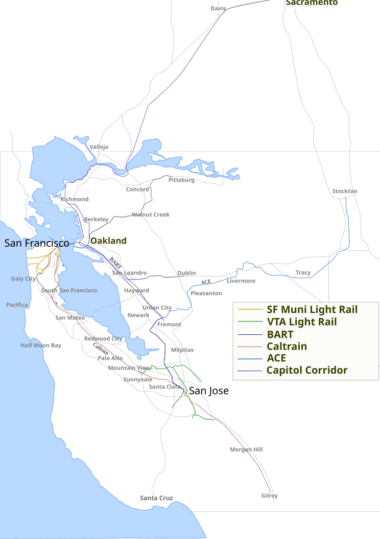
SVG file showing several public transit rail lines, highways and towns in Nothern California. Currently including BART, Caltrain, VTA light rail, SF Muni light rail, and Capitol Corridor. Used for picture here Image:Bay Area Transit.png. |
| Date | 27 October 2006 (original upload date) |
| Source | No machine-readable source provided. Own work assumed (based on copyright claims). |
| Author | No machine-readable author provided. JVittes~commonswiki assumed (based on copyright claims). |
Licensing[edit]
| I, the copyright holder of this work, release this work into the public domain. This applies worldwide. In some countries this may not be legally possible; if so: I grant anyone the right to use this work for any purpose, without any conditions, unless such conditions are required by law. |
File history
Click on a date/time to view the file as it appeared at that time.
| Date/Time | Thumbnail | Dimensions | User | Comment | |
|---|---|---|---|---|---|
| current | 23:17, 18 January 2007 | | 744 × 1,052 (151 KB) | JVittes~commonswiki (talk | contribs) | Added the new T line. |
| 11:15, 27 October 2006 |  | 744 × 1,052 (153 KB) | JVittes~commonswiki (talk | contribs) | ||
| 11:10, 27 October 2006 |  | 744 × 1,052 (149 KB) | JVittes~commonswiki (talk | contribs) | SVG file showing several public transit rail lines, highways and towns in Nothern California. Currently including BART, Caltrain, VTA light rail, SF Muni light rail, and Capitol Corridor |
You cannot overwrite this file.
File usage on Commons
There are no pages that use this file.