File:North and Baltic Seas, 1911.png
Jump to navigation
Jump to search

Size of this preview: 800 × 521 pixels. Other resolutions: 320 × 208 pixels | 640 × 417 pixels | 960 × 625 pixels.
Original file (960 × 625 pixels, file size: 1.36 MB, MIME type: image/png)
Captions
Captions
Add a one-line explanation of what this file represents
Summary[edit]
| Description |
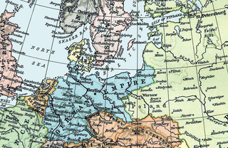
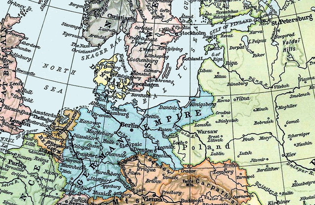
English: Map of the North and Baltic Seas in 1911. |
||||||||||||||||||||||
| Date | |||||||||||||||||||||||
| Source | Derivative of File:Europe 1911.jpg. From Shepherd, William R. , ed. (1911) The Historical Atlas, Category:New York: Henry Holt and Co. OCLC: 3561632. | ||||||||||||||||||||||
| Author |
|
||||||||||||||||||||||
Licensing[edit]
|
This work is in the public domain in its country of origin and other countries and areas where the copyright term is the author's life plus 70 years or fewer. This work is in the public domain in the United States because it was published (or registered with the U.S. Copyright Office) before January 1, 1929. | |
| This file has been identified as being free of known restrictions under copyright law, including all related and neighboring rights. | |
File history
Click on a date/time to view the file as it appeared at that time.
| Date/Time | Thumbnail | Dimensions | User | Comment | |
|---|---|---|---|---|---|
| current | 13:09, 9 October 2019 | | 960 × 625 (1.36 MB) | Parsecboy (talk | contribs) | slightly wider crop to include St. Petersburg |
| 19:05, 27 September 2019 |  | 924 × 637 (1.31 MB) | Hohum (talk | contribs) | Updated | |
| 22:15, 1 January 2014 |  | 919 × 631 (1.36 MB) | Parsecboy (talk | contribs) | User created page with UploadWizard |
You cannot overwrite this file.
File usage on Commons
There are no pages that use this file.
File usage on other wikis
The following other wikis use this file:
- Usage on en.wikipedia.org
- SMS Ägir
- SMS Zähringen
- SMS Preussen (1903)
- SMS Bremen
- SMS Hansa (1898)
- SMS Braunschweig
- SMS Undine
- SMS Wörth
- SMS Brandenburg
- SMS Kaiser Wilhelm II
- SMS Kaiser Karl der Grosse
- SMS Mecklenburg
- SMS Kaiser Wilhelm der Grosse
- SMS Wittelsbach
- SMS Wettin
- SMS Hannover
- SMS Roon
- SMS Friedrich Carl
- SMS Prinz Adalbert (1901)
- SMS Victoria Louise
- SMS Freya
- SMS Schwaben
- SMS Elsass
- SMS Hessen
- SMS Lothringen
- SMS Beowulf
- SMS Hildebrand
- SMS Danzig
- SMS Medusa
- SMS Amazone
- SMS Nymphe
- SMS Thetis
- SMS Lübeck
- SMS München
- SMS Berlin
- SMS Stuttgart
- SMS Baden (1880)
- SMS Zieten
- SMS Preussischer Adler
- Russian submarine Kaiman
- Usage on es.wikipedia.org
- Usage on fr.wikipedia.org
- Usage on he.wikipedia.org
View more global usage of this file.