File:Nonnendammallee nach FIS2015.jpg
Jump to navigation
Jump to search

Size of this preview: 800 × 229 pixels. Other resolutions: 320 × 92 pixels | 640 × 183 pixels | 1,024 × 293 pixels | 1,280 × 366 pixels | 6,246 × 1,787 pixels.
Original file (6,246 × 1,787 pixels, file size: 4.45 MB, MIME type: image/jpeg)
Captions
Captions
Add a one-line explanation of what this file represents
Summary[edit]
| Description |
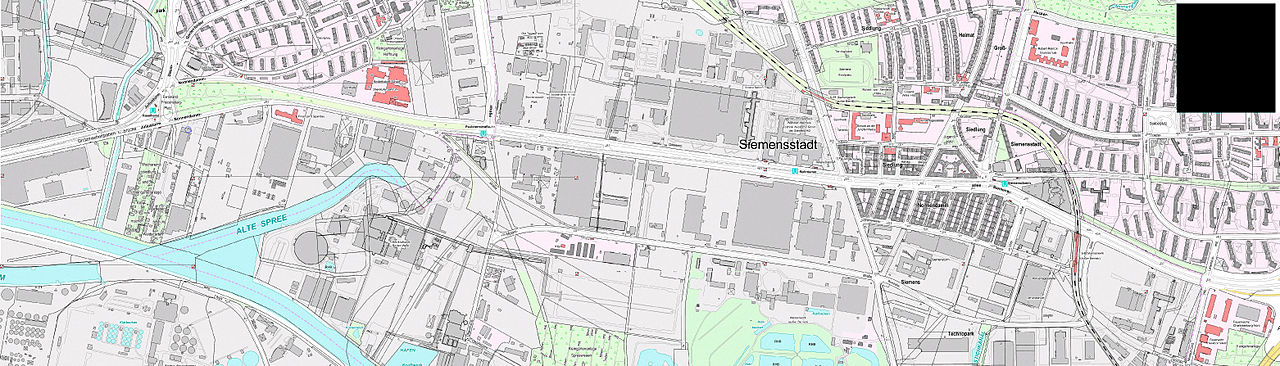
Deutsch: Die Nonnendammallee ist eine Straße in den Berliner Ortsteilen Siemensstadt und Haselhorst (Bezirk Spandau) und liegt auf der Trasse der historischen Straße Spandau-Berlin, auf der Handelsstraße Magdeburg-Gnesen. |
| Date | |
| Source | FIS-Broker Kartenanzeige Karte von Berlin 1:5000 (K5-Farbausgabe), hergestellt von den bezirklichen Vermessungsämtern |
| Author | Senatsverwaltung für Stadtentwicklung |
Licensing[edit]

|
This file is licensed under the terms of the Nutzungsbedingungen of the Senatsverwaltung für Stadtentwicklung und Umwelt Berlin. |
|
You are free:
Under the following conditions:
The terms of the Nutzungsbedingungen have been archived in the OTRS system, see Ticket:2014052710020188. |
File history
Click on a date/time to view the file as it appeared at that time.
| Date/Time | Thumbnail | Dimensions | User | Comment | |
|---|---|---|---|---|---|
| current | 10:38, 13 April 2015 | 6,246 × 1,787 (4.45 MB) | Boonekamp (talk | contribs) | User created page with UploadWizard |
You cannot overwrite this file.
File usage on Commons
The following 2 pages use this file:
File usage on other wikis
The following other wikis use this file:
- Usage on de.wikipedia.org