File:Nile delta elevation cross-section 01.gif
Jump to navigation
Jump to search
Size of this preview: 600 × 600 pixels. Other resolutions: 240 × 240 pixels | 480 × 480 pixels | 730 × 730 pixels.
Original file (730 × 730 pixels, file size: 51 KB, MIME type: image/gif)
Captions
Captions
Add a one-line explanation of what this file represents
Summary[edit]
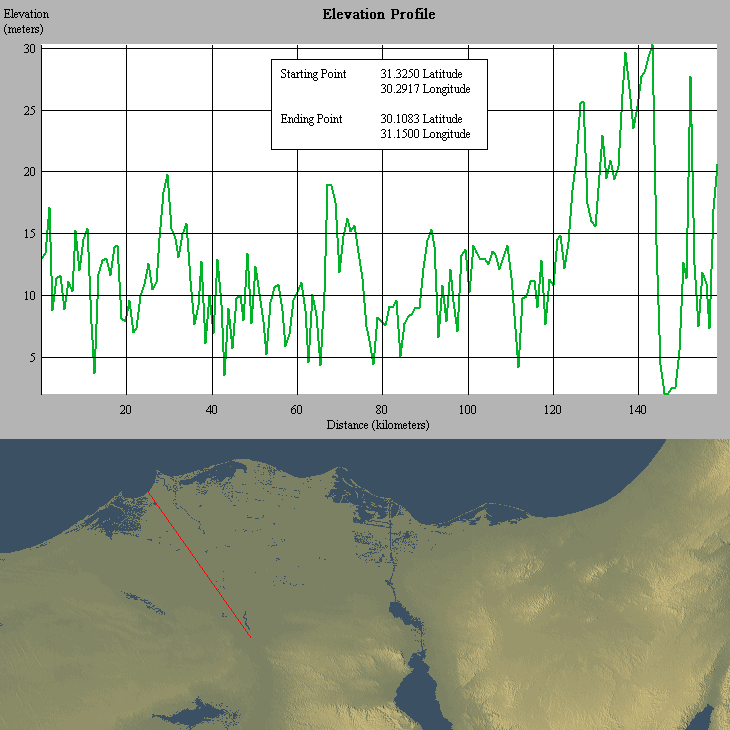
| Description | The Theran Eruption: The image shows that tsunami waves caused by Thera's eruption in 1626 BC could have easily penetrated far into the Nile delta region due to its very low elevation |
| Date | |
| Source | Own work |
| Author | Brave heart, using 3DEM Visualization Software (Version 19.0) and GTOPO30 digital elevation data |
| Permission (Reusing this file) |
public domain |
Licensing[edit]
| I, the copyright holder of this work, release this work into the public domain. This applies worldwide. In some countries this may not be legally possible; if so: I grant anyone the right to use this work for any purpose, without any conditions, unless such conditions are required by law. |
File history
Click on a date/time to view the file as it appeared at that time.
| Date/Time | Thumbnail | Dimensions | User | Comment | |
|---|---|---|---|---|---|
| current | 22:39, 5 August 2006 | | 730 × 730 (51 KB) | Brave heart~commonswiki (talk | contribs) | == Summary == {{Information |Description=The Theran Eruption: The image shows that tsunami waves caused by Thera's eruption in 1626 BC could have easily penetrated far into the Nile delta region due to its very low elevation |Source=own work |Date=2006, A |
You cannot overwrite this file.
File usage on Commons
There are no pages that use this file.
File usage on other wikis
The following other wikis use this file:
- Usage on pl.wikipedia.org