File:Nile River (MODIS 2022-09-06).jpg
Jump to navigation
Jump to search

Size of this preview: 800 × 574 pixels. Other resolutions: 320 × 230 pixels | 640 × 459 pixels | 1,024 × 735 pixels | 1,280 × 919 pixels | 2,560 × 1,837 pixels | 6,137 × 4,404 pixels.
Original file (6,137 × 4,404 pixels, file size: 2.05 MB, MIME type: image/jpeg)
Captions
Captions
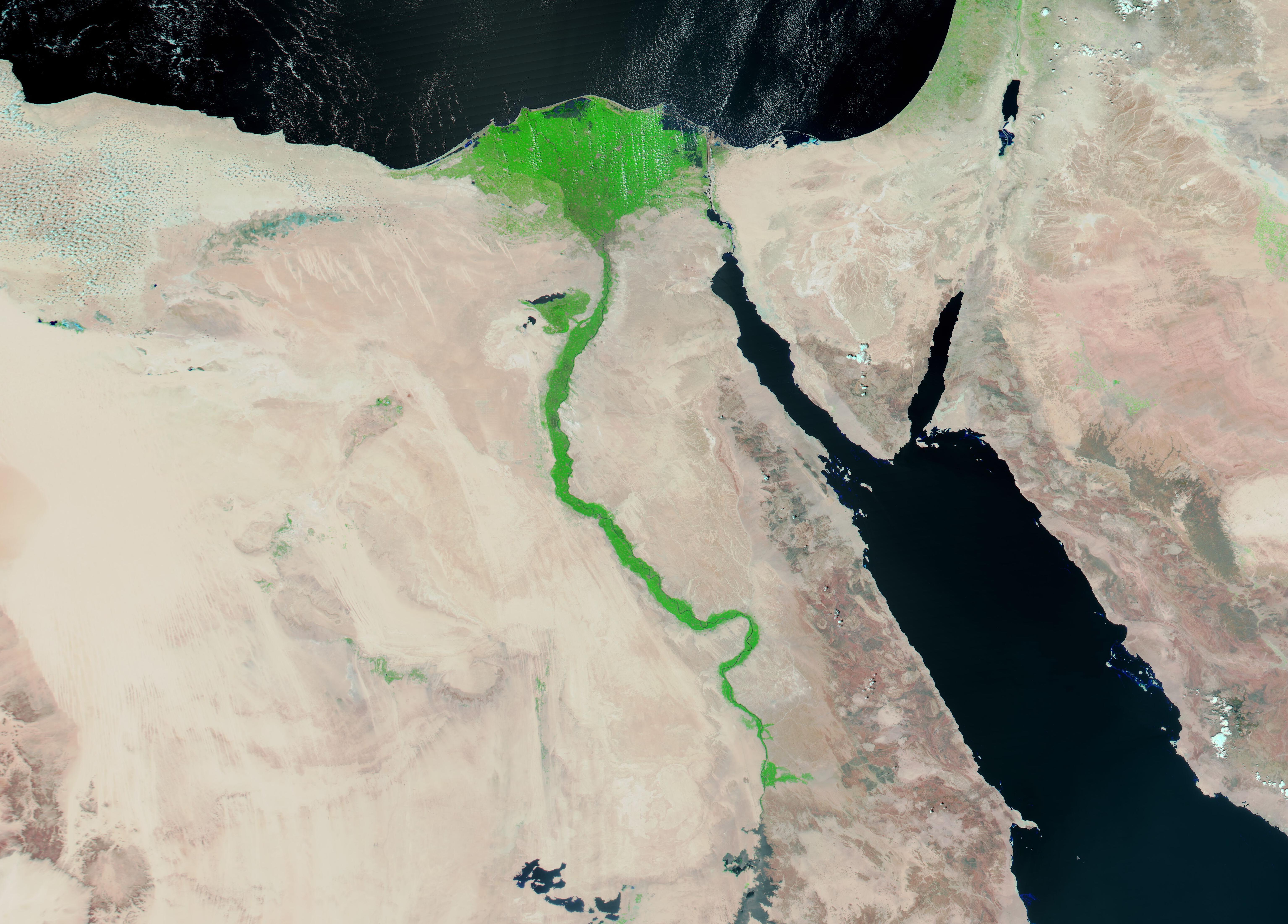
On August 31, 2022, the Moderate Resolution Imaging Spectroradiometer (MODIS) on board NASA’s Aqua satellite acquired a gorgeous false-color image of the rich fertility of the Nile River and its Delta.
Summary[edit]
.jpg&action=edit§ion=1)
| Description |
English: The Nile River courses through some of the driest regions on Earth, with the life-giving water creating fertile valley through the shifting sand. Rising in Burundi, the Nile flows approximately 4,160 miles (6,670 km) to reach the Mediterranean Sea at the expansive Nile River Delta. Nearly one-fourth (22 percent) of the Nile runs through Egypt.
On August 31, 2022, the Moderate Resolution Imaging Spectroradiometer (MODIS) on board NASA’s Aqua satellite acquired a gorgeous false-color image of the rich fertility of the Nile River and its Delta. This type of image combines shortwave infrared, near infrared, and red light (MODIS bands 7,2,1) to create an image that highlights water from land. Water appears blue, with deep water appearing darker, vegetated areas look bright green, and bare ground are tinted in a variety of tans and browns. At the lower (southern) edge of the image is Lake Nassar, the large impoundment created by the Aswan High Dam, which opened in 1970. To the west of Lake Nassar are the Toshka Lakes which sit in the sands of the Sahara Desert. The Red Sea sits in the east and the Mediterranean Sea stretches across the north (top) of the image. A thin blue line, marking the Nile River, is almost hidden in the bright green vegetative growth spanning the river. As it approaches the Mediterranean, the Nile River expands to form the lush, green “V” of the Nile River Delta. Light patches of green tint the desert in various locations, especially near the Mediterranean Coast—evidence of life-giving moistness in those areas. |
||
| Date | Taken on 31 August 2022 | ||
| Source |
|
||
| Author | MODIS Land Rapid Response Team, NASA GSFC |
| This media is a product of the Aqua mission Credit and attribution belongs to the mission team, if not already specified in the "author" row |
Licensing[edit]
.jpg&action=edit§ion=2)
| This file is in the public domain in the United States because it was solely created by NASA. NASA copyright policy states that "NASA material is not protected by copyright unless noted". (See Template:PD-USGov, NASA copyright policy page or JPL Image Use Policy.) | ||
 |
Warnings:
|
File history
Click on a date/time to view the file as it appeared at that time.
| Date/Time | Thumbnail | Dimensions | User | Comment | |
|---|---|---|---|---|---|
| current | 21:50, 9 January 2024 | | 6,137 × 4,404 (2.05 MB) | OptimusPrimeBot (talk | contribs) | #Spacemedia - Upload of http://modis.gsfc.nasa.gov/gallery/images/image09062022_250m.jpg via Commons:Spacemedia |
You cannot overwrite this file.
File usage on Commons
There are no pages that use this file.
.jpg&oldid=840107744)