File:Niger admin.png
Jump to navigation
Jump to search
No higher resolution available.
Niger_admin.png (500 × 326 pixels, file size: 9 KB, MIME type: image/png)
Captions
Captions
Add a one-line explanation of what this file represents

|
This locator map image could be re-created using vector graphics as an SVG file. This has several advantages; see Commons:Media for cleanup for more information. If an SVG form of this image is available, please upload it and afterwards replace this template with
{{vector version available|new image name}}.
It is recommended to name the SVG file “Niger admin.svg”—then the template Vector version available (or Vva) does not need the new image name parameter. |
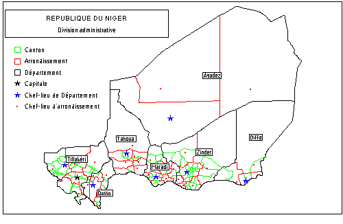
Administrative division map of the Republic of Niger transfer of GFDL user made image from fr:wikipedia. http://fr.wikipedia.org/wiki/Image:Niger_admin.png Reads:"Carte administrative du Niger
Carte faite par CR
GFDL "
CR at the French-language Wikipedia, the copyright holder of this work, hereby publishes it under the following license:

|
Permission is granted to copy, distribute and/or modify this document under the terms of the GNU Free Documentation License, Version 1.2 or any later version published by the Free Software Foundation; with no Invariant Sections, no Front-Cover Texts, and no Back-Cover Texts. A copy of the license is included in the section entitled GNU Free Documentation License. |
| This file is licensed under the Creative Commons Attribution-Share Alike 3.0 Unported license. | ||
| Attribution: CR | ||
| ||
| This licensing tag was added to this file as part of the GFDL licensing update. |
File history
Click on a date/time to view the file as it appeared at that time.
| Date/Time | Thumbnail | Dimensions | User | Comment | |
|---|---|---|---|---|---|
| current | 21:56, 31 January 2008 | | 500 × 326 (9 KB) | T L Miles (talk | contribs) | Administrative division map of the Republic of Niger transfer of GFDL user made image from fr:wikipedia. http://fr.wikipedia.org/wiki/Image:Niger_admin.png Reads:"Carte administrative du Niger Carte faite par CR GFDL " {{GFDL-u |
You cannot overwrite this file.
File usage on Commons
The following page uses this file:
File usage on other wikis
The following other wikis use this file:
- Usage on arz.wikipedia.org
- Usage on fr.wikipedia.org
- Usage on ga.wikipedia.org
- Usage on ja.wikipedia.org
- Usage on ms.wikipedia.org
- Aderbissinat
- Abala, Niger
- Adjekoria
- Affala
- Akoubounou
- Albarkaram
- Alakoss
- Allakaye
- Allela
- Anzourou
- Attantane
- Ayerou
- Azagor
- Azarori
- Azeye
- Babankatami
- Badaguichiri
- Bader Goula
- Bagaroua
- Bambeye
- Bana, Niger
- Bande, Niger
- Bangui, Niger
- Banibangou
- Bankilare
- Baoudetta
- Barmou
- Bazaga
- Bengou
- Bermo, Niger
- Bibiyergou
- Birni Lalle
- Bitinkodji
- Bosso, Niger
- Boune
- Chadakori
- Chetimari
- Dabaga
- Dakoussa
- Damagaram Takaya
- Dan-Barto
- Dan-Goulbi
- Dioundiou
- Dirkou
- Dingazi
- Diantchandou
View more global usage of this file.