File:Netanya.svg
Jump to navigation
Jump to search

Size of this PNG preview of this SVG file: 800 × 518 pixels. Other resolutions: 320 × 207 pixels | 640 × 414 pixels | 1,024 × 663 pixels | 1,280 × 829 pixels | 2,560 × 1,658 pixels | 2,100 × 1,360 pixels.
Original file (SVG file, nominally 2,100 × 1,360 pixels, file size: 115 KB)
Captions
Captions
Add a one-line explanation of what this file represents
Summary[edit]
| Description |
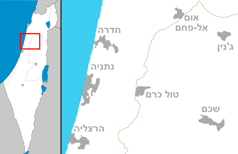
English: Map of Netanya area, Israel
עברית: מפה של איזור נתניה |
| Date | (UTC) |
| Source | Own work |
| Author | Costello |
Licensing[edit]
I, the copyright holder of this work, hereby publish it under the following licenses:
This file is licensed under the Creative Commons Attribution-Share Alike 3.0 Unported license.
- You are free:
- to share – to copy, distribute and transmit the work
- to remix – to adapt the work
- Under the following conditions:
- attribution – You must give appropriate credit, provide a link to the license, and indicate if changes were made. You may do so in any reasonable manner, but not in any way that suggests the licensor endorses you or your use.
- share alike – If you remix, transform, or build upon the material, you must distribute your contributions under the same or compatible license as the original.

|
Permission is granted to copy, distribute and/or modify this document under the terms of the GNU Free Documentation License, Version 1.2 or any later version published by the Free Software Foundation; with no Invariant Sections, no Front-Cover Texts, and no Back-Cover Texts. A copy of the license is included in the section entitled GNU Free Documentation License. |
You may select the license of your choice.
File history
Click on a date/time to view the file as it appeared at that time.
| Date/Time | Thumbnail | Dimensions | User | Comment | |
|---|---|---|---|---|---|
| current | 16:31, 2 October 2008 | | 2,100 × 1,360 (115 KB) | Costello (talk | contribs) | fix of the Dead sea south border |
| 10:10, 15 August 2008 |  | 2,100 × 1,360 (112 KB) | Costello (talk | contribs) | ||
| 09:53, 9 August 2008 |  | 2,100 × 1,360 (111 KB) | Costello (talk | contribs) | plain svg | |
| 09:43, 9 August 2008 |  | 2,100 × 1,360 (114 KB) | Costello (talk | contribs) | {{Information |Description={{en|1=Map of Netanya area, Israel}} {{he|1=מפה של איזור נתניה}} |Source=Own work by uploader |Author=Costello |Date=~~~~~ |Permission= |other_versions= }} {{ImageUpload|full}} [[Category:SVG ma |
You cannot overwrite this file.
File usage on Commons
The following page uses this file:
File usage on other wikis
The following other wikis use this file:
- Usage on ar.wikipedia.org
- Usage on arz.wikipedia.org
- Usage on ca.wikipedia.org
- Usage on da.wikipedia.org
- Usage on en.wikipedia.org
- Usage on es.wikipedia.org
- Usage on he.wikipedia.org
- עמק חפר
- נחל אלכסנדר
- געש
- המעפיל
- העוגן
- אלטלנה
- באקה-ג'ת
- הרצליה
- טייבה
- טירה (עיר)
- כפר סבא
- נתניה
- קלנסווה
- רעננה
- אבן יהודה
- אליכין
- אלפי מנשה
- ג'ת
- זמר (יישוב)
- כוכב יאיר צור יגאל
- כפר יונה
- כפר שמריהו
- פרדסיה
- רמות השבים
- תל מונד
- האוניברסיטה הפתוחה
- בת חפר
- שפיים
- אביחיל
- עין החורש
- מעברות
- מועצה אזורית עמק חפר
- משמר השרון
- רמת הכובש
- בורגתא
- להבות חביבה
- הפיגוע במלון פארק
- מועצה אזורית לב השרון
- כפר מל"ל
- בחן
- טולכרם
- מכון וינגייט
- חרב לאת
- אפולוניה
View more global usage of this file.