File:Nebraska Highway 1 Map.svg
Jump to navigation
Jump to search

Size of this PNG preview of this SVG file: 800 × 566 pixels. Other resolutions: 320 × 226 pixels | 640 × 453 pixels | 1,024 × 724 pixels | 1,280 × 905 pixels | 2,560 × 1,810 pixels | 1,052 × 744 pixels.
Original file (SVG file, nominally 1,052 × 744 pixels, file size: 2.47 MB)
Captions
Captions
Add a one-line explanation of what this file represents
Summary[edit]
| Description |
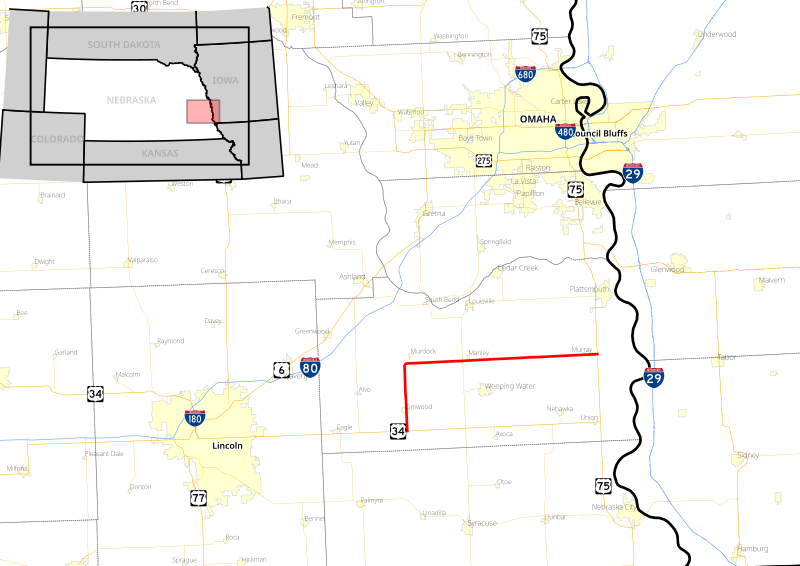
English: Map of Nebraska Highway 1 |
|||
| Date | ||||
| Source |
Own work
|
|||
| Author | Stratosphere | |||
| Permission (Reusing this file) |
I, the copyright holder of this work, hereby publish it under the following license:
|
|||
| SVG development |
File history
Click on a date/time to view the file as it appeared at that time.
| Date/Time | Thumbnail | Dimensions | User | Comment | |
|---|---|---|---|---|---|
| current | 20:10, 4 May 2018 | | 1,052 × 744 (2.47 MB) | Sebastian Wallroth (talk | contribs) | code reviewed |
| 23:05, 24 December 2016 |  | 1,052 × 744 (2.95 MB) | Stratosphere (talk | contribs) | User created page with UploadWizard |
You cannot overwrite this file.
File usage on Commons
The following 6 pages use this file:
- User:Chumwa/OgreBot/Potential transport maps/2016 December 21-31
- User:Chumwa/OgreBot/Potential transport maps/2018 May 1-10
- User:Chumwa/OgreBot/Transport Maps/2016 December 21-31
- User:Chumwa/OgreBot/Transport Maps/2018 May 1-10
- User:Chumwa/OgreBot/Travel and communication maps/2016 December 21-31
- User:Chumwa/OgreBot/Travel and communication maps/2018 May 1-10