File:Narrow-Gauge-Railway Narentabahn Railway-Bridge-at-Aleksin-Han (3).jpg
Jump to navigation
Jump to search
Size of this preview: 800 × 585 pixels. Other resolutions: 320 × 234 pixels | 640 × 468 pixels | 1,024 × 749 pixels | 1,280 × 936 pixels | 2,048 × 1,498 pixels.
Original file (2,048 × 1,498 pixels, file size: 1.64 MB, MIME type: image/jpeg)
Captions
Captions
Add a one-line explanation of what this file represents
Summary[edit]
.jpg&action=edit§ion=1)
| Description |
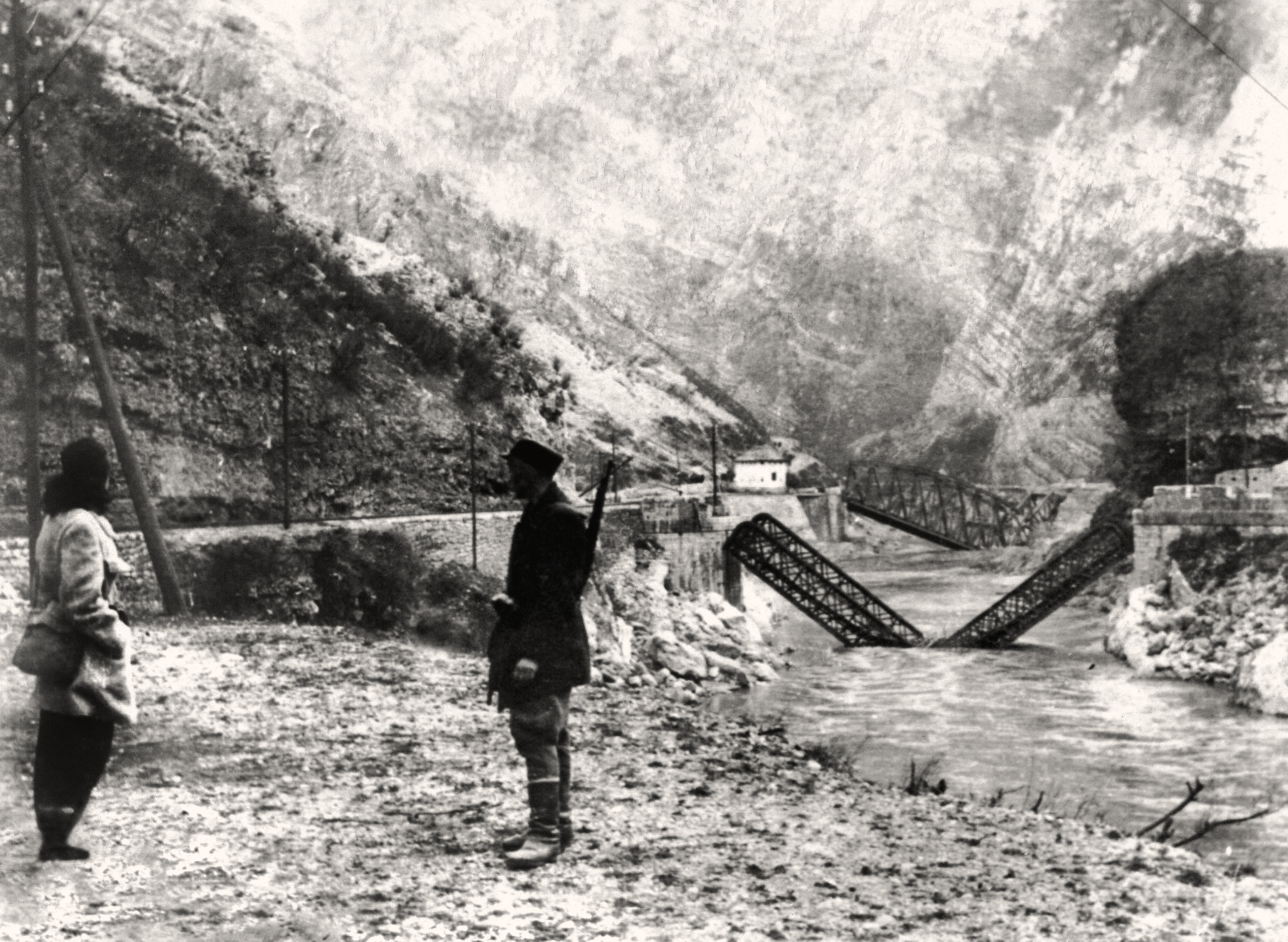
English: During the military operations of the Axis forces in the region of the Neretva River in 1943, the Yugoslav Partisans destroyed a number of bridges on the Neretva River. Here are the road and railway bridge destroyed at the location of Aleksin Han. |
| Date | |
| Source | Old photograph |
| Author | Unknown author |
| Camera location | | View this and other nearby images on: OpenStreetMap |
|---|
.jpg¶ms=043.599500_N_0017.733472_E_globe:Earth_type:camera_heading:45.00&language=en)
Licensing[edit]
.jpg&action=edit§ion=2)
This work first published in Yugoslavia is in the public domain because its copyright expired pursuant to the Yugoslav Copyright Act of 1978 which provided for copyright term of the life of the author plus 50 years, respectively 25 years for photograph or a work of applied art. This applies to works already in the public domain before the breakup of SFR Yugoslavia in 1991.
The work meets one of the following criteria:
A source should be included so that the status can be verified. After this date, use the templates for the Yugoslavian successor states: {{PD-Slovenia}}, {{PD-Croatia}}, {{PD-Bosnia and Herzegovina}}, {{PD-Macedonia}}, {{PD-Montenegro}} or {{PD-Serbia}}.
|
File history
Click on a date/time to view the file as it appeared at that time.
| Date/Time | Thumbnail | Dimensions | User | Comment | |
|---|---|---|---|---|---|
| current | 16:15, 15 December 2021 | | 2,048 × 1,498 (1.64 MB) | My-wiki-photos (talk | contribs) | {{Information |Description ={{en|1=During the military operations of the Axis forces in the region of the Neretva River in 1943, the Yugoslav Partisans destroyed a number of bridges on the Neretva River. Here are the road and railway bridge destroyed at the location of Aleksin Han. }} |Source =Old photograph |Date =1943 |Author ={{unknown|author}} |Permission = |other_versions = }} {{Location|43|36|07.85|N|17|44|14.45|E|heading:NE}} == {{int:license-header}}... |
You cannot overwrite this file.
File usage on Commons
There are no pages that use this file.
File usage on other wikis
The following other wikis use this file:
- Usage on de.wikipedia.org
.jpg&oldid=876123366)